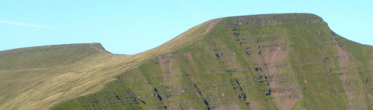
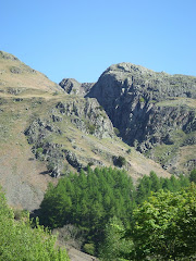
Pen-Y-Fan from Cribyn
Learn to fall in love with the mountain not just the summit
Showing posts with label Abergavenny. Show all posts

Tuesday, March 15, 2011

South Wales Three Peaks


This is an annual challenge walk which takes place on Saturday 26th March 2011, the event is organised by the Cardiff Outdoor Group. The Walk which was first held in March 1963 is the third oldest event of its type in the UK.

Last year £4,766 was raised from the the 48th Three Peaks Trial. This was split between the Longtown Mountain Rescue Team, the Elenydd Wilderness Trust to help maintain the remote Ty'n Cornel and Dolgoch Youth Hostels and the National Trust, owners of Sugar Loaf and Skirrid Fawr, for footpath maintenace.

The proceeds from the 2011 Three Peaks Trial will again be split between: Longtown Mountain Rescue Team (50%), the Elenydd Wilderness Hostels Trust (25%), the National Trust (10% for the repair of footpaths) and the Ruperra Conservation Trust (15%).

The Gold Route is the original challenge, a circular walk of about 20 miles and 5000 feet of ascent, which crosses the three prominent peaks around Abergavenny:

Blorenge, Sugar Loaf and Skirrid.

The Three Peaks Trial is now firmly established on the walkers calendar and regularly attracts as many as five hundred entrants.

For more information see Three Peaks website

Thursday, February 17, 2011

Sugar Loaf


As you approach Abergavenny from Raglan in the east on the straight autobahn-like A40, the distinctive outline of the conical summit of the Sugar Loaf (at 596 metres) dominates the horizon as the southern most peak of the Black Mountains.

It was extremely disappointing to depart from home with blue skies and sunshine to arrive at Abergavenny only twenty minutes later in miserable low cloud. Its normally the other way round!

The approach to the start of the ascent was made via the National Trust car park, from the north-east of the Sugar Loaf about a half mile past Bettws.

Walking during February in either the Brecon Beacons or Black Mountains is often through low cloud and after the initial climb onto the lower plateau, with views of Partishow Hill to the north, the visibility gradually reduced to less than 100 metres.


The only incident of note on the ascent was when I spooked a grouse or pheasant a few feet away in the bracken and heather, that subsequently made me jump at the loud flapping of its frantic wings.

The final climb to the summit is steep and the long narrow ridge, only 20 feet wide, stretches for about 50 or 60 yards from south to north. On a clear day views to the Bristol Channel in the south-east and the Malvern Hills to the north-east can be spectacular, but unfortunately not today.


The only benefit of the poor visibility was the deserted summit where I stayed for 15 minutes.


The Sugar Loaf was donated to the National Trust in 1936 by Margaret Haig Thomas, Viscountess Rhondda, and daughter of David Alfred Thomas who served as a Liberal Member of Parliament for Merthyr Tydfil, from 1888 to 1910.

The walk was 8 kilometres and involved 369 metres (1,100 feet) of ascent, taking 1 hour and forty minutes.

Saturday, May 22, 2010

Ysgyryd Fawr


An imposing landmark situated just to the north-east of Abergavenny that looks down on the A465 as it trundles below. The 360 degree views from the summit are well worth the climb through the woods from the foot of the mountain.

Leaving a small but equally convenient parking area at the side of the B4521 you walk through a hedge-lined track until you come to a gate to join the Beacons Way. The hardest part of the climb comes at the very beginning of the walk as you make your way through dense woodland, that provided a protective shadow from the fierce sun.

There was an abundance of Cabbage White butterflies in the hedgerows, while Wagtails and Meadow Pipits were also evident.


The welcome breeze at the higher altitude was enjoyable when leaving the wooded slopes after the hard uphill slog, to emerge onto the exposed upper elevation of the mountain that on a clear day can be seen from (another Country!!) over 20 miles away as you leave the outskirts of the city of Hereford on the west bound A465.


The walk along the cats back ridge to the trig point at 486 metres was the final climb before the panoramic views included Grosmont, Hereford and the Malvern Hills in the east, the Black Mountains and the Vale of Ewyas to the north, Abergavenny and the Sugar Loaf to the west. Plus dozens of brightly coloured fields full of Rape Seed in all visible directions.

The mountain has long been referred to as the Holy Mountain. It has a distinct shape formed by a landslip on one side dating from the Ice Age. The evangelical importance of the mountain was marked with a small medieval place of worship, dedicated to St. Michael, and squeezed onto the narrow summit. Years of mountain top weather have taken their toll and only the outline plus two small standing stones that form a doorway now remain.

Skirrid Mountain, as it is commonly known, was a favourite walk of Rudolph Hess, Deputy Fuhrer of the Third Reich, when he was detained in Maindiff Court Military Hospital (located near to Wern Ddu Farm) during the Second World War, after being captured when his plane crash landed on the way to Scotland.


The thermal currents that create an up-draught around the steep sides of Skirrid make this an ideal environment in which to para glide and while near the summit three 'twenty somethings' literally 'threw' themselves off the edge of the ridge as they launched the huge canopies 'whooping and hollering' to ascend gracefully into the clear blue skies, before circling silently to hundreds of feet above the mountain in a spectacular display. It was definitely an 'I was there' moment in time.