Pen-Y-Fan from Cribyn
Learn to fall in love with the mountain not just the summit
Showing posts with label Pembrokeshire Coastal Path. Show all posts

Saturday, August 4, 2012

St. Davids


After a welcome overnight rest in the Golden Lion, Newport, a non-walking day consisted of a visit to St Davids Cathedral. The walking clothes were still drying out after yesterday's drenching!

Set a few miles inland from a spectacular Pembrokeshire peninsula jutting out into the Atlantic, upon the site of an earlier sixth-century monastery built by St David, the Patron Saint of Wales, St Davids Cathedral has been a site of pilgrimage and worship for more than 800 years.


The monastic community was originally founded by Saint David, Abbot of Menevia, who died in 589. Between 645 and 1097, the community was attacked many times by raiders, including the Vikings, however, it was of such note as both a religious and intellectual centre that King Alfred summoned help from the monastic community at St. David's in rebuilding the intellectual life of the Kingdom of Wessex.

In 1081, William the Conqueror visited St. David's to pray, and thus recognised it as a holy and respected place.


Work on the present cathedral began sometime between 1180 and 1182 and is the culmination of centuries of rebuilding and expansion. Constructed in the Transitional Norman style using fine-grained, purple Cambrian sandstone, it has survived both the collapse of its tower and an earthquake in the 13th century, although today the floor slopes noticeably, the arcades veer from the vertical, and the east and west ends of the building differ in height by about four metres!


The restored Shrine of St David was unveiled and re-dedicated by The Right Reverend Wyn Evans, Bishop of St Davids, at a Choral Eucharist on St David's Day 2012. Sarah Crisp painted and gilded the five icons which have been installed to sit within the exisiting niches of the restored shrine. The icons, made in egg tempera on gesso, depict St David and other saints associated with the cathedral and the local area. The three icons at the front of shrine depict from left to right: St Patrick, St David and St Andrew. The icons are painted on lime wood panels and combine the styles of classic Byzantine with early Italian works. Traditional paint and techniques were used throughout.

The Cathedral has also been used as a location for a BBC production called "The Hollow Crown" as part of the castle of Richard II.

The title of "city" was re-instated to St. David's, and formally conferred by Her Majesty Queen Elizabeth II on 1 June 1995.


The weather had been glorious all day in St. Davids and reluctantly it was decided to return to Newport Sands where ice-creams were consumed before it started to rain!!

Friday, August 3, 2012

Poppit Sands to Newport


Boarding the Poppit Rocket outside the Castle Hotel in Newport at 10:30am the weather was blustery but sunny. The journey to the start of the walk took over half an hour along the narrow Pembrokeshire country lanes via Moylegrove.

After departing the 'Rocket' in the large car park at Poppit Sands on the mouth of the River Teifi, the costal path starts to climb almost immediately following a minor road past the Youth Hostel to Allt-Y-Goed Farm, where it becomes a footpath.


This takes you to Cemaes Head which is now a nature reserve owned by the Wildlife Trust, where guillemots, cormorants, fulmars and razorbills nest in the cliffs in Spring and early Summer, but not today!


The geology of this section of the coastline is spectacular. The cliffs at Pwll Granant in places are 600 feet high and consist of layers of sandstone and mudstone.

Arriving at Ceibwr Bay after a few hours walk the weather had remained kind. The steep valley down which the Nant Ceibwr flows was deepened by glacial meltwater in the Ice Age. Lunch was taken overlooking a group of school children coasteering along the rocky outcrops in the bay below.


Less than a mile further along the coastal path is the Witches Cauldron (Pwll-Y-Wrach) which is a natrually formed blow-hole caused by the collapse of a cave roof.


Soon after this point the weather deteriorated and it started to rain and the conditions were made difficult by the prevailing head-wind. This particular section of the coastal path is remote and extremely challenging, rising and falling quite dramatically in places. After the downhill trundle you know that a trudge upwards is always inevitable!


Before turning the headland a shoal of porpoises were clearly visible in the sea below.


After five hours the welcome sight of Newport Sands and the Nevern Estuary finally came into view, although there was still a few miles to walk to reach the Golf Club.

Over half of the 15 mile walk had been completed in driving rain and strong head-winds!

Photographs taken on this walk can be viewed here. Select 'slide-show' for automated viewing.

Tuesday, January 17, 2012

Weatherman Walking - Pwll Deri


An epic coastal trek starting at the picturesque coastal village of Trefin, passing through Abercastle, finishing up at the hostel in Pwll Deri. A 10.5 mile linear walk along a quieter section of the Pembrokeshire coastal path.

Time the walk right and you can catch the Strumble Shuttle bus service back to the start. The shuttle bus runs from Fishguard to St David's, 7 days a week during the summer and the nearest bus stop to Pwll Deri is at Trefasser Cross, (around 1km away).


You can see the full programme including a 7.5 mile linear walk along the spine of Offa's Dyke to the historic market town of Montgomery and its 13th century castle here.

Thursday, July 21, 2011

St. Govans Head


Less than two months since his last visit, the almost irresistible magnetic pull of the majestic Pembrokeshire Coast line drew Butterballs to Lydstep, where he based himself for a short Summer break.


Using the good weather conditions he explored an area 3 miles to the west on the first morning walking to Skrinkle Cove.


The beach at Broad Haven is the best he has ever seen anywhere - "as I rounded a mound it was a staggering site really - totally unspoilt and run by National Trust". It is one of Pembrokeshire's finest beaches in terms of the water quality, its south-facing location and dramatic cliff views backed by sand dunes and expansive National Trust woodland and lily ponds.


On the second day he headed east to the Ministry Of Defence firing range at Penally, passing Gillar Point which is the nearest area of land to Caldey Island.


One of the highlights of his stay was a visit to St. Govans Head where he went in search of St. Govans Chapel. This was built in a fissure in the cliff face in the 13th century.


This he discovered at the bottom of a long flight of stone steps. The present small vaulted chapel of local limestone was built over a cave although the site may have been of monastic importance since the 5th century


We are blessed that with both the Gower Peninsular and Pembrokeshire National Park we have such area’s of outstanding natural beauty on our doorstep and within such easy reach.

Monday, May 23, 2011

Skomer Island - The Video Diary

Previously unseen footage from the recent visit made to Pembrokeshire Coast National Park:


This was brought to you by 'Tydfil Strollers on Tour 2011'.

Friday, May 20, 2011

St Brides


After leaving Skomer we had one further place to visit before the very enjoyable stay in Pembrokeshire came to a satisfactory conclusion.


Heading a few miles north of Marloes we travelled on the country lanes before arriving at the delightful setting of St Brides bay in Nabs Head.


While two of the repribates literally basked in the sunshine, the remaining member of the tour party did some beachcombing and walked a short section of the coastal path past St Brides castle heading south west towards Musselwick Bay.


This is a fabulous secluded part of the coast line and well worth a visit.


After our short stay we made the return journey down the A40 and A465 after a great two days spent in the Pembrokeshire National Park.

Assessment of tour -
Weather: Very Good for walking
Location: Amazing
Accommodation: Superb value for money
Company: Brilliant!!

Skomer Island


There was considerable debate the night before whether to queue first to secure a ticket for the ferry and then return for breakfast, or to turn up in the dinning room before 8.00am hoping that we could start eating as soon as possible and then leave for Martins Haven to catch the ferry to Skomer.

Sue soon kindly explained that if we queued first then we definitely wouldn't be able to return in time to eat breakfast - as it turned out this was some good advice.


So it was an early shower before eating a full cooked breakfast, with cereal and toast before departing the Clock House after a splendid overnight stay. A ten minute journey to the car park at Martins Haven and we soon discovered that we were in the first twenty customers for the ferry (that only holds fifty).

We didn't know it when we booked the date for our visit to Skomer that the island had been closed for the previous three days for the annual bird count, but it was fortunately re-opened to visitors today!


You are unable to pre-book the ferry (the cost was £10 each), it's first-come-first-served, so at 8.30am we purchased our landing ticket (£8 each) and settled down to patiently wait for the first ferry at 10.00am. We were able to watch the volunteers land at Martins Haven over the next hour as they returned to the mainland following their 3 day stay on Skomer.

The breeze and swell made the fifteen minute crossing to Skomer really pleasant for the packed Dale Princess as Fat Alex, the skipper, negotiated some dangerous looking rocks that poked through the surface of the sea.

After landing at the jetty we then climbed a few hundred feet to the meeting point where one of the volunteers working on the islands provided us with a brief welcome and introductory talk. The bird count earlier in the week had identified 22,000 pairs of Manx Shearwaters and 13,000 pairs of Puffins. The burrows used by the Puffins and Manx Shearwaters litter the island like bomb craters.

The Island is about one and a half miles long and one mile wide and will only cater for up to 250 visitors each day; volcanic rocks make the scenery spectacular, with hosts of wild flowers in early summer.


We decided to start the 6.5 kilometre perimeter walk around the island to the south passing the Neck and visiting South Plateau and The Wick (a geological fault has created an impressive large, flat cliff face opposite a giant slab sloping into a thin wedge of sea), where we saw Razor Bills, Guillemots, Herring Gulls, Oyster-catchers and Puffins.


Passing the spectacular Mew Stone we were then amazed to see these cute Puffins brazenly walking across the path immediately in front of us at Skomer Head!


After a visit to the trig. point at 79 metres (no Nuttalls on Skomer to visit!), we then looked around the self-catering accommodation available for over-night guests to stay on the island and visitor centre on the site of the 19th century old farm, that were refurbished in 2007, before crossing the island to return to the landing jetty where a grey seal was basking on a rocky outcrop in the cove.


The return journey to Martins Haven through Jack's Sound, was made even more enjoyable by the warm sunshine and clear blue skies.


This is a really magical place.

Apparently Springwatch and Ray Mears are filming on the island in the next few weeks.

Thursday, May 19, 2011

Marloes Sands to Musselwick Bay


Taking the path directly behind the Clock House we left our safe haven at 2:45pm. This led us to the Marloes Sands road and we then decided to take the path to the beach.

W-O-W, this was probably one of the finest beaches in the Country!


The sand was white and the sea as clear as the Carribean - it really was an idyllic setting. The sedimentary rock formations in the cliff face overlooking the beach were amazing.


The Duke wanted to cross the rocks to climb Gateholm Island, but the sea was definitely coming in and we were unsure of the tide times (....that old chestnut!). We settled for a brief visit to the neighbouring Albion Sands (named after the paddle steamer that sank here in 1837 - we saw some remains of the steamer protruding from the beach).


We then needed to back track into Marloes Sands before making the steep climb to join the Pembrokeshire Coastal Path. As we walked along the cliff-top Skokholm and Skomer Islands both came into view. Further in the distance Grassholm Island was clearly visible.


At the summit of Deer Park we made a donation to the volunteers of the National Coastwatch Institute who now run the former Coastguard Hut that looks out over Wooltack Point to Skomer. We could now see Ramsey Island and The Bitches far in the distance across St. Brides Bay.


The path now took us through the remains of some ramparts and down the hill to Martins Haven, the embarkation point for Skomer. Just before the pebbled beach the path climbs steeply back up to the headland and heads north-east towards West Hook Farm.

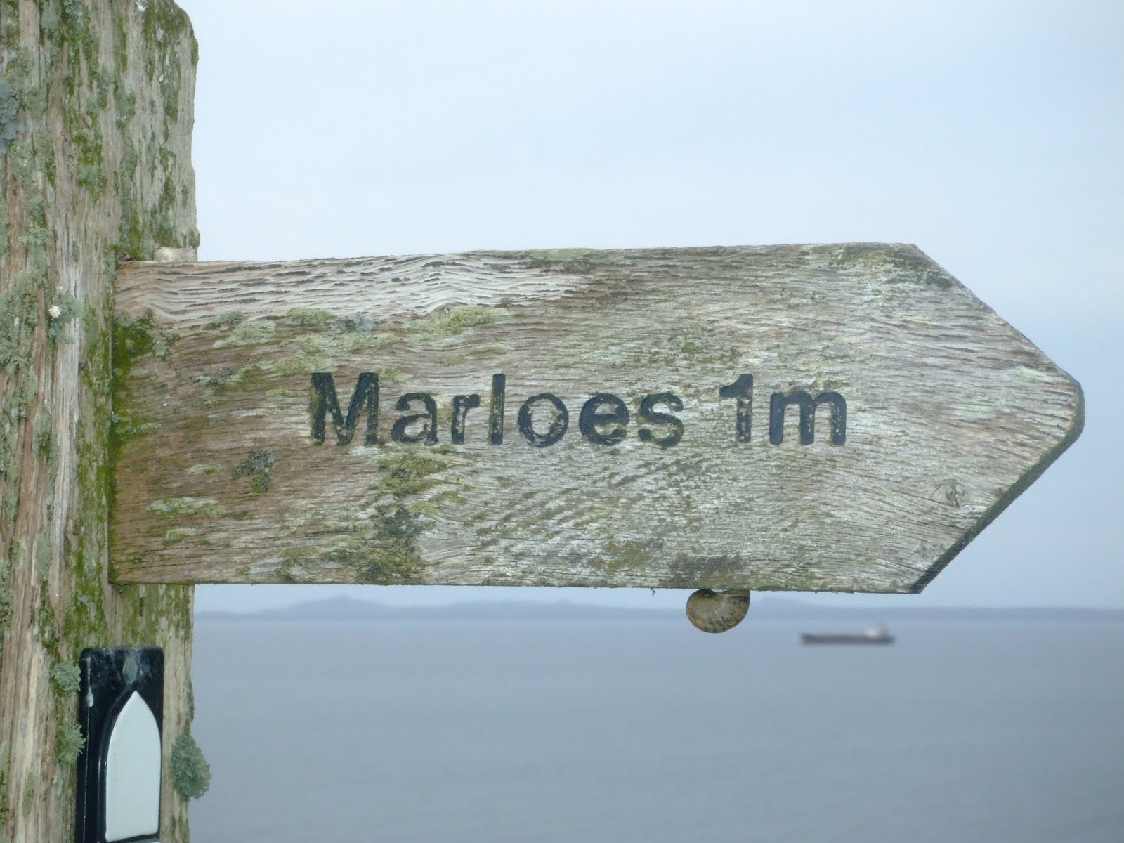
This section of the path had not been as visually dramatic as the first coastal section before the former coastguard hut, but the views soon improved when Musselwick Bay came into sight. Sweeping around the corner directly on top of the cove we left the coastal path at a finger post pointing to Marloes.


Turning left at the end of this path we approached the outskirts of the village by road. We covered the nine miles in three hours before popping into the Lobster Pot for an aperitif or two. The landlord soon gave Wandering a rollicking for removing the menu from his restaurant! But 'entente cordiale' was soon restored when they discovered that both of them had played club cricket! After the earlier incident with the menu the landlord was very non-committal on whether or not we would be able to eat at his establishment later that evening, as he explained that they had been extremely busy over the last few weeks and he could not guarantee that a table would be available!


After a few beers to quench our thirsts it was back to the Clock House for a quick shower and change of clothes.

Ninety minutes later we returned to the Lobster Pot in trepidation to find the place half empty - so much for his predictions on the number of covers the chefs would do that night - to enjoy a pleasant enough meal.

Butterballs won the game of pool, but the music (Razorlight, Jeff Buckley, Killers, Elbow and the Duke's opening choice Lady Gaga!!) was top class.

Another great walking day!

Marloes


The sun was shining in a clear blue sky as we departed Dale after our very brief visit. The 'C' road to Marloes was single lane, bordered by hedge-rows on either side.

The original plan was to book in to the b & b, make a quick brew and then walk part of the coastal path during the afternoon/early evening.


All went according to plan as we quickly found our B & B in the centre of the village of Marloes (population 323 according to the census of 2001) opposite the clock tower! The Clock House is run by Phil and Sue, who were both extremely welcoming and friendly. When we originally booked the accommodation Sue confirmed that we could have the family suite that would provide us with our own bathroom facilities. The Duke and Butterballs were both suitably impressed with the rooms, which were extremely comfortable and excellent value for money. Off-road parking was also provided to the rear of the B & B.


Tea making facilities available in the rooms allowed us to make some mugs of tea before we inquired with our hosts about a packed lunch for tomorrow.

On our way into the village we spotted the local hostelry, the Lobster Pot, where we could possibly eat later in the evening.

Marloes is surrounded by large tracts of both arable and pasture land enclosed by the well maintained hedge-rows. We found out that the village now has a large number of holiday homes with tourism providing the main source of employment.