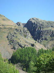
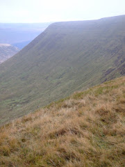
Pen-Y-Fan from Cribyn
Learn to fall in love with the mountain not just the summit
Showing posts with label Glamorgan Heritage Coast. Show all posts

Friday, July 1, 2011

Dunraven Bay and Merthyr Mawr Warren


Another day and another walk, just 24-hours after one visit to Nash Point and Steve was visiting Dunraven Bay on his way to Merthyr Mawr Warren to experience a huge network of sand dunes situated about one mile from the village of Merthyr Mawr, and only a few miles further west from Llantwit Major.


The unique setting at Dunraven Bay with its almost golden coloured limestone rock formations, was used in an episode of the recent BBC TV series 'Merlin' - The Labyrinth of Gedref.


Leaving Dunraven Bay the walk continued through Merthyr Mawr Warren and the highest single sand dune in Europe, known locally as the 'big dipper'. Scenes from the film 'Lawrence of Arabia' were filmed at the dunes.

Walking up these giant sand dune's is exceptionally hard work, although international athletes and sportsmen and women use the dunes for fitness training (the Welsh rugby union team for example have been known to use it as part of a training run).

A hundred years ago sand threatened to engulf nearby Merthyr Mawr after rabbits had stripped the ground of the vegetation holding the dunes together. Buckthorn bushes were planted to stabilise the sand, but now it's the dunes that have to be protected from the buckthorn which is over-grown and threatening to take over.


Merthyr Mawr, is a pretty little chocolate box village, there are no modern buildings here and it's like walking on to a film set. Roses around the cottage doors, thatched roofs, cream teas! An idyllic settlement, as picturesque as they come, with an outstanding collection of Thatched Dwellings straight from the pages of a Thomas Hardy novel, beautifully positioned around an old Village Green.


The warren is an important wildlife habitat and site of scientific interest, which shelters a rich variety of plants.

Thursday, June 30, 2011

Nash Point


As a gesture of support for the industrial action taken by the teachers union against the proposed Government changes to their pensions, Wandering and Lord Twynyrodyn decided to spend the day in a rather less confrontational environment. The initial destination was the beach car park at Llantwit Major on the South Glamorgan coast. Arriving at 10:45 after a pleasant journey through the country lanes when the topic of conversation was inevitably the policies of the coalition, they joined the Glamorgan Heritage coastal path just to the rear of the beach front cafe.


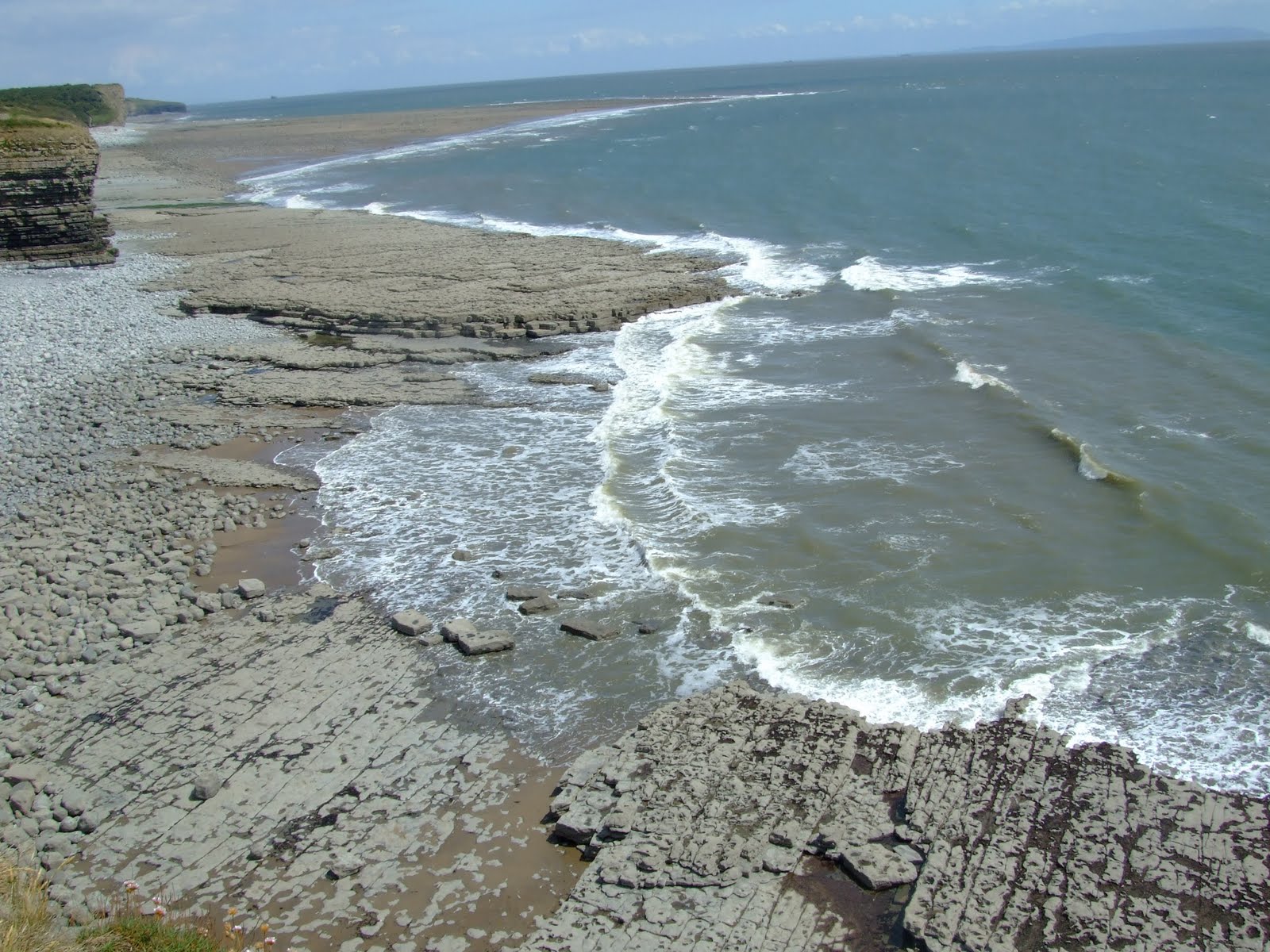
They immediately gained some height climbing to the cliff top for an exhilarating walk along the layers of limestone rock faces which are separated by softer layers of shale (mudstone). The shale often wears away quicker than the limestone leaving it unsupported, causing it to collapse and fall to the beach.

The rocks forming the cliffs were created during a period of the Earth's history called the Liassic, which was part of the early Jurassic times. This was about 180 million years ago.


The first sighting of St Donat's Castle, over a mile in the distance, is from the coastal path itself. A medieval castle built in the late 12th century, it directly overlook's the Bristol Channel. Since 1962 the castle has housed the international Sixth form of Atlantic College.


After seeing photographs of the castle in Country Life magazine, it was purchased and renovated by American newspaper magnate William Randolph Hearst in 1925. Hearst, who at the time was having an affair with the actress Marion Davies, spent a fortune upgrading the castle, installing electricity not only to his residence but also to the surrounding area. Hearst was renowned for holding lavish parties at St Donat's - guests included Charlie Chaplin, Douglas Fairbanks, and a young John F. Kennedy. Upon visiting St Donat's, George Bernard Shaw was quoted as saying: "This is what God would have built if he had had the money."

After Hearst's death in 1951 the castle was eventually purchased in 1962 by Monsieur Antonin Besse II (1927 - ) and given to the Governing Body of Atlantic College.

The College was founded by the German educationalist Kurt Hahn — who also set up Gordonstoun School in Scotland and the Salem School in Germany — as a practical response to the search for new and peaceful solutions in a world riven by political, racial and economic divisions (not a great deal has changed in the last fifty years!)

When Atlantic College opened it was hailed by The Times as "the most exciting experiment in education since the Second World War."


After passing the sea-front promenade to the rear of the college (the students were practicising rolling canoe's in the open air swimming pool in the grounds of the college!), the walk climbs into extremely pleasant woodland until you emerge once again onto the coastal path.


Soon on the horizon in the distance we saw our first glimpse of Nash Point Lighthouse, over an enormous field of wheat that ran almost to the cliff edge.

Nash Point itself is a promontory headland on the Monknash Coast. The Lighthouse was designed by James Walker, the chief engineer for Trinity House. Established in 1832, the lighthouse was electrified in 1968. Nash Point Lighthouse became the last manned lighthouse in Wales, and was only automated in 1998.


Trinity House provide public tours of the lighthouse on a Wednesday, Saturday or Sunday from July to September. The massive foghorn is blown on the first Saturday of every month and third Sunday.


At this point we had to leave the coastal path and head in-land across a series of open access fields before arriving at Marcross, where we spent an hour in a delightful village pub called the Horseshoe Inn - the pint of Cwrw Braf and bar-food is highly recommended.


The road heads east opposite the Horseshoe Inn, passing the Old Schoolhouse and Marcross Court, before taking a right turn down a 'C' road. This led to a section of the Millenium Trail, in another area of woodland that joined and passed through part of the grounds of Atlantic College itself.

Leaving the College the walk passes through King George Fields before rejoining the coastal path for the short return leg to Llantwit Major beach. We decided to leave the coastal path for the last half mile and walk from Treslian Bay to the car park over the slabs of rock created by the build up of millions of shells of tiny sea creatures, together with mud brought into the sea by ancient rivers. Eventually hundreds of metres of this sediment became compacted to form limestone. We enjoyed an ice-cream on the beach prior to the journey home.
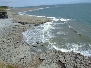


The walk was 9 miles and took approximately 4 hours (including an hour spent obtaining refreshments in the Horseshoe Inn!)

Photographs taken on this walk can be viewed here. Select 'slide-show' for automated viewing.
Thursday, April 1, 2010

Jurassic Coast - Southerndown to Ogmore

There was considerable apprehension in Steve's face as he saw the sign in the car park at Ogmore Castle which was the start of our walk, but the three young lady's we asked all reassured him that high tide had been a few hours earlier - honestly kind sir!!

Built during the early Norman control of the area, Ogmore Castle, is now an extensive ruin settled along the lush estuary of the River Ewenny. The castle guards a major fording place into southern Wales, and sits on flat land rather than on top of a ridge-crest where nature would have provided extra defense. The Normans made their claim to this area as early as 1116.


Leaving the castle keep our journey started with the only real climb of the day from the B4524 up a sandy dune to emerge on the second tee of Southerdown golf course (clubhouse pictured below), where the vista to the west included Trecco Bay at Porthcawl.


The public footpath crossed the 10th fairway, leading to the open common of Ogmore Down before arriving at the small hamlet of Heol-Y-Mynydd.

Joining the bridle path on the southern extremes of the settlement a further half mile walk heralds our arrival at the headland west of Dunraven Bay. We precariously walked on the edge of the magnificent cliffs in a strong head wind, before making our descent to the sandy beach below.

Although really impressive and a geologist's heaven, the coast holds many hidden dangers with cliff falls common. Many of the beaches are tide-traps as the Bristol Channel has the second highest tidal range in the world. The signs on the cliff edge even offer a telphone number for help and assistance!

The cliffs along most of the Glamorgan Heritage Coast are made up of limestone rock layers separated by softer layers of shale (mudstone). The shale wears away quicker than the limestone leaving it unsupported, often causing it to fall to the beach.

The rocks forming the dominant cliffs of the Glamorgan Heritage Coast were created during a period of the Earth's history called the Liassic, which was part of the early Jurassic times. This was about 180 million years ago. The land that is now the Vale of Glamorgan was formed at the bottom of a warm shallow sea near the equator. Most of these rocks were created by the build up of millions of shells of tiny sea creatures, together with mud brought into the sea by ancient rivers. Eventually hundreds of metres of this sediment became compacted to form limestone.


Sutton stone is the oldest of the Liassic rocks along the coast and can be seen at Southerndown and Ogmore-by-Sea. On the beach at Ogmore are patches of Triassic Breccia, an unusual rock formed from sand compressed with a mixture of other rock fragments.


After a brief refreshment break near the beach we made our way up to the next headland above Trwyn y Witch before stepping inside the Heritage Centre for a nose.


The next stage of our route saw us climb though some woodland into open fields for a mile before we emerged at St Brides Major. Mike spotting some wild primrose growing in a very old water ditch.


A planned detour down Pentwyn Road lead us back to Ogmore Down and across Southerndown golf course back to Ogmore Castle.

While the weather on our route remained dry back in the Pearl of the Valleys at various times of the day it had been snowing; raining heavily; hailing; produced a thunder and lighting electrical storm, in fact the only thing missing was the plague of locusts. Nevertheless, contact with Base Camp back at the Civic Centre was maintained throughout the trek by SMS:

Expedition Group: "We're on the beach and the sun is shining!"

Base Camp: "I think you are being economic with the facts"

Expedition Group: "We have the photographic evidence to prove it"

Base Camp: "It is wazzing down here and you are all strangers to the truth"

We spotted an adder in the undergrowth next to a path on the way down the dune to the car park, while during the walk we also saw dippers, blue tits, doves and a buzzard.

The Pelican Inn looked closed so we took refreshments at the Watermill, relaxing in the leather sofa's for an hour or so before heading back home into the driving rain down the M4 after a splendid days walk!!

This walk was 10kl (6 miles) with a link to a map of the route here.