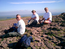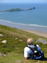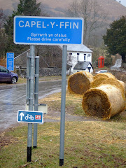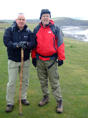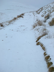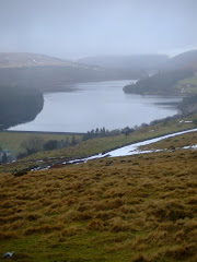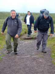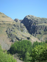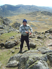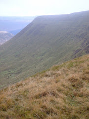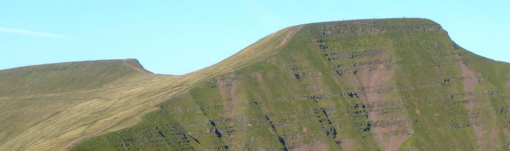
Like the Munro's in Scotland all hills in Wales that are at least 2,000 feet (610 metres), high with a relative height of at least 15 metres (49.2 feet) are classified as Nuttalls. The definitive list was compiled by John and Anne Nuttall and published in 'The Mountains of England & Wales'.
All of the qualifying hills in the two main regions of South Wales are listed below. In total there are 34 Nuttalls to climb in South Wales.
Check how many you may have climbed?
Black Mountains
Waun Fach (811 mtrs)
Pen y Gadair Fawr (800 mtrs)
Pen Allt-mawr (720 mtrs)
Rhos Dirion (713 mtrs)
Black Mountain 3 (703 mtrs)
Pen Cerrig-calch (701 mtrs)
Twmpa (690 mtrs)
Chwarel y Fan (679mtrs)
Mynydd Llysiau (663 mtrs)
Pen Twyn Mawr (658 mtrs)
Pen Twyn Glas (646 mtrs)
Black Mountain Sth Top (637 mtrs)
Brecon Beacons
Pen y Fan (886 mtrs)
Corn Du (873 mtrs)
Fan Brycheiniog (802 mtrs)
Cribyn (795 mtrs)
Waun Rydd (769 mtrs)
Fan Hir (761 mtrs)
Bwlch y Ddwyallt (754 mtrs)
Bannau Sir Gaer (749 mtrs)
Fan Fawr (734 mtrs)
Fan Gyhirych (725 mtrs)
Fan y Big (719 mtrs)
Waun Lefrith (677 mtrs)
Fan Fraith (668 mtrs)
Fan Nedd (663 mtrs)
Allt Lwyd (654 mtrs)
Garreg Las or Twyn Swnd (635 mtrs)
Fan Llia (632 mtrs)
Fan Frynych (629 mtrs)
Craig Cerrig-gleisiad (629 mtrs)
Y Gyrn (619 mtrs)
Cefn yr Ystrad (617 mtrs)
Garreg Lwyd or Moel Gornach (616 mtrs)
Saturday, August 14, 2010
Thursday, August 12, 2010
El Camino Del Ray
The English translation 'The King's little pathway' is a walkway, which has now fallen into major disrepair. It was constructed along the steep walls of a narrow gorge in El Chorro, in the district of Malaga, Southern Spain. The name is often shortened to Camino del Rey.
In 1901 the workers at the hydroelectric power plants at Chorro Falls and Gaitanejo Falls needed a walkway to cross between the falls, to provide transport for materials, and to undertake the inspection and maintenance of the channel. Construction of the walkway took four years and it was finished in 1905.
In 1921 King Alfonso XIII crossed the walkway for the inauguration of the dam Conde del Guadalhorce and it then became known by its present name.
The walkway has now gone many years without any maintenance, and is in an extremely dangerous condition. It is one metre (3 feet and 3 inches) in width, and is over 100 metres (350 feet) above the river. Nearly all of the path has no handrail. Some parts of the concrete walkway have completely collapsed and all that remains is the steel beam originally in place to hold it up.
Several people have lost their lives on the walkway in recent years; after four people died in two accidents in 1999 and 2000, the local government closed the entrances. To this day it remains illegal to cross. However policing is extremely minimal and many adventurous tourists still find their way onto the walkway to explore it.
The regional government of Andalusia budgeted in 2006 for a restoration plan estimated at € 7 million.
In 1901 the workers at the hydroelectric power plants at Chorro Falls and Gaitanejo Falls needed a walkway to cross between the falls, to provide transport for materials, and to undertake the inspection and maintenance of the channel. Construction of the walkway took four years and it was finished in 1905.
In 1921 King Alfonso XIII crossed the walkway for the inauguration of the dam Conde del Guadalhorce and it then became known by its present name.
The walkway has now gone many years without any maintenance, and is in an extremely dangerous condition. It is one metre (3 feet and 3 inches) in width, and is over 100 metres (350 feet) above the river. Nearly all of the path has no handrail. Some parts of the concrete walkway have completely collapsed and all that remains is the steel beam originally in place to hold it up.
Several people have lost their lives on the walkway in recent years; after four people died in two accidents in 1999 and 2000, the local government closed the entrances. To this day it remains illegal to cross. However policing is extremely minimal and many adventurous tourists still find their way onto the walkway to explore it.
The regional government of Andalusia budgeted in 2006 for a restoration plan estimated at € 7 million.
Monday, August 9, 2010
BBC Coast
Re-live our escapade to Worms Head during May through last night's episode of BBC’s Coast
Slightly earlier than our visit, Neil Oliver makes the same crossing from Rhossili to Worms Head with stunning photography of the Gower Peninsula, while Nicholas Crane explores the smuggling connections with Rhossili and Port Eynon.
The section on Worms Head is included in the opening five minutes of the programme, which also includes an interesting feature on Harlech Castle which some of our group also visited in June and August!
This programme will remain available on the BBC iplayer website until 15th September 2010.
Enjoy!
Slightly earlier than our visit, Neil Oliver makes the same crossing from Rhossili to Worms Head with stunning photography of the Gower Peninsula, while Nicholas Crane explores the smuggling connections with Rhossili and Port Eynon.
The section on Worms Head is included in the opening five minutes of the programme, which also includes an interesting feature on Harlech Castle which some of our group also visited in June and August!
This programme will remain available on the BBC iplayer website until 15th September 2010.
Enjoy!
Thursday, August 5, 2010
Grwyne Fechan

Leaving Blaenau Gwent (where the Eisteddfod 2010 is being held – Welsh Learner of the Year on the Maes today), you soon cross over the border into Powys and on the descent from Mynydd Llangynidr the western flank of the Black Mountains is laid out before you in it’s magnificent splendour.
Although the dark storm clouds were gathered over the A470 Heads of the Valley the sun was breaking through less than twenty minutes later as the journey weaved it’s way north of Crickhowell.
 The main purpose of the day was to bag a few South Wales Nuttalls (peaks over 2,000 feet…….but more of that in another posting).
The walk started along a narrow country lane bordered by hedges of hazel and holly. After leaving the road just past Pentwyn Farm, I followed the trail that leads from Tir Y Nant into the forest and starts to climb almost immediately gaining height quickly. Before too long I was in open countryside only to disappear into the eerily quiet and darkness of the forest itself for a relatively short period.
 Crossing a stile to leave the canopy of trees the trail leads diagonally upwards along a heathery clad hillside with evidence of the early stages of the late Summer wimberry harvest. The sun had started to shine and it was getting warmer as the sheep tracks suddenly started to lead off in all directions! Eventually after about 45 minutes and 750 feet of ascent I joined a wide pathway that runs along the crest of the ridge.
After walking for a mile on the ridge I climbed an insignificant path to a forlorn cairn that marked the heather-clad peak of Pen-twyn Mawr, the first Nuttall of the day at 658 metres. This was also a signal to celebrate the first mini-break of the walk.

The more distinctive summit of Pen-y-Gadair Fawr was a further mile in the distance. The wind had picked up as I approached the second highest peak in the Black Mountains at 800 metres, the windswept summit gained pride of place as the second Nuttall of the day.

Although Waun Fach at 810 metres is actually the highest peak in the Black Mountains (and another Nuttall bagged on the day) it is not very attractive, surrounded by dark peat and approached over coarse boggy grass . However, there were a number of walkers arriving or departing at this central hub.

The journey continues to the west as I departed Waun Fach as the route heads towards Pen Trumau which is a rugged interesting start to the downhill section. Passing through the ‘V’ shaped shoulder at the foot of the col, the original intention was to cut to the left and return to the starting point by the low level Grwyne Fechan route crossing the Hermitage bridge, but I couldn’t resist climbing first Mynydd Llysiau at 663 metres and then Pentwynglas at 646 metres (where I enjoyed another brew) to bag two additional Nuttalls (making 5 in total for the day).
 The walk came to a conclusion after the long steady descent down Tal Trwynau with Pen Allt-mawr towering to the west and really MASSIVE awesome views of Grwyne Fechan and Cwn Banw to the east. Passing through some unusual dis-used quarry workings with a particularly distinctive cairn, I finally left the hillside through some open fields and a rickety lane.
This was a really superb days walking in very good conditions.
The total distance covered was 18 kilometres or 11 miles in four and a half hours. A link to the map of the route is here.
All of the photographs taken on this walk can be viewed here. Select 'slideshow' for automated viewing.
Monday, August 2, 2010
Snowdon
The Earl of Twynyrodyn ventured to the North of the Principality for a family celebration, visiting the 'over-rated Portmerion' by which he was totally under-whelmed and Harlech Castle before the pilgrimage to mighty Snowdon at 3,560 feet above sea level.

Catching the mid-day train from Llanberis he was able to summit the highest mountain in Wales by the easiest route possible - not that he had any great views from the top if the pictures are an indication of the visibility!

The Snowdon Mountain Railway is a narrow gauge rack and pinion mountain railway that travels for 4.7 miles (7.6 km) to the summit of Snowdon.
It is the only public rack and pinion railway in the United Kingdom, and after more than 100 years of operation it remains a popular tourist attraction. The railway operates in some of the harshest weather conditions in Britain, with services curtailed from reaching the summit in bad weather. Single carriage trains are pushed up the mountain by either steam locomotives or diesel locomotives.
The railway was constructed between December 1894, when the first sod was cut and February 1896, at a total cost of £63,800 (£7,190,550 at 2010 costs).

Snowdon actually offers some of the most extensive views in the British Isles; on exceptionally clear days, Ireland, (the Republic of Ireland and Northern Ireland), Scotland, England, and the Isle of Man are all visible, as well as 24 counties, 29 lakes and 17 islands. The mountain itself may also be viewed on take off and approach to both Manchester Airport and Liverpool John Lennon Airport on very clear days.
A visit was also made to Beddgelert during the mini-break.

Catching the mid-day train from Llanberis he was able to summit the highest mountain in Wales by the easiest route possible - not that he had any great views from the top if the pictures are an indication of the visibility!

The Snowdon Mountain Railway is a narrow gauge rack and pinion mountain railway that travels for 4.7 miles (7.6 km) to the summit of Snowdon.
It is the only public rack and pinion railway in the United Kingdom, and after more than 100 years of operation it remains a popular tourist attraction. The railway operates in some of the harshest weather conditions in Britain, with services curtailed from reaching the summit in bad weather. Single carriage trains are pushed up the mountain by either steam locomotives or diesel locomotives.
The railway was constructed between December 1894, when the first sod was cut and February 1896, at a total cost of £63,800 (£7,190,550 at 2010 costs).

Snowdon actually offers some of the most extensive views in the British Isles; on exceptionally clear days, Ireland, (the Republic of Ireland and Northern Ireland), Scotland, England, and the Isle of Man are all visible, as well as 24 counties, 29 lakes and 17 islands. The mountain itself may also be viewed on take off and approach to both Manchester Airport and Liverpool John Lennon Airport on very clear days.
A visit was also made to Beddgelert during the mini-break.
Thursday, July 29, 2010
Sarn Helen
"...These mountains and valleys, like the rock on which they are founded, are of old stock and even though there may be little record to tell of the ancient people who passed this way, the very landscape shouts it out."
(The Secret and Sacred Beacons by Brian S. Griffiths)
 Walking in the footsteps of the all conquering Romans is to sense the history of the hardship that must have been suffered to construct the 160 miles of this highway, which connects Aberconwy in the north to Carmarthen in the South. This particular section of Sarn Helen starts just north-west of Ystraffellte and runs northwards beneath Fan Frynych en route to the Roman fort of ‘Y Gaer’ in Brecon.
History now tells us that the Roman conquest of Wales began circa AD 50 and within half a century most of the "strategic" land, including coastal stretches and lowlands, were under Roman rule, a situation which lasted until AD 400 in spite of continual skirmishes with the feisty Celtic tribesmen.

Just as you join this section of Sarn Helen the OS map identifies the site of a Roman Fort although no physical evidence of this appears to remain visible. After about half a mile the surface shows signs of the original road laid by Roman engineers over two millennia ago. With sophisticated drainage channels built into the road, the outlines of the sandstone slabs remain clearly visible.
 After only a mile and a half a stone monolith, Maen Madoc, stands proudly alongside the road over eight feet high. The following Latin words are engraved on its side edge:
"DERVAC FILIUS IUST HIC IACIT"
Which is translated to: "DERVACUS, SON OF JUSTUS. HERE HE LIES."
Like the stone at Gelligaer Common, it is thought to mark a Christian burial (roadside graves being a feature of Roman burials). It is also not that far from the Maen Llia stone which lies about a mile to the north (We visited this a few months ago).
Though the stone is named after a Madog it is not clear who Madog was. One theory is that he was a local landowner. The base of the standing stone is surrounded by deeply embedded stones although previous excavation failed to reveal any sign of a burial.

Fan Nedd and Fan Llia provide a stunning backdrop as the walk passed Coed-Y-Garreg Farm. Leaving Sarn Helen at Duffryn Nedd the path starts quite well defined but soon disappears and this section of the walk did not appear to be used very often.

After a scramble through thick undergrowth you climb a stile and return to a path that leads south to eventually join a ‘C’ road by which you return to Ystraffellte, passing the New Inn which unfortunately was closed by late afternoon.

Near the end of the walk I met a very polite group of teenagers who had been hiking and camping in this region of the Welsh hills for the last few days as part of their Duke of Edinburgh Gold Award, soon afterwards the radio commentary confirmed that Eoin Morgan had scored the maiden century of his Test career against Pakistan in the First Test Match at Trent Bridge.
All of the photographs taken on this walk can be viewed here. Select 'slideshow' for automated viewing.
(The Secret and Sacred Beacons by Brian S. Griffiths)
 Walking in the footsteps of the all conquering Romans is to sense the history of the hardship that must have been suffered to construct the 160 miles of this highway, which connects Aberconwy in the north to Carmarthen in the South. This particular section of Sarn Helen starts just north-west of Ystraffellte and runs northwards beneath Fan Frynych en route to the Roman fort of ‘Y Gaer’ in Brecon.
History now tells us that the Roman conquest of Wales began circa AD 50 and within half a century most of the "strategic" land, including coastal stretches and lowlands, were under Roman rule, a situation which lasted until AD 400 in spite of continual skirmishes with the feisty Celtic tribesmen.

Just as you join this section of Sarn Helen the OS map identifies the site of a Roman Fort although no physical evidence of this appears to remain visible. After about half a mile the surface shows signs of the original road laid by Roman engineers over two millennia ago. With sophisticated drainage channels built into the road, the outlines of the sandstone slabs remain clearly visible.
 After only a mile and a half a stone monolith, Maen Madoc, stands proudly alongside the road over eight feet high. The following Latin words are engraved on its side edge:
"DERVAC FILIUS IUST HIC IACIT"
Which is translated to: "DERVACUS, SON OF JUSTUS. HERE HE LIES."
Like the stone at Gelligaer Common, it is thought to mark a Christian burial (roadside graves being a feature of Roman burials). It is also not that far from the Maen Llia stone which lies about a mile to the north (We visited this a few months ago).
Though the stone is named after a Madog it is not clear who Madog was. One theory is that he was a local landowner. The base of the standing stone is surrounded by deeply embedded stones although previous excavation failed to reveal any sign of a burial.

Fan Nedd and Fan Llia provide a stunning backdrop as the walk passed Coed-Y-Garreg Farm. Leaving Sarn Helen at Duffryn Nedd the path starts quite well defined but soon disappears and this section of the walk did not appear to be used very often.

After a scramble through thick undergrowth you climb a stile and return to a path that leads south to eventually join a ‘C’ road by which you return to Ystraffellte, passing the New Inn which unfortunately was closed by late afternoon.

Near the end of the walk I met a very polite group of teenagers who had been hiking and camping in this region of the Welsh hills for the last few days as part of their Duke of Edinburgh Gold Award, soon afterwards the radio commentary confirmed that Eoin Morgan had scored the maiden century of his Test career against Pakistan in the First Test Match at Trent Bridge.
All of the photographs taken on this walk can be viewed here. Select 'slideshow' for automated viewing.
Monday, July 26, 2010
Caption Contest

"I told you the compass we were using was a stranger to the truth and we are now offically lost...."
....or does anyone have a funnier caption? Post your suggestions via the comments link below.
A free drink on our next walk for the winner.
Subscribe to:
Posts (Atom)