
As you approach Abergavenny from Raglan in the east on the straight autobahn-like A40, the distinctive outline of the conical summit of the Sugar Loaf (at 596 metres) dominates the horizon as the southern most peak of the Black Mountains.
It was extremely disappointing to depart from home with blue skies and sunshine to arrive at Abergavenny only twenty minutes later in miserable low cloud. Its normally the other way round!
 The approach to the start of the ascent was made via the National Trust car park, from the north-east of the Sugar Loaf about a half mile past Bettws.
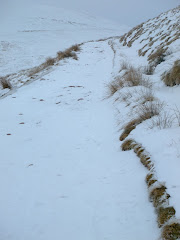
Walking during February in either the Brecon Beacons or Black Mountains is often through low cloud and after the initial climb onto the lower plateau, with views of Partishow Hill to the north, the visibility gradually reduced to less than 100 metres.

The only incident of note on the ascent was when I spooked a grouse or pheasant a few feet away in the bracken and heather, that subsequently made me jump at the loud flapping of its frantic wings.
The final climb to the summit is steep and the long narrow ridge, only 20 feet wide, stretches for about 50 or 60 yards from south to north. On a clear day views to the Bristol Channel in the south-east and the Malvern Hills to the north-east can be spectacular, but unfortunately not today.

The only benefit of the poor visibility was the deserted summit where I stayed for 15 minutes.

The Sugar Loaf was donated to the National Trust in 1936 by Margaret Haig Thomas, Viscountess Rhondda, and daughter of David Alfred Thomas who served as a Liberal Member of Parliament for Merthyr Tydfil, from 1888 to 1910.
The walk was 8 kilometres and involved 369 metres (1,100 feet) of ascent, taking 1 hour and forty minutes.















I have been to this place. it is really amazing. no words to describe it.
ReplyDeletelovely photos!
ReplyDelete