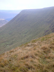
Pen-Y-Fan from Cribyn
Learn to fall in love with the mountain not just the summit

Wednesday, June 30, 2010

Morlais Castle


A local walk starting from the car park of the Brecon Mountain railway, during a balmy late Summers evening through the dis-used limestone quarries just north of Pant.

The area is now used extensively for climbing & abseiling instruction and we witnessed two groups working in different parts of the site. It is also used for motor-cross events.


Mike pointed out the entrance to this forty foot 'chimney' which his daughter squeezed through as part of a pot-holing exercise for her Duke of Edinburgh's Gold Award. The exit at the top of the narrow chimney is shown below!


We also had some great views of Pen-Y-Fan at dusk, which was ten miles away as the crow flies.


This is all that remains of the old castle over-looking the golf course. Originally built around 1270 by the Earl of Gloucester and Lord of Glamorgan, Gilbert de Clare. It's construction at the furthest extreme of the boundary of his land demonstrates that he was probably planning raids into Vaynor with the intention of attempting to take lands from Humphrey de Bohun, Earl of Hereford and Lord of Brecknock.


It is thought that the castle was never properly finished. The violent dispute between these two Earls over the construction of Morlais Castle caused Edward I (Longshanks) to intervene and put both in the Tower of London. The King himself did not want Morlais Castle to be an important stronghold on the boundary between Glamorgan and Brecknock and he stamped his Royal control over these two powerful Norman Lords.


When the castle was excavated in 1833 by Lady Charlotte Guest (who translated The Mabinogion into english), coins from the reign of Edward I were discovered. Morlais was also excavated by the amateur Victorian archaeologist, G.T. Clark of the Dowlais Works.


We concluded the walk by taking a route through the golf course watching the last pair of the First team drive off the 18th tee in a league match before we finally adjourned to the Quarrymans Arms on Pant Road for refreshments.

Saturday, June 26, 2010

Portmeirion


Day Two in North Wales - all roads lead to the village of Portmeirion.

As the tide recedes down the mouth of the estuary the best view of Portmeirion is probably from the middle of the exposed sandbank and this is possible at low tide, except for the threat of quicksand!


The picturesque setting has served as the location for numerous films and television shows. Probably the best-known use occurred in 1966-67 when Patrick McGoohan, playing Number Six, filmed exteriors for a cult TV series called The Prisoner, a surreal spy drama in which Portmeirion itself played a starring role as "The Village".
Number Six: Where am I?
Number Two: In the Village.
Number Six: What do you want?
Number Two: Information.
Number Six: Who are you?
Number Two: The new Number Two.
Number Six: Who is Number One?
Number Two: You are Number Six.
Number Six: I am not a number! I am a free man!


In 1976 a four-episode Doctor Who story entitled "The Masque of Mandragora" set in Renaissance Italy was also filmed on location in Portmerion and an episode of Citizen Smith in which Wolfie visits Rimini. In 2003 some scenes were also filmed here for the final episode of the TV series Cold Feet.

Designed and built by architect, Sir Clough Williams-Ellis between 1925 and 1975 in the style of an Italian village, it is now owned by a charitable trust.

Portmerion is located on the estuary of the River Dwyryd, 2 miles south east of Porthmadog.


After a leisurely stroll around the main village I decided to walk along the coastal route through mixed woodland heading west to the mock Goleudy lighthouse.


Leaving the path I ventured onto the rocks and during the low tide decided to ignoring the warnings of quicksand to cross the beach over the estuary. First mistake! I quickly started to regret this decision as I sank deeper into the sand until I frantically searched for a firm section of wet sandbank.


The receding tide had left a large, deep pool near the shore and to my delight a dozen 5lb Sea Trout had been trapped in the clear water of the pool and amused me for half an hour as they swam strongly searching for an escape route back out to sea.


I re-joined the coastal path and eventually found the battery ridge and its lake teeming with wild life. Dozens of azure blue dragon flies were skiting about the lily ponds and other vegetation around the lake.


An almost perfect setting in the fantastic surroundings of the Lleyn Peninsula - I can't wait to come back to North Wales as soon as possible!

All of the photographs taken on this walk can be viewed here. Select 'slideshow' for automated viewing.

Friday, June 25, 2010

Harlech


Less than ten minutes after leaving the boundary of the County Borough you enter Powys and pass beneath the highest peaks in South Wales, while the A470 eventually meanders it's way into Gwynedd when you start to encounter the really 'big boys' of North Wales.

Towering above the valley floor, you pass Cadair Idris, less than a mile west of the main trunk road that links South with North Wales just before you reach Dolgellau. Then mighty Snowdon, peerless to its contemporaries, dominates the sky-line from Tremadog Bay and the Lleyn Peninsula.

Poet and author, John Ruskin, said that there is "no better walk than from Barmouth through to Dolgellau other than from Dolgellau to Barmouth" - with the toes of Cadair Idris dipping into the Mawddach Estuary it's a phenomenal setting.

After a short refreshment break we head north to Harlech with it's medieval Castle, and a coastline that is one really 'extra' long stretch of golden sand with massive dunes as a glorious backdrop.


Perched on rocky outcrop, two hundred feet above the town, the castle is a World Heritage site, built by King Edward I ('Longshanks') in 1283, as one of an iron ring of fortresses designed to subdue the Welsh Nation.

The castle has been attacked many times and was taken by the Welsh leader Owain Glyndwr in 1404, who held a Welsh parliament there. For a time it served as his capital before being retaken by the English in 1408.


The town also boasts a Championship golf course, established in 1894, Royal St David's Golf Club is the home of one of the finest traditional links courses in the world with undulating fairways and fast true greens.


A walk along the miles of deserted beach (it was 28 degrees with a cloudless sky at the time!) to the Glaslyn Estuary with superb views of the Lleyn Peninsula was the highlight of the first day in North Wales.


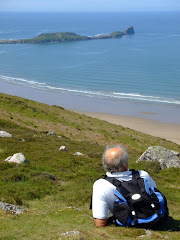
The beach at Harlech is a potential rival to Rhosilli.


It was an ideal opportunity during the stroll to paddle in exceptionally clear, warm blue sea!


All of the photographs taken on this walk can be viewed here. Select 'slideshow' for automated viewing.

Thursday, June 24, 2010

Black (Magic) Mountains Vista

A short bimble to the trig point at Hen Dy-aderyn at 529 mtrs above Llangattock, which we located using the navigational skills of a map and compass!


The glorious vista across the valley included Pen Allt-mawr.


Pen Cerrig-caich above Crickhowell.


The distinctive outline of the Sugar Loaf.


Skirrid Mountain in the far distance to Mike's right shoulder.


And to the west of Gilwern the Blorenge.


A picture is worth a thousand words.

Friday, June 11, 2010

Fforest Fawr

Conveniently tucked between the Brecon Beacons and Mynydd Du (Black Mountain), with the Senni valley from the north and Mellte valley from the south merging to split both two thousand feet peaks of Fan LLia and Fan Nedd - which were our initial targets on the opening day of the 2010 World Cup in South Africa. Probably one of the 'forgotten' hill regions of South Wales, they certainly appeared to live up to their reputation today because in this vast open space we appeared to be the only two visitors! The whole western area of Fforest Fawr is part of the privately owned Cnewr Estate, with a section of our chosen route closed annually between 15th April and 10th May for lambing.


Some basic navigation skills along the narrow country lanes confirmed our arrival at the starting point at the conveniently remote parking area at Blaen Llia forestry. Crossing the bridge over the Avon Llia we started the relatively gentle climb of Cefn Perfedd along this particular section of the Beacons Way. Firm short-cropped grass and patches of bracken created excellent hill-walking conditions underfoot.


Less than forty minutes later we had reached the cairn at 600 metres just below the summit of Fan Llia (2,071 feet). With superb views including Ystradfellte Reservoir and Fan Fawr to our east we continued to Fan Dringarth before turning westward to start the descent to the neolithic standing stone at Maen Llia. With no pre-defined path the going wasn't easy over the tussocks of grass.


Both Steve and I agreed that the weather conditions were perfect for walking. With wispy strands of cirrus clouds high above us at an altitude of 20,000 feet confirming the fine weather. They never produce rain as the clouds form in such a cold part of the atmosphere that they contain only ice crystals. Seeing the cirrus clouds provided us with reassurance that we would not need to use the waterproofs today.


The proud standing stone at Maen Llia is perfectly aligned on a magnetic north/south axis between Ystradfellte and Defynnog. Dating from the Bronze age, it is likely that a quarter to a third of the stone is located below ground level, helping it with-stand thousands of years of wild Welsh weather. The landmark is clearly visibile from some distance and this suggests that it could possibly be a territorial marker or was used to guide travellers down an ancient trackway. Some faint Latin and Ogam inscriptions were visible on the stone's surface until recently.


There is a common legend attached to many standing stones, when usually at mid-summer, the stone 'gets up and goes for a walk' down to the local stream or lake. At sunset on Mid-Summers Day, the shadow from Maen Llia is at its longest. It stretches for over 300 metres and goes through the stream of the Afon Llia. The shadow, because of the shape of the stone and the angle of the setting sun, looks like a tongue, and this could be interpreted as 'going down to the stream for a drink'. if you combine this with the alternative translation for 'Llia', which is to 'lick or to lap', then 'Maen Llia' is literally the licking stone, or the stone that licks (or laps).

Our expertly timed arrival at Maen Llia allowed us the luxury of a well deserved lunch interval before crossing the road that splits the valley to commence the ascent towards Fan Nedd (2,176 feet) via a ladder-stile.

This particular ascent was much tougher then the relatively gentle climb of Fan Llia although we both found the steepest section near the summit to be the easiest!! The views when we arrived at the 'cone shaped' cairn at the northern end of the ridge were spectacular, with the giant of Fan Brycheiniog (definitely another one to do really soon!) to the west and Penyfan in the east.

We then reached the haven of tranquility at the trig point over-looking the Mellte valley at 663 metres before the easy descent and our return to the parking area. This was thirsty work and a compulsory rest and recuperation stop at the Nant Ddu was essential.


This particular walk was 11km (7 Miles) with a link to the map of the route here.

All of the photographs taken on this walk can be viewed here. Select 'slideshow' for automated viewing.

Thursday, June 10, 2010

Mynnydd Llangattock

In one of the driest recorded periods since 1964, the first Lord of Twynyrodyn decided to walk on the escarpment overlooking Crickhowell and Clydach Gorge on a particularly cold, grey, dreich day.

Nevertheless, he managed to dodge the low lying cloud until he was too cold and decided to return to the comfort of his Grade 1 listed manor house.


Mynydd Llangatwg was formed from a layer cake of Palaeozoic era sandstones and limestones which dip gently southwards into the South Wales Coalfield basin. Imposing cliffs of Carboniferous Limestone occur along the northern escarpment and this rock underlies the entire hill and hosts an extensive cave systems which lie beneath it, notably those of Ogof y Daren Cilau and Ogof Agen Allwedd. These two systems are amongst the longest in Britain. The plateau is formed from coarse sandstones ('grit stones') also dating from the Carboniferous period and which have foundered in many places as the underlying limestone has dissolved over millennia.

There were locked gates on the entrance to the caves, although Mike expressed reluctance to explore even if access had been readily available.

While on the mountain his Lordship came into contact with a particular feature of note called the 'Lonely Shepherd' or ‘Bugail Unig’ in Welsh. An isolated limestone pillar which stands at the eastern tip of the plateau, left there by quarry workers who removed great quantities of the surrounding rock. A number of cairns are scattered across the hill, notably the sizable pair which decorate the summit of Twr Pen-cyrn and which are thought to be of Neolithic age.

According to local legend, a farmer at Ty-lsaf farm was so cruel to his wife that she threw herself into the River Usk and drowned. For his sin, the husband was turned into a pillar of stone (Lonely Shepherd), but every year on Midsummer's Eve (June 20th), he goes down to the banks of the Usk to search for his wife, calling her name - in vain. By next morning he has always returned to his lonely place.

It was a local custom in yester-year to white-wash the stone so that it could easily be seen when it walked on Midsummer's Eve.

The greater part of the length of the northern escarpment is scarred by limestone quarries, which remained in operation for most of the nineteenth century. The rock was removed by means of a series of tramroads or tramways via steep inclines to a wharf on the Monmouthshire and Brecon Canal at Llangattock and south to Brynmawr and the ironworks at Nant-Y-Glo, by two tramroads which contoured the eastern end of the hill. The upper tramway which dates from the start of the nineteenth century, runs south from Pant y Gilwern and Daren Disgwylfa and then west around the head of Cwm Clydach. It is now a grassy footpath providing easy walking through otherwise rough terrain. The lower tramway was constructed in 1828-30 and has since been converted to a public road.


On a clear day the peaks of the Blorenge, Sugar Loaf and Ysgyryd Fawr are in view, amongst many others. Unfortunately, not the case today!!

Wednesday, June 9, 2010

Adopt a Path

Launched recently at Merthyr Tydfil Leisure Village by Jane Davidson, Assembly Member and Minister for Environment, Sustainability and Housing, this is the first type of scheme to be introduced by a Welsh Local Authority. The project aims to encourage volunteers with an interest in walking to monitor a section of the offical Rights of Way in the area.

Participants are asked to survey their choosen route three times a year and report any issues to the Rights of Way Section, currently based in Ty Kier Hardie.

How can I get involved?
If you enjoy walking, cycling or horse-riding, you can help MTCBC to maintain the Public Rights of Way network within the County Borough. Public Rights of Way help us to explore and enjoy the Countryside and also provide important links in urban areas.

By adopting a Public Right of Way you will be act as in individual volunteer or part of a group to walk a path within your Ward or a path of your choice at least twice a year. The scheme will give members of the public who have an interest in Public Rights of Way the opportunity to provide "an extra pair of eyes"

What do I have to do?
Just by using the Rights of Way in the surrounding area on a regular basis you will help keep them clear of overgrowth and undergrowth. When you are out on a path please inorm MTCBC if you encounter any of the following

1) Any obstructions on the path, damaged stiles or gates or locked gates.
2) Lack of or damage to waymarkers or signs.
3) Any overgrowth to the path you are using.

For your own safety and insurance purposes, unless you are part of an organized group, MTCBC ask you not to attempt to carry out and clearance, but report any problems to the Local Authority.

If you want to become part of the adopt a path scheme you will be provided with plans of your chosen path and all the relevant forms you will need.

For more details email beth.jones@merthyr.gov.uk

Thursday, June 3, 2010

Summer Festivals

No, not Muse or Seasick Steve at Glastonbury, Paramore at Reading or any of the rubbish at V 2010, but Summer Walking Festivals in Wales.

The 6th Annual Gower Walking Festival starts just over a week after our own visit to Llangennith and Rhossili. Taking place between 5th and 21st June 2010, the festival includes a series of 55 walks!!

Gower Welsh Assembly Member, Edwina Hart will officially open the Festival with the ‘Bay Walk for the Visually Impaired’ on Saturday June 5th. Traditional walks such as the Swansea Outdoor Group’s Gower Gallop, coastal walks, and the walk to the nose of Worms Head (sorry but nesting birds will prevent this particular highlight?) all form part of a varied programme.

On Sunday 6th starting at Three Cliffs Bay, Pennard, including a safe but exhilarating boat trip aboard the 'Sea Serpent'. Walkers will board in shallow water (a small towel will be needed). Your walking clobber will be placed in waterproof bags and you will be put ashore in knee–deep water. An experienced walk leader will guide you back to Mumbles along the coastal route.

A walk from Rhossili to Worms Head takes place on Monday 7th, while 24-hours later 'Dylan Thomas Uplands Circular' contains many references to his childhood and growing up in the Uplands district of Swansea. This walk includes a visit to Cwmdonkin Park.

The Gower Gallop takes pkace on Saturday 12th, when you can select from a choice of three circular walks from Pennard – find your way from checkpoint to checkpoint over a distance of 12.5, 20 or 30 miles.

Full details of the whole programme can be found here

Brecon Walking Festival - takes place between Saturday 3rd to 8th July.

Welsh Valleys Walking Festival - tales place between 4th to 19th September.

More details to follow nearer the dates.