Spectacular rock formations in abundance as the Giro enters the Dolomites on Stage 15 - Conegliano to the ski resort of Gardeccia Val di Fassa.
This particular stage has five very difficult climbs in the Dolomites, including the Cima Coppi (Passo Giau, 2236m), the highest point of this year's race.
The Dolomites region of the Northern Italy is actually smaller than most people believe, however, Stage 15 really is a 'Dolomites stage'. Passo di Fedáia, in particular, the second last climb is very intimidating. It's 13 km of 8% that appears to be one endlessly, steep road to the sky.
This 229 km stage finished with the 6.2 km 10% Rifugio Gardeccia climb ending at the Val di Fassa ski resort.
The average temperature in Rome recenty was in the mid-70's. However, there is still snow lying on the slopes of many of the climbs in the Dolomites.
After leaving Skomer we had one further place to visit before the very enjoyable stay in Pembrokeshire came to a satisfactory conclusion.
Heading a few miles north of Marloes we travelled on the country lanes before arriving at the delightful setting of St Brides bay in Nabs Head.
While two of the repribates literally basked in the sunshine, the remaining member of the tour party did some beachcombing and walked a short section of the coastal path past St Brides castle heading south west towards Musselwick Bay.
This is a fabulous secluded part of the coast line and well worth a visit.
After our short stay we made the return journey down the A40 and A465 after a great two days spent in the Pembrokeshire National Park.
Assessment of tour - Weather: Very Good for walking Location: Amazing Accommodation: Superb value for money Company: Brilliant!!
There was considerable debate the night before whether to queue first to secure a ticket for the ferry and then return for breakfast, or to turn up in the dinning room before 8.00am hoping that we could start eating as soon as possible and then leave for Martins Haven to catch the ferry to Skomer.
Sue soon kindly explained that if we queued first then we definitely wouldn't be able to return in time to eat breakfast - as it turned out this was some good advice.
So it was an early shower before eating a full cooked breakfast, with cereal and toast before departing the Clock House after a splendid overnight stay. A ten minute journey to the car park at Martins Haven and we soon discovered that we were in the first twenty customers for the ferry (that only holds fifty).
We didn't know it when we booked the date for our visit to Skomer that the island had been closed for the previous three days for the annual bird count, but it was fortunately re-opened to visitors today!
You are unable to pre-book the ferry (the cost was £10 each), it's first-come-first-served, so at 8.30am we purchased our landing ticket (£8 each) and settled down to patiently wait for the first ferry at 10.00am. We were able to watch the volunteers land at Martins Haven over the next hour as they returned to the mainland following their 3 day stay on Skomer.
The breeze and swell made the fifteen minute crossing to Skomer really pleasant for the packed Dale Princess as Fat Alex, the skipper, negotiated some dangerous looking rocks that poked through the surface of the sea.
After landing at the jetty we then climbed a few hundred feet to the meeting point where one of the volunteers working on the islands provided us with a brief welcome and introductory talk. The bird count earlier in the week had identified 22,000 pairs of Manx Shearwaters and 13,000 pairs of Puffins. The burrows used by the Puffins and Manx Shearwaters litter the island like bomb craters.
The Island is about one and a half miles long and one mile wide and will only cater for up to 250 visitors each day; volcanic rocks make the scenery spectacular, with hosts of wild flowers in early summer.
We decided to start the 6.5 kilometre perimeter walk around the island to the south passing the Neck and visiting South Plateau and The Wick (a geological fault has created an impressive large, flat cliff face opposite a giant slab sloping into a thin wedge of sea), where we saw Razor Bills, Guillemots, Herring Gulls, Oyster-catchers and Puffins.
Passing the spectacular Mew Stone we were then amazed to see these cute Puffins brazenly walking across the path immediately in front of us at Skomer Head!
After a visit to the trig. point at 79 metres (no Nuttalls on Skomer to visit!), we then looked around the self-catering accommodation available for over-night guests to stay on the island and visitor centre on the site of the 19th century old farm, that were refurbished in 2007, before crossing the island to return to the landing jetty where a grey seal was basking on a rocky outcrop in the cove.
The return journey to Martins Haven through Jack's Sound, was made even more enjoyable by the warm sunshine and clear blue skies.
This is a really magical place.
Apparently Springwatch and Ray Mears are filming on the island in the next few weeks.
Taking the path directly behind the Clock House we left our safe haven at 2:45pm. This led us to the Marloes Sands road and we then decided to take the path to the beach.
W-O-W, this was probably one of the finest beaches in the Country!
The sand was white and the sea as clear as the Carribean - it really was an idyllic setting. The sedimentary rock formations in the cliff face overlooking the beach were amazing.
The Duke wanted to cross the rocks to climb Gateholm Island, but the sea was definitely coming in and we were unsure of the tide times (....that old chestnut!). We settled for a brief visit to the neighbouring Albion Sands (named after the paddle steamer that sank here in 1837 - we saw some remains of the steamer protruding from the beach).
We then needed to back track into Marloes Sands before making the steep climb to join the Pembrokeshire Coastal Path. As we walked along the cliff-top Skokholm and Skomer Islands both came into view. Further in the distance Grassholm Island was clearly visible.
At the summit of Deer Park we made a donation to the volunteers of the National Coastwatch Institute who now run the former Coastguard Hut that looks out over Wooltack Point to Skomer. We could now see Ramsey Island and The Bitches far in the distance across St. Brides Bay.
The path now took us through the remains of some ramparts and down the hill to Martins Haven, the embarkation point for Skomer. Just before the pebbled beach the path climbs steeply back up to the headland and heads north-east towards West Hook Farm.
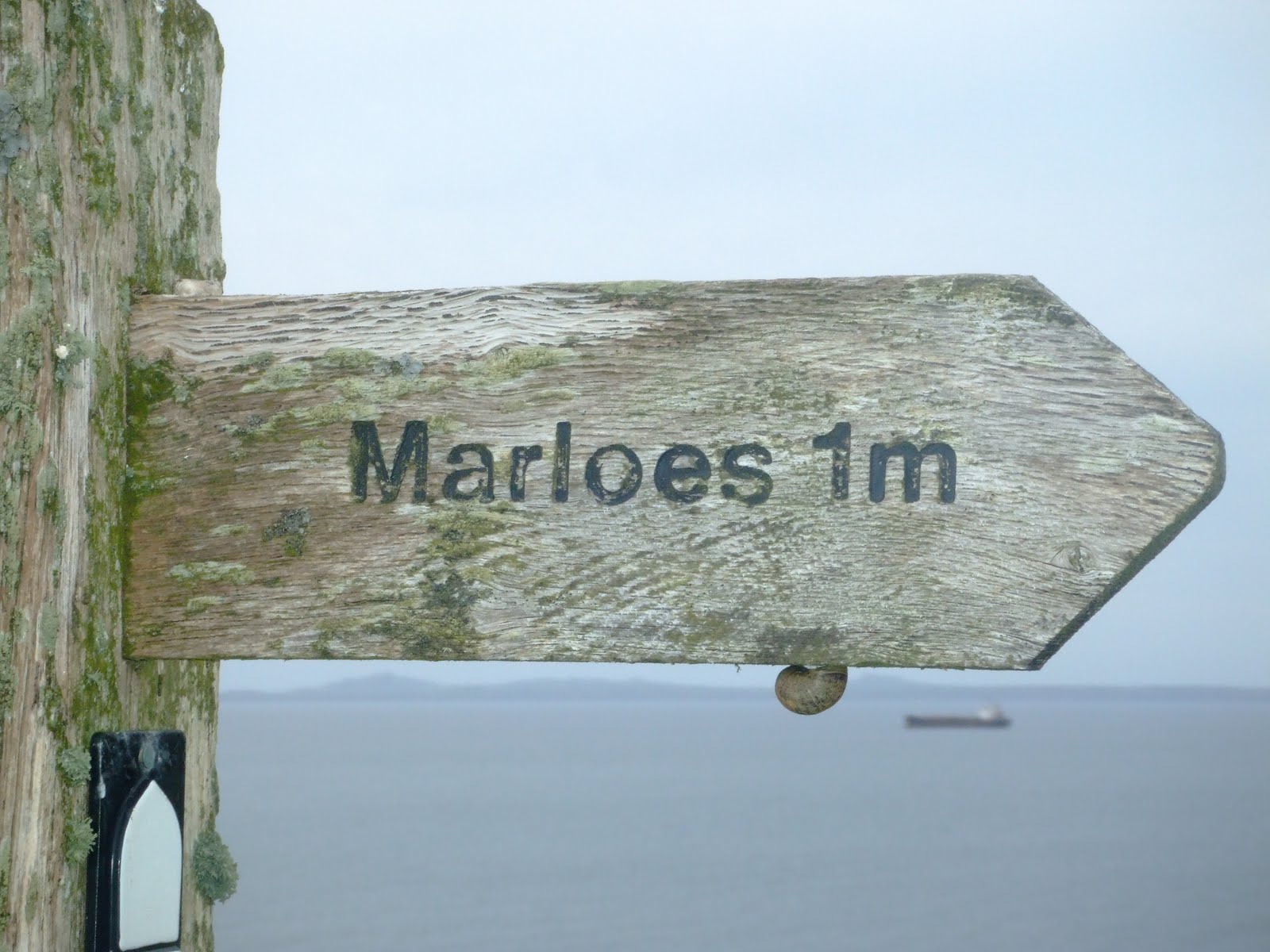
This section of the path had not been as visually dramatic as the first coastal section before the former coastguard hut, but the views soon improved when Musselwick Bay came into sight. Sweeping around the corner directly on top of the cove we left the coastal path at a finger post pointing to Marloes.
Turning left at the end of this path we approached the outskirts of the village by road. We covered the nine miles in three hours before popping into the Lobster Pot for an aperitif or two. The landlord soon gave Wandering a rollicking for removing the menu from his restaurant! But 'entente cordiale' was soon restored when they discovered that both of them had played club cricket! After the earlier incident with the menu the landlord was very non-committal on whether or not we would be able to eat at his establishment later that evening, as he explained that they had been extremely busy over the last few weeks and he could not guarantee that a table would be available!
After a few beers to quench our thirsts it was back to the Clock House for a quick shower and change of clothes.
Ninety minutes later we returned to the Lobster Pot in trepidation to find the place half empty - so much for his predictions on the number of covers the chefs would do that night - to enjoy a pleasant enough meal.
Butterballs won the game of pool, but the music (Razorlight, Jeff Buckley, Killers, Elbow and the Duke's opening choice Lady Gaga!!) was top class.
The sun was shining in a clear blue sky as we departed Dale after our very brief visit. The 'C' road to Marloes was single lane, bordered by hedge-rows on either side.
The original plan was to book in to the b & b, make a quick brew and then walk part of the coastal path during the afternoon/early evening.
All went according to plan as we quickly found our B & B in the centre of the village of Marloes (population 323 according to the census of 2001) opposite the clock tower! The Clock House is run by Phil and Sue, who were both extremely welcoming and friendly. When we originally booked the accommodation Sue confirmed that we could have the family suite that would provide us with our own bathroom facilities. The Duke and Butterballs were both suitably impressed with the rooms, which were extremely comfortable and excellent value for money. Off-road parking was also provided to the rear of the B & B.
Tea making facilities available in the rooms allowed us to make some mugs of tea before we inquired with our hosts about a packed lunch for tomorrow.
On our way into the village we spotted the local hostelry, the Lobster Pot, where we could possibly eat later in the evening.
Marloes is surrounded by large tracts of both arable and pasture land enclosed by the well maintained hedge-rows. We found out that the village now has a large number of holiday homes with tourism providing the main source of employment.
After the relatively uneventful two hour journey via the A40 and B4327 deep into rural Pembrokeshire, we decided that this would be our first port of call so to speak..............for much needed refreshments.
Situated on the entrance to the mouth of Milford Haven estuary with the oil refinery clearly visible 6 miles in the distance, this small village with 205 inhabitants at the time of the last census in 2001, is located on the Dale Peninsular a sheltered inlet at the extreme south west tip of Pembrokeshire.
This was particularly familiar to Butterballs who had spent a week in a local cottage a few years ago. A short walk from the car park we found the Griffin Inn, the only pub in the village. Situated directly on the waterfront in a picturesque setting the pub had plenty of authentic character although a relatively cold welcome! The snack that we ordered was a tad expensive, but nevertheless it was very welcome after the journey.
Fifteen years ago on 15 February 1996, (the Spanish-built, Norwegian-owned, Cyprus-registered, Glasgow-managed, French-chartered, Russian-crewed, and Liberian-flagged!!) oil tanker Sea Empress grounded at the entrance to the Milford Haven estuary off St. Anns Head, spilling 72,000 tonnes of crude oil and creating an environmental disaster for the area.
The village, which feels the affects of the wild Atlantic weather during the winter months, is now a local centre for sailing, windsurfing and all water-sports.
The one-way system caused Wandering some navigational problems as we left Dale 'en route' to our main base for the short over-night stay a few miles away at Marloes.
When I checked the itinerary for this years Giro D'italia I was pleased to discover that the nearest stage to Rome would take place on one of the days that we were staying in the Italian capital city.
Purchasing the tickets and boarding the express train (from Naples to Milan) which left Rome at 12.30pm to cover the 60 miles to Umbria in an hour, was definitely an experience worth repeating!
Orvieto is situated on the flat summit of a large hill of volcanic ash. The site of the city is among the most dramatic in Europe, rising above the almost-vertical cliff faces that are completed by defensive walls built of the same stone. The white wine of the district, produced to the north-east of the city, is also highly prized
Leaving the station I took the funicular to the Piazza Cahen, where the fifth stage of the Giro would conclude later that afternoon at 5.15pm.
The 'circus' that accompanies the race was already in place as the excitable spectators started to arrive. But first there was an opportunity to explore the city with a visit to the Duomo (construction started in 1290), some ice-cream to consume and a browse around the local shops.
Only forty-eight hours earlier Belgian cyclist Wouter Weylandt had tragically lost his life during a descent of Passo Del Bacco, while yesterday in tribute his Leopard Trek team mates led the peloton home in a procession as a mark of respect. So it was a return to competitive racing today as Dutchman Pieter Weenings produced an outstanding solo performance to claim victory of the stage. The Rabobank rider timed his push for the victory with under 10 kilometres to go and despite struggling during the steep climb to the finish, led the field by 8 seconds and also secured the pink jersey as the leader of the general classification.
Spanish rider and current Tour De France champion Alberto Contador finished the stage without a saddle...........uncomfortable!!
After a scramble to board the funicular I caught the 6.15pm back to Rome after probably the best day of this particular visit to Italy.
According to ancient legend, the city of Rome was founded in 753 BC on the banks of the Tiber.
So after a few days of acclimatisation and La Dolce Vita it was time to stretch the old legs and navigate parts of Rome that are mainly used by the local permanent residents.
With the intention of walking the 2 miles from our hotel to the Basilica at St. Peters Square, we decided to use the footpaths and cycleway immediately alongside the river itself.
The river has been confined since 1876 between high stone embankments. Within the city, the riverbanks are lined by boulevards known as lungoteveri, streets 'along the Tiber'.
To access the walkway we crossed the Ponte Palatino (below) before passing the Isola Tiberina in mid-stream, between Trastevere and the ancient center of the City.
The Tiber was critically important to Roman trade and commerce, as ships could reach as far as 100 kilometres (60 miles) upriver; there is evidence that it was used to ship grain from the Val Teverina as long ago as the 5th century BC.
Walking along the western bank we passed under three bridges before leaving the river banks to climb the Ponte Princ that leads past the Castel Sant' Angelo on the approach to St Peters Square.
Only a week previously over 2 million people attended the penultimate stage of the confirmation of Pope John Paul II (who must be one of the most popular Popes of the modern day) as a saint.
The scale of the Basilica itself is amazing and befits the head quarters of the Catholic Church.
Next on the agenda was a long trek along the walls of the Vatican City to visit the Sistine Chapel to see 'The Creation of Adam'- fresco's painted on the ceiling by Michelangelo between 1508 and 1512. Unfortunately taking photographs were prohibited.