Watch the seasons change as the walks we enjoyed during 2010 gradually progress through the various months of the year. From the snow of the deep mid-winter at the start of the year, through spring to the clear blue skies of summer, through autumn and back to the early snow and ice as the year ends.
Monday, December 27, 2010
Friday, December 24, 2010
Review Of 2010 - Part Two
Further brief summary of all of the walks that were carried out in the second half of 2010:
 Monte Bollettora - 12 July 2010
European trip to the Lombardy region of Northern Italy.
Como to Brunate to Bollettora
Weather: Very Hot
Sarn Helen - 29 July 2010
Roman Road in Fforest Fawr
Mean Madoc standing stone
Weather: Warm
 Grwynne Fechan - 5 August 2010
Trek in the Black Mountains
Circular walk to Pen-Y-Gadair Fawr and Waun Rhydd, the highest point in the range.
Weather: Dry and Mild
British Camp - 23 August 2010
Iron age hill fort
Herefordshire Beacon at the start of the Malvern Hills
Weather: Humid, Overcast, Warm and Wet
 Twmbarlwm - 16 September 2010
Circular walk from Cwmcarn Visitor Centre to highest point in Gwent.
Stunning views across the Bristol Channel
Weather: Dry, Sunny and Cold
Kilpeck - 16 October 2010
Visit to Norman church in Kilpeck with a de-tour to Grosmont.
Weather: Overcast but Dry
Fan Gyhrych - 28 October 2010
Climb from Cray Reservior to trig. point on Fan Gyhrych.
Weather: Wet and Windy
 Taff Trail - starting on 13 November 2010
Three sections of Taff Trail - Cefn Coed to Pontstcill, Rhydycar to Aberfan and Aberfan to Quakers Yard
Weather: Dry and Cold
Hen Rhydd - 10 December 2010
Majestic waterfall country while frozen
Weather: Cold
 Monte Bollettora - 12 July 2010
European trip to the Lombardy region of Northern Italy.
Como to Brunate to Bollettora
Weather: Very Hot
Sarn Helen - 29 July 2010
Roman Road in Fforest Fawr
Mean Madoc standing stone
Weather: Warm
 Grwynne Fechan - 5 August 2010
Trek in the Black Mountains
Circular walk to Pen-Y-Gadair Fawr and Waun Rhydd, the highest point in the range.
Weather: Dry and Mild
British Camp - 23 August 2010
Iron age hill fort
Herefordshire Beacon at the start of the Malvern Hills
Weather: Humid, Overcast, Warm and Wet
 Twmbarlwm - 16 September 2010
Circular walk from Cwmcarn Visitor Centre to highest point in Gwent.
Stunning views across the Bristol Channel
Weather: Dry, Sunny and Cold
Kilpeck - 16 October 2010
Visit to Norman church in Kilpeck with a de-tour to Grosmont.
Weather: Overcast but Dry
Fan Gyhrych - 28 October 2010
Climb from Cray Reservior to trig. point on Fan Gyhrych.
Weather: Wet and Windy
 Taff Trail - starting on 13 November 2010
Three sections of Taff Trail - Cefn Coed to Pontstcill, Rhydycar to Aberfan and Aberfan to Quakers Yard
Weather: Dry and Cold
Hen Rhydd - 10 December 2010
Majestic waterfall country while frozen
Weather: Cold
Labels:
Black Mountains,
Forest Fawr,
Italy,
Kilpeck,
Waterfall Country
Monday, December 20, 2010
Sunday, December 19, 2010
Review of 2010 - Part One
Very brief summary of all of the walks that were carried out in the first half of 2010:
 Garn Ddu - 12 February 2010
Glais Bridge to Cilsanws trig. point
Garn Du, forrestry to Pentwyn Reservoir then Cefn Penmaillard to Cefn Coed
Weather: Dry and Cold
Severn Bore & Slimbridge - 2 March 2010
Minsterworth to watch best rated 'bore' of the year
Then drove to the wild foul centre at Slimbridge
Weather: Dry and Frosty
Red Daren - 19 March 2010
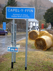
Llanthony Prior to Hatterrall Ridge to join Offa’s Dyke.
Descent to Capel-Y-Fin and return to Priory
Weather: Dry and Mild
 Southerndown - 1 Aril 2010
Jurassic coastal path to Dunraven
St Brides Major to Ogmore Down to Ogmore Castle
Weather: Dry, with Wind and periods of Sunshine
Shirhowy Skyline - 13 May 2010
Circular walk from Penyfan Country Park to Manmoel
Mynydd Pen Y Fan back to Country Park
Weather: Dry, Sunny and Cold
Ysgyrdd Fawr - 22 May 2010
Ascent through woodland, ridge walk to trig. point on tip of Skirrid mountain
Weather: Sunny and Very Warm
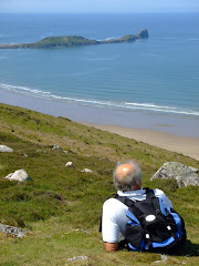
 Worms Head - 28 May 2010
Magical sunny day on the Gower Peninsula
Climb up Swirles Howe to trig. point on Rhossili Down.
Through village of Rhossili to headland above causeway.
Cross causeway to Inner Head of Worm.
Return to Rhosilli Beach and then Llangennith
Weather: Sunny and Warm
Mynnydd Llangattock - 10 June 2010
Gloomy day for a visit to the Lonely Shephard
Weather: Wet and Coldish
Fforest Fawr - 11 June 2010
Climb of Fan Llia, descent to Maen Llia monolithic standing stone.
Ascent of Fan Nedd then return to car park
Weather: Sunny and Mild
 Hen Dy-aderyn - 24 June 2010
Successful search for the trig point on Llangattock Mountain
Weather: Sunny and Warm
Morlais Castle - 30 June 2010
Evening walk across limestone quarry opposite Brecon Mountain Railway
Visit to crypt, then return across golf course to car park.
Weather: Sunny and Warm
 Garn Ddu - 12 February 2010
Glais Bridge to Cilsanws trig. point
Garn Du, forrestry to Pentwyn Reservoir then Cefn Penmaillard to Cefn Coed
Weather: Dry and Cold
Severn Bore & Slimbridge - 2 March 2010
Minsterworth to watch best rated 'bore' of the year
Then drove to the wild foul centre at Slimbridge
Weather: Dry and Frosty
Red Daren - 19 March 2010
Llanthony Prior to Hatterrall Ridge to join Offa’s Dyke.
Descent to Capel-Y-Fin and return to Priory
Weather: Dry and Mild
 Southerndown - 1 Aril 2010
Jurassic coastal path to Dunraven
St Brides Major to Ogmore Down to Ogmore Castle
Weather: Dry, with Wind and periods of Sunshine
Shirhowy Skyline - 13 May 2010
Circular walk from Penyfan Country Park to Manmoel
Mynydd Pen Y Fan back to Country Park
Weather: Dry, Sunny and Cold
Ysgyrdd Fawr - 22 May 2010
Ascent through woodland, ridge walk to trig. point on tip of Skirrid mountain
Weather: Sunny and Very Warm
 Worms Head - 28 May 2010
Magical sunny day on the Gower Peninsula
Climb up Swirles Howe to trig. point on Rhossili Down.
Through village of Rhossili to headland above causeway.
Cross causeway to Inner Head of Worm.
Return to Rhosilli Beach and then Llangennith
Weather: Sunny and Warm
Mynnydd Llangattock - 10 June 2010
Gloomy day for a visit to the Lonely Shephard
Weather: Wet and Coldish
Fforest Fawr - 11 June 2010
Climb of Fan Llia, descent to Maen Llia monolithic standing stone.
Ascent of Fan Nedd then return to car park
Weather: Sunny and Mild
 Hen Dy-aderyn - 24 June 2010
Successful search for the trig point on Llangattock Mountain
Weather: Sunny and Warm
Morlais Castle - 30 June 2010
Evening walk across limestone quarry opposite Brecon Mountain Railway
Visit to crypt, then return across golf course to car park.
Weather: Sunny and Warm
Labels:
Forest Fawr,
Manmoel,
Morlais Quarry,
Offa's Dyke,
Rhossili,
Skirrid,
Slimbridge,
Southerndown
Friday, December 17, 2010
Winter Wonderland......Again

I decided to set the alarm clock for 5.00am to watch the afternoon session of the Third Test from Perth (where it was 31 degrees celcius!) before Lord Twynyrodyn and Butterballs picked me up to walk to one of the crash sites on the Carmarthen Fan.


You can sense the change of atmosphere when it's snowed overnight as the light reflects from the white blanket outside the bedroom window. Well the forecaster's got it spot on with about 4" of fine, powdery snow on the ground. Guess that this would mean that the walk was off so settled down to watch Mitchell Johnson wipe out the English middle order.

Caught this cheeky chappie hanging 'upside down' on a bird feeder in the rear garden of a house next to the park which is opposite us. He must have been starving!
Tuesday, December 14, 2010
Psycho Vertical
 Andy's journey from remedial student to successful climber, writer and speaker makes a fascinating story.
Was it when he was growing up in Tywyn, North Wales, that he developed his love of adventure and the outdoors? His parents divorced when he was six years of age and together with his brother and sister, the family moved to live in Hull, one of the flattest cities in Britain! The book is very cleverly structured cutting from family scene to climb for fun to serious climb (reflecting during the alternate paragraphs his experience growing up in a tough urban background, his family life away from climbing and the hardship experienced in tackling some of the toughest pitches in the World).
Perhaps it is the really early period of his life - living in North Wales close to the mountains and beaches on the sea-shore – that had more of an effect on him than the actually separation of his parents.
The fact that he was dyslexic went undiagnosed until he was 19-years old. With no qualifications and very few prospects, he left home to live in a squat before starting work in an outdoor shop in the Derbyshire Dales (cycling the 12-miles from Sheffield to and from work each day!).
The book describes his laughable, almost amateurish introduction to winter Alpine climbing and a 12-day solo ascent of the Reticent Wall of El Capitan in Yosemite, viewed at the time as perhaps the hardest climb of its type in the world.
It is really easy reading and if you get the time well worth the effort.
Friday, December 10, 2010
Henrydd Waterfalls

The gradual thaw over the last few days made this an ideal time to visit the spectacular ice sculpture created from the semi-frozen waterfalls in the Upper Neath Valley.
 Sgwd Henrhyd (Henrhyd Waterfall or Henrhyd Falls) is the tallest waterfall in South Wales with a drop of 90 feet (27 metres). It lies on National Trust land on the southern edge of the Brecon Beacons National Park. The falls occur where the small river, the Nant Llech (grid reference SN854122) drops over the faulted edge of a hard sandstone known as the Farewell Rock.
 Just outside Coelbren, on the road between Glynneath and Abercraf, from a small car park we started the steep walk down into the valley. Hard packed ice under-foot made progress precarious - crampons and ice-axes would have been more appropriate!

The southern fringe of the Brecon Beacons National Park consists of a long belt of outcrop lime stone which has created a highly distinctive environment characterised by wooded gorges, caves, swallow holes, and waterfalls. This intriguing landform is most distinct in the locality known as Coed Y Rhaeadr, which translates as 'Wood of the Water Falls' but is referred to locally simply as Waterfall Country.

Tackling the wooden walkway to cross the floor of the gorge over the River Nant Llech, was similar to walking on an ice-rink in a pair of flip-flops. Eventually reaching the head of the gorge we all decided that it was a trifle too dangerous to walk behind and underneath the waterfall as the sound of huge chunks of ice cracking before eventually falling echoed around the gorge.

Waterfall Country is situated in a triangle formed by the villages of Hirwaun, Ystradfellte, and Pontneddfechan, including the head waters of the rivers Nedd, Mellte, Pyrddin and Hepste. These rivers drain the old red sandstone mountain ranges of the Fan’s in the north and travel south through the deep 'V' shaped wooded valleys the rivers have formed in the carboniferous limestone of the southern belt of the National Park. Waterfall country is officially designated as a site of special scientific interest containing over 200 species of mosses, liverworts, and ferns. Since designation as a national park in 1957 the popularity of waterfall country combined with a steep and difficult terrain which is subject to heavy rainfall has led to widespread footpath erosion.

After the main event the 3 kilometre walk to Abercraf took us through the surrounding deciduous woodland of Oak and Ash trees. Initially the paths were frozen but eventually it became much softer underfoot.

The well maintained almost sympathetic line of the paths take us high above the deep valley floor. We found ourselves walking alongside the course of the river on a narrow, slippery footpath with extremely steep dangerous drops on one side. The valley is heavily wooded and the leaves that had fallen during the autumn provided a natural surface for the paths. The rock outcrop in sections of the footpaths surface which were either covered in ice or extremely wet, were especially slippery. Particular care and attention was essential.

The gorge was like something out of 'The Lost World' by Sir Arthur Conan Doyle and you could almost imagine pterodactyls and giant eagles flying with the buzzards overhead. Having said that the walk was fascinating and one of the most rewarding experiences of the year.
All of the photographs taken on this walk can be viewed here. Select 'slide-show' for automated viewing.
Tuesday, December 7, 2010
Frozen River Wye

The cold weather continues to dominate all outdoor activity at present with the freezing temperatures still causing problems.
The prolonged period of extremely cold weather has frozen this particular section of the River Wye.

I felt really sorry for a family of Moorhens who were swimming in a military straight line in sub-zero temperatures, but nature has equipped them to survive even in the current Arctic like temperatures.

This particular bridge was built in 1490 and had been damaged in the English Civil War.

Sunday, December 5, 2010
Taff Trail Route
Friday, December 3, 2010
Blanket of Snow

The University of Dundee's satellite receiving station captured this image of how the heavy snow of the past week has affected the UK. The picture shows almost the entire country (with the exception of the South West of Ireland) covered by a blanket of snow.
The mean temperatures for November was the coldest across the UK since 1993.
A minimum temperature of –18.0 °C was recorded at Llysdinam (Powys) early on 28th, and a wind gust of 91 mph was recorded at Capel Curig (Conwy) on 11th.
Thursday, December 2, 2010
Llwyn Yr Eos

A planning application (No. P/10/0185) for a new private housing development comprising of 18 dwellings in Abercanaid, was submitted in July 2010. Part of this application includes two separate associated highway crossings directly over the Taff Trail, near the Llwyn Yr Eos. Although there are other vehicle crossings that also dissect the Taff Trail, they predate the establishment of the trail itself. This could be a significant issue for both walkers and cyclists.
The proposed road in question is a two lane highway with at least one if not two pavements, it will provide access to the Llwyn Field (the development will be known as The Lowes), which is currently a green field site used for grazing.
The Gethin Action Group is opposing the application and a petition containing over 500 names has already been submitted to the Planning Department, clearly demonstrating the feeling of the local community against the construction of the proposed road and housing development.
Monday, November 29, 2010
It's Snow Joke!
Sunday, November 28, 2010
Thomastown Park - Winter

With temperatures overnight falling to -10 degrees celsius, the lowest in November for 25 years, the snow that fell during Friday afternoon provided our first taste of real winter conditions since..........well at least March!

The recent autumn conditions have quickly turned into a winter landscape, long before the solstice.

The forecast is for more freezing temperatures well into next week.

It's slightly warmer in Brisbane were the First Ashes test match of the series is currently taking place!

Even the usual dog-walkers appear to have decided to remain indoors, in the warmth of their livingroom.

Conditions on the mountains in the Brecon Beacons should be perfect for outdoor activities.

Anyone remember where this squirrel buried his winter food supply!

Saturday, November 27, 2010
Brecon Beacons Mountain Rescue

During the walk to Pontsticill yesterday a real life drama was unfolding a few miles further north on Pen-Y-Fan.
As heavy snow swept across South Wales, members of the Central Beacons Mountain Rescue Team were called at 11:45 to a light aircraft crash on Bwlch Duwynt near the summit of Corn Du. A helicopter from RAF Chivenor, Devon, was called to the scene but the team were not initially needed after the pilot, a businessman from Bridgend, managed to free himself. But shortly afterwards they were called to airlift a 70-year-old man with a leg injury and hypothermia, and a mountain rescuer with a head wound.
Huw Jones, of the Central Beacons Mountain Rescue team, said it took about five hours to reach and rescue the walker at about 18:30. During the operation a rescuer slipped and suffered a head injury.
The helicopter landed on the closed road between Storey Arms and Merthyr to brief the crew. Rescuers praised "an incredible bit of flying" by the helicopter to reach the casualties in conditions they described as "more like Alaska than south Wales".
"In all my years in mountain rescue, I struggle to say when I remember seeing a helicopter crew flying in those conditions," said Mr Jones.
The heavy snow forced the crew to abort attempts to land at the nearest hospital, Prince Charles in Merthyr, and then at the University Hospital of Wales in Cardiff and the Royal Glamorgan in Llantrisant, before finally managing it at Morriston.
The 70-year-old man was treated for a broken leg and the mountain rescuer was sent home with concussion.
Mr Jones said the weather forecast for coming days brought higher risks for walkers, and said they should take crampons and an ice axe.
Friday, November 26, 2010
The Taff Trail - Cefn Coed to Pontsticill
 This particular section starts at the Community Centre and alongside St. Johns Church is a very narrow path that very soon crosses a bridge over the A465.
Leaving Cefn Coed behind, rapid progress is made to the south east of Trefechan before you enter the Cwm Taf Fechan Nature Reserve. Although it wasn't snowing at the start of the walk a few small flakes started falling on the approach to Pontsarn.
The next footbridge takes you over the Glais hill before you pass the remains of the platform at Pontsarn Station. The first train came through the station on 8th August 1868, before increasing to 21 trains a day by 1873. The station was closed in 1963 as part of the Beeching review.


Almost at the end of the platform you pass under a bridge and then cross the Pontsarn Viaduct which was built in 1866 to carry the Brecon and Merthyr Railway. The viaduct, which has seven spans and is a listed structure, is 455 feet (139 mtrs) long and 92 feet (28 mtrs) high.

The trail continues the well defined route before the path ends rather abruptly at a sign declaring the next section is private land. The trial now joins the main vehicle access under a bridge then turns right past the water treatment works to the dam of Ponsticill Reservoir.


Passing under the bridge (above) this particular walk left the official Taff Trail to climb the Ffynon Dwn straight into Pontsticill. At this point it was snowing persistently and starting to stick!

The blazing open coal fire in the Red Cow invited me to stay longer than just one pint and it was tempting, but with the snow falling heavier it was definitely time to depart.
The walk was 4 miles and took just over 80 minutes to complete in snowy conditions! Again the terrain was easy underfoot with only one ascent into Pontsticill. All of the photographs taken on this walk can be viewed here. Select 'slide-show' for automated viewing.
Monday, November 22, 2010
The Taff Trail - Aberfan to Quakers Yard

This is the next stage - linked to a previous walk - along the southern section of the Taff Trail. Because this section was always likely to be a linear walk it was to commence (......and end) using public transport with a bus to Aberfan to pick up the start of the walk (.....where the first section ended) at the Community Centre.
Within a few hundred yards of joining this southern bound section the cemetery, with the headstones of the 116 children who tragically lost their young lives in the disaster that engulfed the village forty four years ago, are clearly visible from the trail.

You soon start to leave the urban sprawl of Aberfan and Merthyr Vale and return to the delightful woodland, which at this time of the year is showing its true autumnal colours.

You switch back through an underpass beneath the A470 and for the next few miles the trail runs parallel with the main trunk road, as the vehicles hurtle past at 70 mph. Surely, life is too short to rush everywhere and not enjoy the natural surroundings.
Leaving the path for a brief de-tour, a walk to the 'Giant's Bite' above Edwardsville could also be included in the trek. However, at this point the trail returns back under the A470 and shortly arrives at the quirky Pontygwaith Bridge. The camber on this is incredibly steep and would have been extremely difficult to navigate in a car. An episode of the BBC series 'Merlin' was filmed under the bridge.

Pontygwaith (in English means "Bridge of the Ironworks") was previously a small village where a Sussex Ironmaster named Anthony Morley set up a small ironworks in 1583. There is little of the original village remaining today, which was inhabited and continued to exist until approximately 1977, as a terrace of ten houses and a farm.
After crossing the River Taff to the Merthyr Vale side of the valley you now enter the Pontygwaith Nature Reserve, located on land owned by Taff Bargoed Fishing Club.

The trail now follows the historic tramroad along which the first steam locomotive in the world made its debut journey. In 1804, Cornishman Richard Trevithick adapted the design of his high pressure steam engine to build the first full scale steam locomotive.
 Samuel Homfray (a local ironmaster) was so impressed with Trevithick's locomotive that he made a bet with another ironmaster, Richard Crawshay, for 500 guineas that Trevithick's steam locomotive could haul 10 tons of iron along the Merthyr Tydfil Tramroad from Penydarren to Abercynon, a distance of 9.75 miles (16 km). Amid great interest from the public, on 21 February 1804 it successfully carried 10 tons of iron, 5 wagons and 70 men the full distance in 4 hours and 5 minutes, an average speed of approximately 2.4 mph (3.9 km/h)
 The nature reserve, where herons, otters, foxes and kingfisher can be seen, must be a twitchers delight with the large number of native British birds that were seen during this brief section.
Climbing a bank to leave the trail the path crosses the railway track and leads to the northern end of Quakers Yard station, where the use of public transport continued with a return to Rhydycar on an Arriva train, that was right on time!

The walk was 3.4 miles and took just over an hour to complete. Again the terrain was easy underfoot with only two minor ascents. All of the photographs taken on this walk can be viewed here. Select 'slide-show' for automated viewing.

Subscribe to:
Posts (Atom)


