Nevertheless, he managed to dodge the low lying cloud until he was too cold and decided to return to the comfort of his Grade 1 listed manor house.

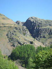
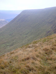
Mynydd Llangatwg was formed from a layer cake of Palaeozoic era sandstones and limestones which dip gently southwards into the South Wales Coalfield basin. Imposing cliffs of Carboniferous Limestone occur along the northern escarpment and this rock underlies the entire hill and hosts an extensive cave systems which lie beneath it, notably those of Ogof y Daren Cilau and Ogof Agen Allwedd. These two systems are amongst the longest in Britain. The plateau is formed from coarse sandstones ('grit stones') also dating from the Carboniferous period and which have foundered in many places as the underlying limestone has dissolved over millennia.
There were locked gates on the entrance to the caves, although Mike expressed reluctance to explore even if access had been readily available.
While on the mountain his Lordship came into contact with a particular feature of note called the 'Lonely Shepherd' or ‘Bugail Unig’ in Welsh. An isolated limestone pillar which stands at the eastern tip of the plateau, left there by quarry workers who removed great quantities of the surrounding rock. A number of cairns are scattered across the hill, notably the sizable pair which decorate the summit of Twr Pen-cyrn and which are thought to be of Neolithic age.
According to local legend, a farmer at Ty-lsaf farm was so cruel to his wife that she threw herself into the River Usk and drowned. For his sin, the husband was turned into a pillar of stone (Lonely Shepherd), but every year on Midsummer's Eve (June 20th), he goes down to the banks of the Usk to search for his wife, calling her name - in vain. By next morning he has always returned to his lonely place.
It was a local custom in yester-year to white-wash the stone so that it could easily be seen when it walked on Midsummer's Eve.
The greater part of the length of the northern escarpment is scarred by limestone quarries, which remained in operation for most of the nineteenth century. The rock was removed by means of a series of tramroads or tramways via steep inclines to a wharf on the Monmouthshire and Brecon Canal at Llangattock and south to Brynmawr and the ironworks at Nant-Y-Glo, by two tramroads which contoured the eastern end of the hill. The upper tramway which dates from the start of the nineteenth century, runs south from Pant y Gilwern and Daren Disgwylfa and then west around the head of Cwm Clydach. It is now a grassy footpath providing easy walking through otherwise rough terrain. The lower tramway was constructed in 1828-30 and has since been converted to a public road.

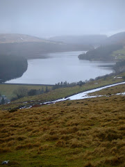
On a clear day the peaks of the Blorenge, Sugar Loaf and Ysgyryd Fawr are in view, amongst many others. Unfortunately, not the case today!!













lovely.
ReplyDelete