
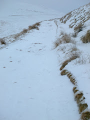
It was still very frosty when the walk started from the village, just as the sun was struggling to rise above the surrounding hills.
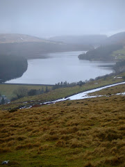
The route includes a full 5.5 mile circuit of the reservoir, using part of the Taff Trail. The outward section meanders its way through the forestry until it briefly re-joins the road to Tal-Y-Bont, before crossing the bridge that separates the Pontsticill section of the reservoir from the Pentwyn (known locally as Dol-y-Gaer) expanse.
 Leaving the road that leads to Dol-Y-Gaer Outdoor Pursuits Centre, the path runs alongside the narrow gauge line of the Brecon Mountain Railway for nearly a mile, almost parallel to the eastern side of the reservoir.
This must be one of the most scenic narrow gauge railway routes in the country, taking passengers into the heart of the Brecon Beacons, alongside the glistening stretches of the serene, reflective waters edge.
 Pontsticill Reservoir, which was completed in 1927, can hold 3.4 thousand million gallons of water (is that 3 billion gallons?). The water flooded the vicarage and 15th Century Capel Taf Fechan, Bethlehem Congregational Chapel, some cottages, small holdings and land belonging to eight farms. In times of drought the remains of some of these buildings often appear above water level.
Mid-way on the eastern bank is the deserted head-quarters of the Merthyr Sailing Club, hopefully, internally the building is more welcoming than the featureless external facade? Sailing is one of the activities provided for visitors and residents of the nearby out-door pursuits centre.
Another minor diversion on the walk was a visit to the Pontsticill station of the Mountain Railway (the first trains was not due to arrive until 12.30pm today!), with wonderful views in the distance to the north of the cloud covered tops of Corn Du and Pen-Y-Fan.

The narrow-gauge railway has been a major visitor attraction for the last 30 years, created by the inspiration and vision of Tony Hill and his family.
The site occupies a stretch of the old 'abandoned' Brecon and Merthyr Railway which closed in 1964. Fighting its way through the Brecon Beacons, climbing the steep gradients including the Torpantau tunnel, which at 1,313 feet above sea level, is the highest railway tunnel in Great Britain.

By 1978 various planning and other consents had been obtained, with construction of the narrow-gauge railway commencing with the re-building of the former Station House and conversion of the adjoining waiting room into a small workshop.
After this project was completed work started on the repair and replacement of the 7 bridges between Pant and Pontsticill. Laying the track itself commenced in 1979 and was completed in 1980.

Meanwhile, "Sybil" - a small slate quarry engine from North Wales - had been re-built to haul the train.
After leaving the platform the walk returns across the dam, past the giant 'overflow plug' and back into the village.
All of the photographs taken on this walk can be viewed here. Select 'slide-show' for automated viewing.












What a great article! Thanks for posting this up. I'd stumbled across this reservoir last year and wanted to know if a circuit was possible. Thanks to your helpful descriptions I managed to arrange a successful walk today (even if it did rain!) Thanks for sharing! :)
ReplyDeleteLooks like a good walk! I am wondering if there are any stiles to climb over on this route, as myself and some friends would like to do this walk but will have a few dogs with us who don't jump and are a bit heavy to be lifting over! Thanks
ReplyDelete