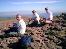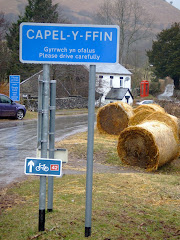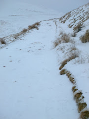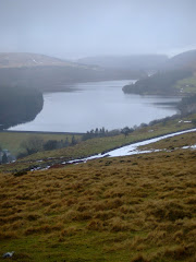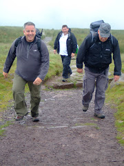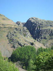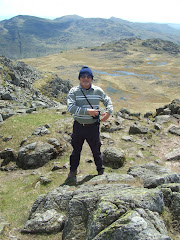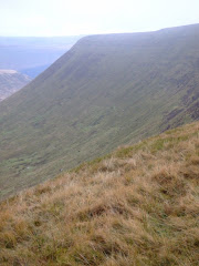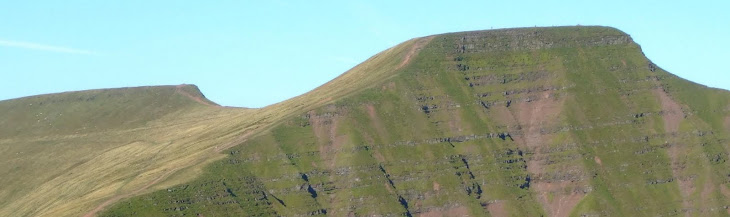
The popular walking hotspot of the Brecon Beacons is the fifth-most popular destination for people in Britain, coming behind only some of London's top sights.
According to the Guardian Observer Travel awards, the Welsh national park is only topped by:
* the British Museum,
* the Victoria and Albert Museum,
* the National Gallery and
* the Imperial War Museum.
This year is the first time finance has been set aside to promote the picturesque hills of the Beacons and the facilities it offers, with the investment appearing to pay off in terms of popularity.
Director of Brecon Beacons Tourism Richard Tyler and sustainable tourism manager for the national park's authority Punch Maughan said: "We are delighted that the Brecon Beacons National Park is developing a worldwide reputation as a choice holiday destination and tourist attraction."
Friday, October 22, 2010
Tuesday, October 19, 2010
Ordnance Survey
 He didn't realise it at the time but when Bonny Prince Charlie was heavily defeated at the Battle of Culloden in 1746, his disappearance with his surviving Jacobean army into the Highlands led to the development of the first detailed, scaled maps of the British landscape.
In their pursuit of the fleeing Jacobite's the Hanoverian soldiers were hopelessly lost in the unfamiliar surroundings. They could not establish whether they were trying to climb Sgurr na Lapaich or Carn nan Goghar - the highland peaks all looked the same. In the confusion Prince Charlie eluded his pursuers and escaped to Skye and finally Borrowdale in the Outer Hebrides, the rest as they say is history!
But a Colonel David Watson was very unhappy. He convinced the Army that they needed to produce a decent map of the Highlands and he found just the man for the job - a young surveyor by the name of William Roy. He produced a military map of Scotland, but also saw the need for a large scale map of the whole of Britain.
 From 1791 to 1870 the Government decided to undertake the Ordnance Survey, covering the country from the Shetland Isles to Land's End.
There are over 5,000 triangulation (trig.)points in the Country that were used to take bearings by the surveyors who created the maps. They spent days, even weeks, camped on cold, wet mountain tops just waiting for the clouds to part.
The triangulation surveys were turned into maps in the Tower of London, by interior surveyors who engraved sheets of cooper with all the details of the villages, woods, roads and rivers. And they had to draw this back to front, so that when inked it came out the right way round!
Up until 1805 the maps were mainly used by the military, until they were published for retail sale costing 3 guineas for a small county and six guineas for a larger one. in 1870 the last of the 204 sheets was published.
Triangulation has now been made obsolete by GPS, laser beams, aerial photography, satellites and sat-nav.
In the 1830's George Everest took the survey to India and they eventually decided to name a famous mountain after him!
Saturday, October 16, 2010
Kilpeck

Veterinary matters and a hospital appointment caused a slight delay to the potential commando like raid across the Marches border. In an almost inaudible whisper the Duke of Gilfach Cynon confirmed with sinister undertones that “Operation K-i-l-p-e-c-k is on this afternoon”. That was all he said in a brief telephone conversation which included the rendezvous time – providing a short ‘window of opportunity for a light lunch. We didn't know how dangerous the mission was likely to be or when we would have the opportunity to eat next!
After leaving the safety of the Principality we carefully edged our way over the border, through Pontrilas and stealthily completed the short distance to the village of Kilpeck, attempting to ensure that the reconnaissance exercise continued to operate under the radar of the tracking stations.
 As we arrived at the destination there were a few quizzical looks from the Home Guard, who at the time was washing the armour plated Robin Reliant outside the church. We appeared to dissolve into thin air in front of this sentry as he continued to ignore our presence behind the heavily disguised 'yellow' three wheeled military machine. I'm afraid that his innocent looking activities didn't fool us into a false sense of security!
Kilpeck Church was built around 1140, and may have replaced an earlier Saxon church at the same site. The oval raised form of the churchyard is typical of even older Celtic foundations. Around the 6th and 7th centuries the Kilpeck area was within the British kingdom of Ergyng, which maintained Christian traditions dating back to the late Roman period.
 The plan of the church with a semicircular apse, is typical for the Norman period. At the time the current church was built, the area around Kilpeck, known as Archenfield, was relatively prosperous and strategically important, in the heart of the Welsh Marches. The renowned carvings in the local red sandstone are remarkable for the number and fine preservation, particularly round the south door, the west window, and a row of corbels which run right around the exterior of the church under the eaves. The carvings are all original and in their original positions. They have been attributed to a Herefordshire School of stonemasons, probably local but who may have been instructed by master masons recruited in France.
 The south door has double columns. The outer columns have carvings of a series of snakes, heads swallowing tails. In common with most of the other carvings, the meaning of these is unclear, but they may represent rebirth via the snake's seasonal sloughing of its skin. At the top of the inner is a green man. The semicircular tympanum above the door depicts a tree of life.

Eighty-five of the corbels have actually survived, one fewer than are illustrated by Lewis in 1842 (originally there were 91). The meaning of most is obscure and they include a Sheela na Gig (image above).
Two green men (image below) appear as capitals on the richly decorated columns of the west window. In the centre of the corbel table below the window, and at each corner of the nave's west wall, are large protruding dragons' heads with coiled tongues. Each of the three mouths gapes to a different degree, rather like an animated sequence evenly spaced across the western facade. (A fourth dragon head, on the south-east corner of the nave, is broken.)

After leaving the Church we visited the remains of Kilpeck Castle, the motte and earthwork which were started circa. 1090 by William Fitz Norman, who had been given the manor of Kilpeck by William the Conqueror. The stone curtain wall and keep were built at a later period in the 13th century. Oliver Cromwell's men captured the castle in 1645 during the Civil War, and it was subsequently demolished by order of Parliament.

We decided to venture deeper into the heart of the village to the relative comfort of the re-furbished Kilpeck Inn. The Duke was uneasy in the alien surroundings declaring that the 'character' had been removed from the pub, although he was pleasantly surprised when he discovered that all of the latest hi-tech environmentally friendly building techniques had been used. It had bio-mass heating, photo voltaic solar panels, full re-cycling facilities etc. In fact in the words of Cheryl Cole it was ‘Reet up his street’.
To avoid any unnecessary detection the decision was made to strategically withdraw and retreat back across the border to Grosmont. After the short journey we arrived at the safety of the Gentle Jane Tea Rooms where the Duke used his persuasive charms to establish how long the pretty brunette Sarah had lived in the village, as she served us with tea and scones. This was to be the first encounter that the Duke was to have that afternoon with the ‘mystery of the Bog Trotters’ (his memory of the conversation appeared to be overshadowed by the image implanted in his head of Sarah gliding across the tea room floors surrounded by a halo of golden light!). Try as she could to explain that the Bog Trotters played regularly at the Angel, the Duke would repeatedly refer to them as the ‘Buzzcocks’.
On leaving the Tea Rooms we visited the second castle of the day, a clear sign at the extent of protection that was required in previous periods of conflict between the two nations.

After the Duke climbed the narrow spiral staircase to pay a visit to the church bell tower, we adjourned to the Angel Inn.

A group of residents who purchased the Monmouthshire pub have been rewarded with its inclusion in the Good Beer Guide. We discovered that the 17th century inn, was acquired five years ago by six local residents following fears locally that it would close or be turned into a restaurant.
The 2011 Good Beer Guide, published by the Campaign for Real Ale (CAMRA) confirms that the pub is of historic importance. It was one of seven community-run pubs singled out for special mention by CAMRA, which expressed concern that 39 pubs were closing every week in the UK.
Six local residents raised £250,000 to buy it and prevent its closure. We spoke at length to Rob Barker, one of the co-owners who spoke enthusiastically about live music at the pub - a regular haunt for the Bog Trotters but not the Buzzcocks
In 2006 the pub featured as a focal point in full-length film, The Baker, starring Damian Lewis and Michael Gambon. It was renamed The Daffodil for the purpose of filming and retains the specially-made sign and props from the movie.
Thursday, October 14, 2010
Thomastown Park - Autumn

The colours of nature change with the seasons as Autumn begins with a subtle filter in the daylight. As temperatures seem to suddenly drop. With the change in the season often come the first hoar frosts. As we see the sudden loss of the birds that migrate to warmer climates further south.

The leaves turn red or brown and then cover the floor in a carpet of decay. In hibernation until spring.
"Winter is an etching, spring a watercolor, summer an oil painting and autumn a mosaic of them all." - Stanley Horowitz

Autumn Leaves
The falling leaves drift by the window
The autumn leaves of red and gold
I see your lips, the summer kisses
The sun-burned hands I used to hold
Since you went away the days grow long
And soon I'll hear old winter's song
But I miss you most of all my darling
When autumn leaves start to fall.
(Originally a French song Les Feuilles Mortes with lyrics by poet Jacques Prevért)

Monday, October 11, 2010
Welsh Marches

There is no modern official or legal definition for the extent of the Welsh Marches. However, it is a term still commonly used to describe, in particular, those parts of the English counties which lie along the border with Wales, particularly Shropshire and Herefordshire.
The term "March of Wales" was first used in the Domesday Book of 1086. Over the next four centuries, Norman lords established mostly small marcher lordships between the Dee and Severn, and further west. Military adventurers came to Wales from Normandy and elsewhere, raided an area of Wales, and then fortified it and granted land to some of their supporters.

For many centuries, Offa's Dyke was regarded as the frontier between the Welsh and English. Athelstan, often seen as the first king of a united England, summoned the British kings to a meeting at Hereford in 926, and according to William of Malmesbury laid down the boundary between Wales and England, particularly the disputed southern stretch where he specified that the River Wye should form the boundary.

Immediately after the Norman Conquest, King William of England installed three of his most trusted confidants, Hugh d'Avranches, Roger de Montgomerie, and William FitzOsbern, as Earls of Chester, Shrewsbury and Hereford respectively, with responsibilities for containing and subduing the Welsh. The process took a century and was never permanently effective.
During the 12th century the Marches were a frontier society in every sense, and a stamp was set on the region that lasted into the time of the Industrial Revolution. Hundreds of small castles were built in the border area in the 12th and 13th centuries, predominantly by Norman lords as assertions of power as well as defences against Welsh raiders and rebels. The area still contains Britain's densest concentration of motte-and-bailey castles.

The Marcher lords encouraged immigration from all the Norman-Angevin realms, and encouraged trade from "fair haven" ports like Cardiff.
At the same time, the Welsh continued to attack English soil and supported rebellions against the Normans. Marcher lords ruled their lands by their own law—sicut regale ("like unto a king").
Under the Laws in Wales Acts 1535–1542 introduced under Henry VIII, the jurisdiction of the marchers lords was abolished in 1536. The Acts had the effect of annexing Wales to England and creating a single state and legal jurisdiction, commonly referred to as England and Wales.

There is a long distance footpath called the Marches Way which connects Chester in the north, via Whitchurch, Shrewsbury, Leominster, and Abergavenny to Cardiff in South Wales.
Friday, October 8, 2010
Bulgaria

A change of scenery for a few members of the group with a visit to the capital city for a Euro 2012 qualifier.
After an enjoyable meal and a few pints of Brains, the almost inevitable disappointment of a 1-0 defeat. The side, selected by Brian Flynn for the first time, was devastated by injuries (Bellamy, Ramsey, Collinson all missing) and early retirements (Simon Davies and Gabbidon) failed to score for the second game in the group stage.
Tuesday, October 5, 2010
Gower Coastal Path

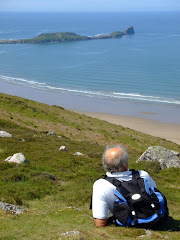
Jane Davidson , Environment Minister, recently opened a new 16-mile (25km) stretch of the Wales Coast Path from Llanmadoc to Port Eynon in Gower. The route includes Worm's Head and Rhossili beach, a particular favorite of our group.
The Minister was handed a baton by children from Llanrhidian Primary School at the start of the ceremony which was held at the St Madoc Centre in Llanmadoc.
She walked to meet local ramblers and handed over the baton before they walk along the path. Speaking before opening the project, managed by Countryside Council for Wales, Ms Davidson said: "Walking is a great way to enjoy the heritage and wildlife of Wales as well as the stunning coastline. This section in particular includes one of the most iconic views in Wales as well as two nature reserves and some of the most important archaeological sites in Wales."
The Minister added that it was more than just a tourist attraction, contributing to the Welsh Assembly Government's ‘Change4Life’ programme.
For the first time, visitors will have the right to walk the whole of Gower coastline and see the surrounding landscape from a new angle.
The Gower path is the latest stretch of the Assembly Government's proposed All Wales Coast Path - a continuous 850-mile (1,368km) path to run right around the coastline of Wales by 2012.
To create the new path there were:
7 legal diversions of public footpaths
1.2 miles (1.9km) of new public footpaths
13 new gates provided
41 sign and waymark posts erected
22 steps cut from solid rock
Subscribe to:
Posts (Atom)