From the 'Crash' album released in 1996, the single reached #2 in the US album charts before the band recorded 6 consecutive #1 albums in the American LP charts over the next 16 years.
The song has also been covered by various artists including Stevie Nicks formerly of Fleetwood Mac, who performed it on her 2008 Soundstage episode. Her version was later released as a single.
The video was recorded live at Continental Airlines Arena in East Rutherford, New Jersey
Friday, June 29, 2012
Sunday, May 27, 2012
Haga District

The morning of our final day in the second largest city in Sweden was spent wandering around the Haga district and a general wide sweep of the main harbour area.
Fortunately, most of the stores were closed for the Sabbath so very little money was actually spent!
Haga is renowned for its 19th century-atmosphere and cafés. Originally a working class suburb of the city with a rather bad reputation, it was gradually transformed into a popular area for both tourists and local residents.

The district was first established in the mid-17th century by Queen Kristina, making it Göteborg's first suburb. It was not until the 1840's that new industries were established in Göteborg, which led to an influx of workers into Haga, creating the first worker's district in the area. This led to a housing shortage during the 1870s and by the 1920s, after extensive expansion of the district, the population of the area began to decline.
A redevelopment plan drawn up in 1962 for Göteborg, which included the demolition of buildings in the district, in 1970 led to the founding of the Haga Group, with the aim to preserve the original architecture of the area. Between 1973 and 1977, demolition work decreased due to the pressure of the locals. This also moved the authorities to help restore some of the buildings which were already in disrepair.

Feskekôrka is a fishmarket by the Rosen Lundskanalen in the heart of Gothenburg. Feskekôrkan was opened on 1 November 1874 and the name is derived because it is compared to a church. In the 18th century, fishing was the most important industry for the city. In the past the fish market was a significant meeting point for residents of the city. However, in 1731 the Swedish East India Company was founded, and the city flourished due to its foreign trade with highly profitable commercial expeditions to Asian countries.

The harbour area developed into Sweden's main location for trade towards the west, and with Swedish emigration to North America increasing, Gothenburg became Sweden's main point of departure.

A lovely city with excellent facilities but rather flat!
Saturday, May 26, 2012
Aspero Island

After a typical Swedish breakfast we used the local transport service in the city which is absolutely superb, with trams that are both punctual and extremely clean, to rendezvous with Wandering Junior.

The weather was wonderful and we were able to use a ‘rover’ travel card to catch the tram from the city centre to the coast before boarding a ferry at Saltholmen on the short but pleasant 15-minute journey to Aspero Island (402 inhabitants in 2010).

This is part of the Southern Gothenburg Archipelago, which has 5,000 permanent and another 6,000 summer residents.

It was fascinating to learn about the traditional Swedish life-style, as families retreat to the coast for the long Summer holidays to the wooden clapper-board holiday homes. The Swedish are very supportive of a good work/life balance.

The only mode of transport allowed on the island was bicycle or a motorised type of golf buggy!
We spent an hour or so walking from the jetty to the main ‘street’ that consisted of the only general store on the archipelago! Enjoying an ice-cream beside the glistening crystal clear waters. Catching the ferry back to the mainland from the second jetty on the island later in the afternoon.

Friday, May 25, 2012
Goteborg
The clear blue skies and excellent visibility on the outward bound flight from Heathrow east of the capital, allowed a clear view of the Olympic Stadium in Stretford ahead of the London 2012 games that take place in July. The site looked enormous and is now a significant 'landmark' in the capital city below.

As we crossed the western seaboard of Sweden the Scandinavian Air Services flight allowed us another spectacular view of the archipelago’s that stretched out below.
After the obligatory bus transfer from the airport to the city centre we were able to stroll the short distance to our Post House Hotel to check in before a quick walk around the Nordstan.


The local knowledge of Wandering Junior, who lives and works in the city, helped considerably with the choice of restaurant for our evening meal.


As we crossed the western seaboard of Sweden the Scandinavian Air Services flight allowed us another spectacular view of the archipelago’s that stretched out below.
After the obligatory bus transfer from the airport to the city centre we were able to stroll the short distance to our Post House Hotel to check in before a quick walk around the Nordstan.


The local knowledge of Wandering Junior, who lives and works in the city, helped considerably with the choice of restaurant for our evening meal.

Wednesday, April 18, 2012
Sir Ian Botham's Charity Walk 2012
 International cricket legend, Sir Ian Botham was walking on the Taff Trail in Cardiff today raising funds in aid of leukaemia research.
Cardiff is the seventh city in Beefy’s Great British Walk 2012 – part of a series of walks made by the former England all-rounder in aid of the charity Leukaemia and Lymphoma Research.
In all, Botham will cover over 150 miles in 10 cities over 10 days. The walk took in sites around Cardiff before members of the public joined Botham for the final four miles along the Taff Trail.
Among those taking part were members of the Glamorgan County Cricket team and Wales rugby star Jamie Roberts.

Speaking ahead of the walk, Botham said: “I’ve been to Cardiff a lot and I’m looking forward to it. I’ll be walking along the Taff Trail so as a keen fisherman I’m looking forward to being by the river. I always love coming to Cardiff. They’ve been good to us and in return we’ve been good to them. We’ve had a fantastic response and raised about £175,000 in six days and that speaks for itself. We’re hoping to get hundreds, maybe thousands, of people down today. We had that in other cities and hopefully Cardiff will be good too.”
When Sir Ian first walked from John O’Groats to Lands End in 1985, only 20% of children with leukaemia survived. Yet now, thousands of miles and over £13 million later, 90% of children are beating the most common form of this devastating disease.
But Sir Ian will not stop fundraising until every child with a blood cancer survives. He needs your help although great advances have been made there are still children and teenagers losing their battle.
Thursday, March 29, 2012
Fan Frynych - Mountain Centre - Brecon

The decision to use public transport for this particular excursion was forced upon us by the crazy antics taking place at the local petrol forecourts. Following the Coalition Governments' totally inappropriate advice to ‘keep your petrol tanks topped up' and fill Jerry Cans because there MAY be a tanker delivery driver strike AFTER the Easter holidays!!
 TrawsCymru had recently won the tender to run the T4 Brecon service and Lord Twynyrodyn met Wandering promptly at 9:00am to catch the 9:20 departing to the Storey Arms. We were well impressed with the quality of the bus used on the route to Mid-Wales and a £6.20 Explorer ticket was purchased that would allow us to return from Brecon later in the afternoon.
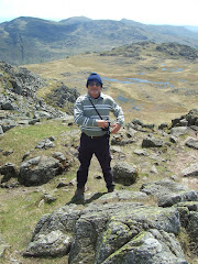
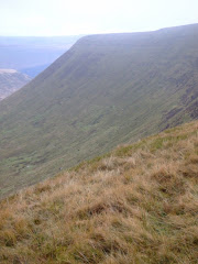
After Lord Twynyrodyn used his compass and string (yes, an extremely high tech piece of string was required) to plot the line of the route to Fan Frynych, we left the Storey Arms at 9:45am along the long diagonal path of the Beacons Way heading towards the distinctive Craig Cerrig-Gleisiad (See previous trip report here for photographs).

Although the sun was shining in a clear blue sky it was still a bit nippy at 1,800 feet. The long spell of dry weather guaranteed mud free path’s as the route gained height quickly, without any really hard work, until we could gaze down onto the A470 and the sumptuous views down the valley leading to Brecon.

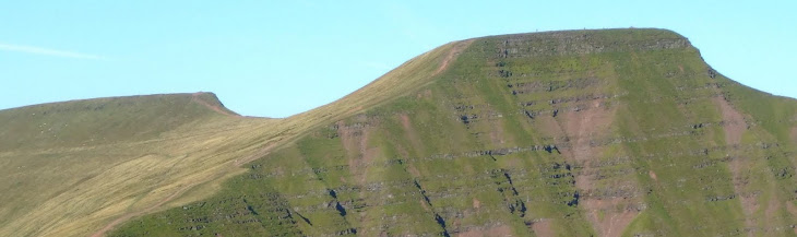
The vistas created by Pen-Y-Fan, which was to remain with us all day, Fan Ghyrich and Fan Brycheiniog in the Black Mountain were amazing in the clear mountain air.
Lord Twynyrodyn’s navigation skills were almost spot on as we approached the trig point at Fan Frynach.

We left the Fan heading in a north easterly direction down Twyn Dulluan-ddu, towards Blaenclyn farm, crossing Daudraeth Illtyd Nature Reserve and our intermediate destination of the Mountain Centre, where we enjoyed a hot bowl of soup and a bread roll.

We needed to make an important decision about the remainder of the route, toying with a footpath alongside Mynydd Illtud that would take us to Llanspyddid, but instead headed for Tai’r Bull.
We passed this particular magnificent outward bound location that was owned by Hampshire County Council and must be worth near seven figures!


Contemplating the remainder of the route on a bench in Libanus the unilateral decision was taken by Lord Twynyrodyn to approach Brecon from the hamlet of Libanus Mill on some minor country roads.
We came across the remains of this Motte and Bailey site outside Cilwhybert and arrived at our destination at 3:00pm. Completing the 11 miles in just over 4 hours.

The refreshments provided by the Drovers Arms were well received, before we caught the 4:00 bus home.

Thursday, March 15, 2012
Gwaelodygarth? - It must be this way!

We were able to make an earlier start than originally intended after the birth of Lord Twynrodyn's grandson the night before. After a series of congratulatory calls on his Blackberry we arrived at a rather misty Pentyrch.

Parking the car outside the Lewis Arms we headed into the fog along Heol Goch Road. At the end of Cefn Brychan Lane the steep muddy footpath takes you down through the woods to the main road. After crossing the road a stile on the right hand side allows you to access a wide farm track leading down into the base of the valley.

Unfortunately there were no views of the Garth Mountain looming above due to the low cloud and poor visibility.
Without an OS map to check the grid reference coordinates this is where Derek the Weatherman’s basic directions once again let us down badly. There was no hedge line, no finger posts and no defined footpath, so it would be difficult for anyone to actually find the proposed route to the Coed Y Bedw Nature Reserve without some local knowledge of the area.
Our alternative route headed north along the broad farm track towards the invisible bulk of the Garth Mountain. However, we appeared to pass what we thought at the time was the remains of Morgan Thomas’ (former mine owner and poet) ruined cottage…………or was it!?!?!?

At this point we should have been heading through an ancient woodland and although we did make a short de-tour to check out an alternative finger posted route we decided to remain on a single track tarmacked road that eventually lead us to the upper level of Gwaelodygarth.

We knew that we were now definitely heading in the wrong direction. We descended the steep narrow mountain road into the village passing the inviting hostelry of the Gwaelodygarth Inn (where we were later to return) and then branched off right to climb into the picturesque hamlet of Geogetown.
 After feeding a delightful Shetland pony and passing the cattery we entered an atmospheric pine forest, with daylight from the canopy streaming through tall trees and illuminating the forest floor. Leaving the forest to the west we crossed a few open fields and returned to the wide farm track.
There was no large wooden broad walk, bridge over a stream, wildlife information board or cleverly made seat carved into a tree branch!
The ‘To Let’ signs on the Lewis Arms looked uninviting and we decided to return to the Gwaelodygarth Inn for a splendid lunch in a typical country pub.
Not the walk that we originally intended to take but it was an opportunity to be outdoors enjoying the fresh air and local countryside.
Subscribe to:
Posts (Atom)