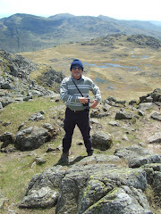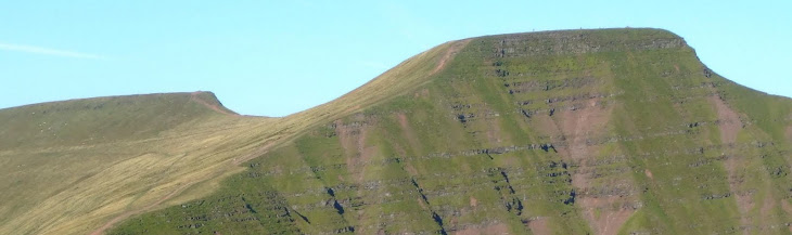
Pen-Y-Fan from Cribyn
Learn to fall in love with the mountain not just the summit

Saturday, October 27, 2012

Pennard, Gower


The really strong winds that were blowing across Swansea Bay as we passed St. Helens had virtually disappeared by the time that we reached the sea front car park at Pennard.

With clear blue skies and warmish sunshine, the air temperature was approximately 9 degrees as we walked along the headland on the outward loop eastwards from Southgale. At the furthest point we were able to see Caswell Bay in the distance. As we returned to Southgale we were surprised to establish that this particualr section was actually linked to the Pwll Du walk which we made in September 2011.


We returned in a westerly direction along the 'C' road towards Pennard. A few quiet moments were taken sitting on the bench at the car park looking out to the flat calm sea.

Forsaking the main footpath used by the majority of walkers Lord Twynyrodyn and Wandering decided to scramble down the 100 foot limestone cliff face to the beach below, without knowing at the time whether it would even be possible to make it safely to the bottom.


After posing for the obligatory photo at a rock promontory it was firstly a grass bank and then a slide down loose screed before tackling the final rocky outcrop. Circumnavigating a wide crevice in the rocks, the two 'veterans' managed to keep their feet long enough to make it to the safety of the sandy beach.


The bay takes its name from the three sea cliffs that jut out into the bay. The beach routinely qualifies for Blue Flag status. Inland about 500 yards from the main beach on high ground above Pennard Pill is Pennard Castle, which was built in the early 12th century.


In June 2006 the BBC Holidays at Home programme declared Three Cliffs Bay to be Britain's best beach. In a recent programme broadcast in the UK the view over Three Cliffs Bay was nominated for "Britain's Best View".


To leave the beach the duo needed to walk though the natural arch created in the rock, because Pennard Pill, the river that bisects the beach, was too deep to cross. After leaving the beach and crossing a wooden bridge we had to climb a steep, energy sapping sand dune to reach the ruins of Pennard Castle.


We crossed a section of the links golf course and passed the clubhouse before making our return to the car park, but only after his Lordship had enjoyed a bowl of hearty Pumpkin Soup (to celebrate All Hallows Eve) in the cafe before departing after our excellent adventure on the Gower Peninsular.

Photographs taken on this walk can be viewed here. Select 'slide-show' for automated viewing.

Sunday, September 16, 2012

Abergavenny Food Festival

Regarded my many highly respected gastro's as the 'Glastonbury of food festivals' the highlight of this year's visit for Wandering were the Churros dipped in chocolate sauce by Churros con Chocolate.

Christmas Food Festival takes place on Sunday 9th December.

Festival website

Friday, September 14, 2012

Stage 6 - Tour of Britain 2012


It was always the intention of Wandering to be a spectator on this stage of the Tour of Britain but Lord Twynyrodyn expressed a curious interest when it was mentioned in a conversation between them, so it was two Strollers that made the short journey to the Storey Arms at mid-morning.


The start of this stage was from the National Trust's Powis Castle completing a loop of Welshpool before a fast descent of the Honddu valley. Soon after leaving Brecon the A470 gradually begins the climb in the shadow of Pen-Y-Fan, as the steepness of the gradient increases after Libanus, which starts the seven-kilometre SKODA King of the Mountains climb up to Storey Arms.


There were big crowds lining the route north of Storey Arms as we took our vantage point. Because of significant head-winds the peloton was behind schedule as they thundered past heading towards the open moorland that eventually descends to Penderyn and Hirwaun.


A brief climb to Ystrad Mynach through Nelson and Parc Penalta, towards Llanbradach to the edge of Caerphilly. The route passed Caerphilly Castle taking the one-way system the wrong way in order to maximise the approach to the climb, which proved to be one of the iconic moments of this years Tour of Britain.

The stage was eventually won by Leopold Koenig, of the Team NetApp with Jonathan Tiernan-Locke, of Endura Racing taking second place on the stage and overall GC winner.

Brief video footage taken by Wandering as the peloton passed our vantage point on the climb to the Storey Arms!!

Wednesday, September 12, 2012

Mercy

A thought provoking video from the Dave Matthews Band.

"Mercy" embraces the song's themes of unity and harmony in a new collaborative video, made with the help of a few thousand fans. According to the band, 14,334 people provided original photos and videos for the inspirational clip.

Matthews recently told 'Billboard' that he hopes this release "inspires [people] to find the things that they love, inspires them to feel good, to feel love, or ambition, or feel powerful. Whatever they need."

"Mercy" is realesed from the Dave Matthews Band's latest album, Away From the World.


Thursday, September 6, 2012

Garth Mountain


This was a walk that was partially abandoned earlier this year in low cloud, so with the recent spell of good weather a 'second attempt' was made to reach the summit trig point.

Another reason for completing the walk was football related. During 2010/11, the Martyrs spent a season in exile away from our spiritual home of Penydarren Park, during the games in the Western league I often used to gaze up at Garth Mountain and wonder what the Rhiw Dda'r ground looked like from the bluff, 1,000 feet above the extremely busy A470.


Well I was about to find out.

The early stage of the walk was exactly the same as the original, starting from the Lewis Arms car park. However, on this occasion I climbed the steep path that eventually led to the bluff, that is so prominently visible from the A470 as you approach the outskirts of Cardiff.


And there it was the ground were the Martyrs spent a year in exile climbing their way back through the non-league pyramid.


The all-round views are really spectacular. With Cardiff Bay to the South and Castell Coch just a few miles away, to Llantrisant in the west and Caerphilly Mountain in the north-east. After gazing at the two main communities situated directly beneath the mountain - Taff's Well and Gwaelodygarth, it was onwards to the trig point.


The circular route was completed when you leave the mountain to return through Pentyrch and back to the Lewis Arms.


The movie staring Hugh Grant, 'the Englishman Who Went Up a Hill But Came Down a Mountain', is based on a story about the village of Taff's Well and the neighbouring Garth Hill.

Set in 1917 (with World War I as a backdrop), the film is based on two English cartographers. They arrive to measure the local "mountain" – only to cause outrage when they conclude that it is only a hill because it is slightly short of the required 1000 feet in height. The villagers, aided and abetted by the wily Morgan the Goat and the Reverend Mr Jones (who after initially opposing the scheme, grasps its symbolism in restoring the community's war-damaged self-esteem), conspire to delay the cartographers' departure while they build an earth cairn on top of the hill to make it high enough to be considered a mountain.

Saturday, August 4, 2012

St. Davids


After a welcome overnight rest in the Golden Lion, Newport, a non-walking day consisted of a visit to St Davids Cathedral. The walking clothes were still drying out after yesterday's drenching!

Set a few miles inland from a spectacular Pembrokeshire peninsula jutting out into the Atlantic, upon the site of an earlier sixth-century monastery built by St David, the Patron Saint of Wales, St Davids Cathedral has been a site of pilgrimage and worship for more than 800 years.


The monastic community was originally founded by Saint David, Abbot of Menevia, who died in 589. Between 645 and 1097, the community was attacked many times by raiders, including the Vikings, however, it was of such note as both a religious and intellectual centre that King Alfred summoned help from the monastic community at St. David's in rebuilding the intellectual life of the Kingdom of Wessex.

In 1081, William the Conqueror visited St. David's to pray, and thus recognised it as a holy and respected place.


Work on the present cathedral began sometime between 1180 and 1182 and is the culmination of centuries of rebuilding and expansion. Constructed in the Transitional Norman style using fine-grained, purple Cambrian sandstone, it has survived both the collapse of its tower and an earthquake in the 13th century, although today the floor slopes noticeably, the arcades veer from the vertical, and the east and west ends of the building differ in height by about four metres!


The restored Shrine of St David was unveiled and re-dedicated by The Right Reverend Wyn Evans, Bishop of St Davids, at a Choral Eucharist on St David's Day 2012. Sarah Crisp painted and gilded the five icons which have been installed to sit within the exisiting niches of the restored shrine. The icons, made in egg tempera on gesso, depict St David and other saints associated with the cathedral and the local area. The three icons at the front of shrine depict from left to right: St Patrick, St David and St Andrew. The icons are painted on lime wood panels and combine the styles of classic Byzantine with early Italian works. Traditional paint and techniques were used throughout.

The Cathedral has also been used as a location for a BBC production called "The Hollow Crown" as part of the castle of Richard II.

The title of "city" was re-instated to St. David's, and formally conferred by Her Majesty Queen Elizabeth II on 1 June 1995.


The weather had been glorious all day in St. Davids and reluctantly it was decided to return to Newport Sands where ice-creams were consumed before it started to rain!!

Friday, August 3, 2012

Poppit Sands to Newport


Boarding the Poppit Rocket outside the Castle Hotel in Newport at 10:30am the weather was blustery but sunny. The journey to the start of the walk took over half an hour along the narrow Pembrokeshire country lanes via Moylegrove.

After departing the 'Rocket' in the large car park at Poppit Sands on the mouth of the River Teifi, the costal path starts to climb almost immediately following a minor road past the Youth Hostel to Allt-Y-Goed Farm, where it becomes a footpath.


This takes you to Cemaes Head which is now a nature reserve owned by the Wildlife Trust, where guillemots, cormorants, fulmars and razorbills nest in the cliffs in Spring and early Summer, but not today!


The geology of this section of the coastline is spectacular. The cliffs at Pwll Granant in places are 600 feet high and consist of layers of sandstone and mudstone.

Arriving at Ceibwr Bay after a few hours walk the weather had remained kind. The steep valley down which the Nant Ceibwr flows was deepened by glacial meltwater in the Ice Age. Lunch was taken overlooking a group of school children coasteering along the rocky outcrops in the bay below.


Less than a mile further along the coastal path is the Witches Cauldron (Pwll-Y-Wrach) which is a natrually formed blow-hole caused by the collapse of a cave roof.


Soon after this point the weather deteriorated and it started to rain and the conditions were made difficult by the prevailing head-wind. This particular section of the coastal path is remote and extremely challenging, rising and falling quite dramatically in places. After the downhill trundle you know that a trudge upwards is always inevitable!


Before turning the headland a shoal of porpoises were clearly visible in the sea below.


After five hours the welcome sight of Newport Sands and the Nevern Estuary finally came into view, although there was still a few miles to walk to reach the Golf Club.

Over half of the 15 mile walk had been completed in driving rain and strong head-winds!

Photographs taken on this walk can be viewed here. Select 'slide-show' for automated viewing.