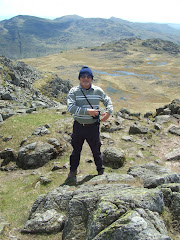
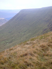
Pen-Y-Fan from Cribyn
Learn to fall in love with the mountain not just the summit

Tuesday, August 31, 2010

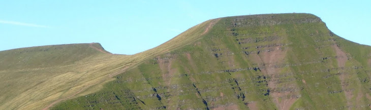
Sunset on Cribyn


Although the mountain range must have been extremely busy throughout the August Bank Holiday, the actual solitude sitting on Cribyn at sunset was a really special feeling.

Everyone had disappeared and there was no one to be seen anywhere, apart from a few lucky individuals who were wild camping near the Neuadd! But there is evidence of life all around you in this very special place.

This single moment in time was absolutely unique.

Sunday, August 29, 2010

Valleys Walking Festival

The 6th annual Festival takes place from 4th to 19th September 2010.

Described as a celebration of walking with a wide selection of guided and non-guided walks for all abilities. The 2010 programme includes an increased number of walks spread over a larger geographical area, from Machen in the east to Carmarthenshire in the west.

There are a variety of walks on offer, including family based walks, themed nature walks, historical walks and disabled friendly. All walks are led by experienced walk leaders whose local knowledge is guaranteed to add to the experience.

All walks are free but it is recommend that booking early will ensure a place on the walk.

The brochure can be downloaded from here.

A few local examples:
Saturday 4th September - Heol Cymro
Circular route along Trevethick Trail and up onto the valley ridge.
Sunday 12th September - Taff Bargoed
Merthyr Common and Parc Taf Bargoed
Tuesday 14th September - Wild Whiskey
Walk around Penderyn including a visit to the Whiskey Distillery!!
Wednesday 15th September - Gethin Woodland Walk
Scenic walk through forestry with spectacular views of the valley below.
Thursday 16th September - Trrevethick Trail
South to Pontygwaith Bridge
Friday 17th September - Chartists Cave
Including visits to Dukes Table, Bryn Oer Tramroad and Pre-historic burial mounds.

Thursday, August 26, 2010

The Great Climb

Dave MacLeod and Tim Emmett plan to make a 'live' televised ascent of what they have described as one of the toughest rock faces in the world - Sron Ulladale, an overhanging cliff on Harris in the Western Isles.

The climb on Saturday 28 August will be filmed in high definition (HD) and broadcast on BBC Two Scotland and BBC HD Channel. If you have Sky you can also watch BBC2 Scotland on channel 990.

Triple Echo - which produces BBC Scotland's Adventure Show - said the Sron Ulladale climb will be a world first in the terms of technology used during the outside broadcast. This is set to be one of the most inspiring films ever produced of climbers in action

Permission for this summer's programme was granted on the basis that the producers agreed a "leave-no-trace" commitment to protect the fragile local environment. Most of the equipment will be flown in to prevent any erosion to the mountain trails and rare plant life.

Dougie Vipond, who will present the broadcast, said: "This is set to be one of the most inspiring films ever produced of climbers in action. It will be a hugely challenging and bold ascent and our cameras will be there to capture all the drama as it happens."

The programme will also feature a world record attempt the two climbers will make earlier in the summer. They plan to ascend five new routes on five islands in five days.

Writing on his blog, Dave MacLeod said: "I'd love to tell you exactly which part of the mighty Sron we will try to climb, but on a previous recce, close inspection of the cliff was out of the question due to the golden eagles, nesting on the main part of the face once again. If the eagles hatch chicks (best of luck to them!) we won't be able to look closely at the lines until August. So until then, it's training and waiting. Naturally, our plan is to climb the hardest possible route that imagination and finger strength allows."

Monday, August 23, 2010

British Camp


The absolutely atrocious August weather (75mm of rain in 24-hours!), led to the early curtailment of this particular walk, that was due to finish at the Worcestershire Beacon just outside Great Malvern. Instead it turned into a relatively short circuit around the amazing 2,500 year old hill fort on the border of Herefordshire and Worcestershire.


The heavy rain of the early afternoon fortuitously abated for a brief period, although the low cloud still hung around the summit of the fort which is 338 metres (1,109 feet) above sea level. In this type of sinister atmosphere you almost expected to hear the war cries of the garrison when they commence their attack as you climb to the very top of the hillside still shrouded in mist.


Comprising of extensive earthworks that must have made the location almost impregnable - anyone approaching the fort would have been spotted in a radius of fifteen miles in all directions - the site must have been of significant importance to the ancient Britons.


A ditch and counter-scarp bank circles around the entire site, which covers three hills, although those to north and south are little more than spurs. The first earthworks were constructed around the base of the central hill known as the citadel. At least four pre-historic phases of building have so far been identified on the site. Original gates appear to have existed to east, west and north-east sides of the fort.


British folklore suggests that the ancient British chieftain, Caractacus, made his last stand at British Camp. Excavation at Midsummer Hillfort (located near to British Camp) suggests evidence of violent destruction around 48BC. This may suggest that the British Camp site was also abandoned or destroyed around the same time.


The Shire Ditch, or Red Earl's Dyke, runs north and south of the site along the ridge of the hills. It was created in 1287 by Gilbert de Clare, the Earl of Gloucester, following a boundary dispute with the Bishop of Hereford. Recent research has shown that the Shire Ditch might actually be much older. Indeed there is some evidence that it may have started life as a pre-historic trackway running from Midsummer Hillfort to the Worcestershire Beacon, the highest hill in the Malvern range over three miles to the north of the Camp.


Soon after reaching the directional stone the heavy rain returned and it was time to head back to the car. A return in the near future to complete the leg to Malvern is essential.

Friday, August 20, 2010

Middle Earth

Born in Bloemfontein, spending his childhood in Birmingham, before going to University in Oxford, then fighting in the Somme during World War 1. Where exactly did Tolkien find the inspiration for the mountainous land of Mordor in the eastern extremity of Middle Earth in the Lord of the Rings?

Roads go ever ever on,
Over rock and under tree,
By caves were never sun has shone,
By streams that never find the sea,
Over snow by winter sown,
And through the merry flowers of June,
Over grass and over stone,
And under mountains in the moon.

Roads go ever ever on,
Under cloud and under star,
Yet feet that wandering have gone,
Turn at last to home afar,
Eyes that fire and sword have seen,
And horror in the halls of stone,
Look at last on meadows green,
And trees and hills they long have know.


First published in 'The Hobbit' by JRR Tolkien in 1937.

The road goes ever on and on,
Down from the door where it began,
Now far ahead the road has gone,
And I must follow, if I can,
Pursuing it with eager feet,
Until it joins some larger way,
Where many paths and errands meet,
And whither then? I cannot say.

Published in 'The Fellowship of the Ring' by JRR Tolkien in 1954.

Wednesday, August 18, 2010

You Tube

In this age of modern technology it was only a matter of time before we had a presence on You Tube. This is the very first video production of it's kind from Tydfil Strollers that attempts to capture elements of our visit to the Gower Peninsular in May. This is very much an experimental version of the 'brave new world' that lies ahead and quite a few things still need to be improved.


When the trial and errors (more of the errors than the trial at present!) have been resolved a few additional movie clips may be added over the next few weeks.

All published copyright is owned by Tydfil Strollers!

Saturday, August 14, 2010

South Wales Nuttalls

Like the Munro's in Scotland all hills in Wales that are at least 2,000 feet (610 metres), high with a relative height of at least 15 metres (49.2 feet) are classified as Nuttalls. The definitive list was compiled by John and Anne Nuttall and published in 'The Mountains of England & Wales'.

All of the qualifying hills in the two main regions of South Wales are listed below. In total there are 34 Nuttalls to climb in South Wales.
Check how many you may have climbed?

Black Mountains
Waun Fach (811 mtrs)
Pen y Gadair Fawr (800 mtrs)
Pen Allt-mawr (720 mtrs)
Rhos Dirion (713 mtrs)
Black Mountain 3 (703 mtrs)
Pen Cerrig-calch (701 mtrs)
Twmpa (690 mtrs)
Chwarel y Fan (679mtrs)
Mynydd Llysiau (663 mtrs)
Pen Twyn Mawr (658 mtrs)
Pen Twyn Glas (646 mtrs)
Black Mountain Sth Top (637 mtrs)

Brecon Beacons
Pen y Fan (886 mtrs)
Corn Du (873 mtrs)
Fan Brycheiniog (802 mtrs)
Cribyn (795 mtrs)
Waun Rydd (769 mtrs)
Fan Hir (761 mtrs)
Bwlch y Ddwyallt (754 mtrs)
Bannau Sir Gaer (749 mtrs)
Fan Fawr (734 mtrs)
Fan Gyhirych (725 mtrs)
Fan y Big (719 mtrs)
Waun Lefrith (677 mtrs)
Fan Fraith (668 mtrs)
Fan Nedd (663 mtrs)
Allt Lwyd (654 mtrs)
Garreg Las or Twyn Swnd (635 mtrs)
Fan Llia (632 mtrs)
Fan Frynych (629 mtrs)
Craig Cerrig-gleisiad (629 mtrs)
Y Gyrn (619 mtrs)
Cefn yr Ystrad (617 mtrs)
Garreg Lwyd or Moel Gornach (616 mtrs)