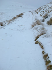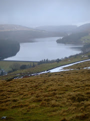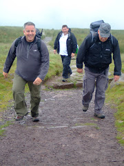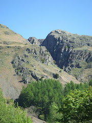
Pen-Y-Fan from Cribyn
Learn to fall in love with the mountain not just the summit

Saturday, January 29, 2011

En Haut de Pen-Y-Fan


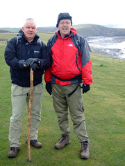
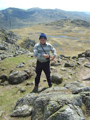
Conditions at the top of the highest peak in the southern half of Britain at 13:29 were described as '..fresh!' as the father and daughter duo from the Cynon Valley reached the summit.

In almost perfect winter conditions, with a minus wind chill factor, the steady climb to 886 metres would not prove too difficult for one of the fittest fiftysomething's in South Wales and his triathlon competing daughter.


This was the third time for Rebecca to climb Pen Y Fan, although it was 4 years ago since the previous occasion! "I suggested this walk after speaking to friends about various other walks. I'd enjoyed the walk before, and as it is quite local thought it would be a convenient option. I love the views at the top of Pen Y Fan, especially seeing the snow & ice still lying on the top. I also loved the cloud inversions!! I will definitely do the walk again, hopefully, more regular than every 4 years. I would also like to do some other local walks" said Rebecca.

It took 48 minutes to get to the top... including a short photo stop at Corn Du!

Did they have the peak to themselves on a Saturday afternoon with beautiful clear blue skies.......well what do you think? His response was summed up in one word '...busloads'. But its the achievement that counts.


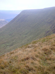
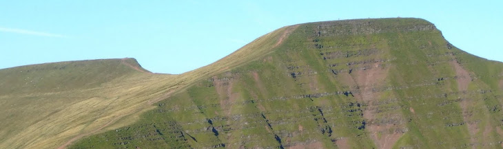
With the north face of Craig Gwaun Taf covered in frost, a low winter sun and a cloud inversion it was well worth the effort. Unfortunately the low cloud enveloped the summit just as the final photograph of the pair was taken by some random person who was probably minding their own business until press-ganged into pressing the shutter.

"Dad could not walk all that way without his flask of tea!! he also had a bacon and egg sandwich plus a cup of tea to finish the walk! He has gone upmarket now with the flask......although it was all ready made for him!"


Super-fit Rebecca completed the triathlon in Brecon (that included an 800 metre Swim, 21 kilometre cycle ride and 5 kilometre run) in a very impressive time of 1 hour 32 minutes.

Most of the photographs taken on this walk can be viewed here. Select 'slide-show' for automated viewing.

Thursday, January 27, 2011

Weatherman Walking - Episode 4


The final episode of the current series ended this week with a 6 mile circular walk from Blaencwm to the iconic summit of Pen Pychin in the Rhondda Valley, passing waterfalls and former industrial landscapes on the way.

The walk including spectacular ridge views of the Rhondda, stone circles at an iron age settlement, trails through forestry land, locating the source of the River Rhondda, re-claimed industrial land and the Rhigos mountain road.

Perhaps another walk to add to our itinerary?

Watch the final episode 'Waterfalls and a Barefoot Walk' on the BBC iplayer.

Tuesday, January 25, 2011

Ice Climbing in Eidfjord


The incredible force of nature turned the normally raging waterfall in Eidfjord, Norway, into a wall of ice by the harsh Scandinavian winter - where temperatures dropped to minus 15 celcius.

At 650 feet high the ice wall had not previously been successfully climbed until recently when extreme sports enthusiasts, Will Gadd and Christian Pondella, defeated the frozen rapids using just their ice picks.


Christian, an adventure sports photographer from California, said "Temperatures fell to minus 10 while we were climbing so it did get tough. But luckily we wrapped up nice and warm. The waterfall was incredibly beautiful and very photogenic so I spent most of my time stopping to take pictures while Will powered on to the top. We felt on top of the world and its amazing to think that any other time of year this whole thing would have been a raging torrent of water".

Saturday, January 22, 2011

Circuit of Pontsticill Reservoir


It was still very frosty when the walk started from the village, just as the sun was struggling to rise above the surrounding hills.

The route includes a full 5.5 mile circuit of the reservoir, using part of the Taff Trail. The outward section meanders its way through the forestry until it briefly re-joins the road to Tal-Y-Bont, before crossing the bridge that separates the Pontsticill section of the reservoir from the Pentwyn (known locally as Dol-y-Gaer) expanse.

Leaving the road that leads to Dol-Y-Gaer Outdoor Pursuits Centre, the path runs alongside the narrow gauge line of the Brecon Mountain Railway for nearly a mile, almost parallel to the eastern side of the reservoir.

This must be one of the most scenic narrow gauge railway routes in the country, taking passengers into the heart of the Brecon Beacons, alongside the glistening stretches of the serene, reflective waters edge.

Pontsticill Reservoir, which was completed in 1927, can hold 3.4 thousand million gallons of water (is that 3 billion gallons?). The water flooded the vicarage and 15th Century Capel Taf Fechan, Bethlehem Congregational Chapel, some cottages, small holdings and land belonging to eight farms. In times of drought the remains of some of these buildings often appear above water level.


Mid-way on the eastern bank is the deserted head-quarters of the Merthyr Sailing Club, hopefully, internally the building is more welcoming than the featureless external facade? Sailing is one of the activities provided for visitors and residents of the nearby out-door pursuits centre.

Another minor diversion on the walk was a visit to the Pontsticill station of the Mountain Railway (the first trains was not due to arrive until 12.30pm today!), with wonderful views in the distance to the north of the cloud covered tops of Corn Du and Pen-Y-Fan.


The narrow-gauge railway has been a major visitor attraction for the last 30 years, created by the inspiration and vision of Tony Hill and his family.

The site occupies a stretch of the old 'abandoned' Brecon and Merthyr Railway which closed in 1964. Fighting its way through the Brecon Beacons, climbing the steep gradients including the Torpantau tunnel, which at 1,313 feet above sea level, is the highest railway tunnel in Great Britain.


By 1978 various planning and other consents had been obtained, with construction of the narrow-gauge railway commencing with the re-building of the former Station House and conversion of the adjoining waiting room into a small workshop.

After this project was completed work started on the repair and replacement of the 7 bridges between Pant and Pontsticill. Laying the track itself commenced in 1979 and was completed in 1980.


Meanwhile, "Sybil" - a small slate quarry engine from North Wales - had been re-built to haul the train.

After leaving the platform the walk returns across the dam, past the giant 'overflow plug' and back into the village.

All of the photographs taken on this walk can be viewed here. Select 'slide-show' for automated viewing.

Friday, January 21, 2011

Crickhowell Walking Festival 2011


There are over 70 walks to choose from during the nine days of the festival, which takes place between Saturday 26th February and Sunday 6th March 2011.

With something for every level of walker, whether you are happy trekking all day across the tops of the Black Mountains and Brecon Beacons or would rather just keep to the popular paths and the lower slopes.

All of the walks are led by experienced local guides and are graded into four categories - easy, harder, prepare for a full day and full day walks. Registration is currently open and booking is already over 50% full.

Visit the Crickhowell Walking Festival website for more details.

Wednesday, January 19, 2011

Craig Cerrig-Gleisiad


A ridge of extremely high pressure guaranteed clear blue skies this morning, although with the severe hoar frost overnight the temperature at the start was a rather low -2 celsius!

After leaving the lay-by on the A470 you walk into an enclosed atmospheric amphitheatre created by the soaring, craggy cliffs - formed by glacial action over 20,000 years ago - the high ridge seen above will eventually provide the middle section of the walk.

The grinding action of the ice carved the 500 feet cliff face and escarpments that remain. Ironic that the moraines created by glacial action were covered in frost and ice!

The north facing rocks rarely see the sun, probably only occasionally in summer. Because of the cold, dark conditions rare arctic-plants survive at their southern most limit only re-appearing in the Alps.


The initial walk takes you into the 'bowl' of the Nature Reserve below Craig Cerrig-Gleisiad before starting the steep climb towards Fan Frynych. Luckily the paths were still frozen so the conditions underfoot were perfect. Looking back to the east you see the first view of Pen-Y-Fan and in the far distance the Black Mountains.


At the top of the ascent (after climbing to a height of 629 metres) the route bears left towards the ridge of the crag. The wonderful landscape opened out providing crystal clear views to the west of Fan Llia, Fan Nedd, Fan Gyhirych and Fan Fraith which all looked superb bathed in the winter sunshine.


The ridge of the crag takes the walk eastwards providing superb views down into the cwm, to the low lands of Brecon and east to Pen-Y-Fan and Corn Du.


The descent was extremely trecherous as the ground (it was like walking on Crunchy Nut Cornflakes!) was still very frozen and slippery. In normal conditions this would have been relatively straight forward but this morning it was very much a case of take your time or end up on your bottom!


The final section of the walk down the flank of the crag returns across a semi-frozen brook to the original path used at the start.

All of the photographs taken on this walk can be viewed here. Select 'slide-show' for automated viewing.

Monday, January 17, 2011

Gwent Levels


The continuous 'dreich' weather conditions of the last few weeks has discouraged any serious physical activity, but the plethora of 'out-doors' type programmes on the television has certainly been able to supplement the planning process.

The third episode of 'Weatherman Walking' saw Derek Brockway climb Cnicht, the Welsh Matterhorn in North Wales a proper pointy peak on the edge of the Snowdonia National Park overlooking Porthmadog and the beautiful Glaslyn estuary.

Then as a complete contrast, he follows in the footsteps of Romans and mediaeval monks as he discovers the delights of the Gwent Levels, Wales's own low country and an unusual land of reens, gouts, grips and vurrows with a walk from Goldcliff to Redwick. This is a walk to be added to the programme for the Summer.

Countryfile spent some time in the Duddon Valley, Cumbria.

Simon King's stunning 'Shetland Diaries' is also being repeated on BBC2 this week.

The second installment of the excellent 'Men of Rock' is on Thursday evening.

Julia Bradbury's German Wanderlust adventures are being repeated on BBC2 on Friday.

With a forecast for drier and colder weather over the next few days, a potential walk 'outdoors' is looking a distinct possibility.