The New York Times front-page story on 2nd August 2008 written by journalist Graham Bowley, attempted to explain the chaos that unravelled on the world's second-highest mountain - K2 which was living up to its lethal reputation.
Hundreds of miles to the north of Everest with its near-perfect pyramid shape, at 28,251-feet the world's second-highest mountain has lured serious climbers to its rock faces for decades. Near the end of a brief climbing season cut even shorter by bad weather, no fewer than ten international teams crowded the mountain's dangerous slopes with their Nepalese Sherpas and Pakistani High Altitude Porters (HAP's), waiting to ascend.
Finally, on 1st August, they were able to start the ascent. From professional Dutch climbers to an independent Basque, Norwegians to a 61-year old Frenchman this cosmopolitan mix set out for the summit working in some form of dis-organised serendipity. The climbers sensed that there was probably some safety in numbers, and by early afternoon, despite two early fatalities, 19 climbers made the fateful "group" decision to carry on. This committed them to the twin sins of a tricky late summit assault and a dangerous dark descent.
But hindered by poor judgment, lack of adequate equipment, and overcrowded conditions, the last group did not summit until nearly 8 p.m. hours later than originally planned. Exhausted they punched the thin air in mock celebration - joining the elite band who have conquered the world's most lethal mountain. About the time many of the climbers were euphorically taking the obligatory photo and calling their families from the summit - a giant serac collapse wiped out the fixed ladders and ropes hundreds of feet below the climbers, changing the terrain and creating a volatile funnel ripe for avalanches. Small errors and bad decisions made earlier in the day would ultimately create a wide-scale disaster, and an already risky descent became a nightmare free-for-all.
More than a dozen climbers and porters still above the Bottleneck — many without oxygen and some with no headlights — faced the near impossible descent in the darkness with no guidelines and no essential safety measures. Over the course of the chaotic night, some would miraculously make it back. Others would fail.
The extraordinary narrative certainly grabbed my attention from start to finish, in the same way that K2 must captivate the hardened mountaineers that attempt to reach the summit. I found the passage when the Dutch climbers Wilco van Rooijen and Cas van de Gevel embraced each other after van Rooijen had incredibly spent two frost-bitten nights bivouacking in minus 30 degrees above the Shoulder, to be a really emotional moment.
The research carried out by Graham Bowley, who interviewed all of the survivors, helps him to describe what actually happened on K2, as if you are actually standing on the Bottleneck watching it all unfold as it happened. It is a harrowing account of the true brutality of climbing K2, where heroes emerge and inflated egos are reduced - the only thing that actually achieves immortality is the cold ruthless mountain. It is a riveting and powerful story of an extraordinary tradegy.
This video has also been produced in the form of a movie trailer - only it's to advertise the book. I would recommend that you make the time to read this book.
Sunday, September 26, 2010
Wednesday, September 22, 2010
Geocache
This particular subject cropped up on a recent walk. Mr. B had stumbled across a polythene container on a previous stroll and this led to further debate.
Although more people now seem to be aware of this pass-time, what does this strange world involve?
Apparently its classed as some sort of outdoor ‘game’ in which navigational techniques are used to 'hide and seek' containers, called "geocaches" or "caches". A typical cache is a small waterproof Tupperware container which contains a logbook.
There are geocaches placed in over 100 counties around the world and on all seven continents, including Antarctica. After 10 years of activity there are over 1.1 million active geocaches published on various websites devoted to the activity.
Geocaching can be compared to a "treasure hunt" or "letterboxing", which uses clues and references embedded in a ;ist of instructions or a story. Geocaching was actually conceived shortly after the removal of selective availability from GPS on 1st May 2000. Because of the improved accuracy of GPS it allowed a small container to be specifically placed and located.
For the traditional geocache, someone will place a waterproof container with a log book (including pen or pencil) and other items to be traded, then record the cache's coordinates. These coordinates, along with other details of the location, are posted on a listing website. The finding geocachers record their exploits in the logbook and online. Geocachers are free to remove objects (except the logbook, pencil, or stamp) from the cache in exchange for leaving something of similar or higher value in its place.
The most common cache containers in rural areas are lunch-box sized plastic storage containers or surplus military ammunition cans, which are considered the gold standard of containers because they are very sturdy, waterproof, animal and fire resistant, relatively cheap, and have plenty of room for trade items. If a geocache has been vandalized or stolen it is said to have been "muggled" or "plundered."
Geocaches vary in size, difficulty, and location. Simple caches are often called "drive-bys", "park 'n grabs" (PNGs) or "cache and dash." Geocaches may also be complex, involving lengthy searches or significant travel. Examples include staged multi-caches; underwater caches, caches located up a tree, caches found only after long off-road drives, caches on high mountain peaks, caches located in challenging environments (such as Antarctica or north of the Artic Circle), and magnetic caches attached to metal structures and/or objects.
See www.geocaching.com as an example.
Although more people now seem to be aware of this pass-time, what does this strange world involve?
Apparently its classed as some sort of outdoor ‘game’ in which navigational techniques are used to 'hide and seek' containers, called "geocaches" or "caches". A typical cache is a small waterproof Tupperware container which contains a logbook.
There are geocaches placed in over 100 counties around the world and on all seven continents, including Antarctica. After 10 years of activity there are over 1.1 million active geocaches published on various websites devoted to the activity.
Geocaching can be compared to a "treasure hunt" or "letterboxing", which uses clues and references embedded in a ;ist of instructions or a story. Geocaching was actually conceived shortly after the removal of selective availability from GPS on 1st May 2000. Because of the improved accuracy of GPS it allowed a small container to be specifically placed and located.
For the traditional geocache, someone will place a waterproof container with a log book (including pen or pencil) and other items to be traded, then record the cache's coordinates. These coordinates, along with other details of the location, are posted on a listing website. The finding geocachers record their exploits in the logbook and online. Geocachers are free to remove objects (except the logbook, pencil, or stamp) from the cache in exchange for leaving something of similar or higher value in its place.
The most common cache containers in rural areas are lunch-box sized plastic storage containers or surplus military ammunition cans, which are considered the gold standard of containers because they are very sturdy, waterproof, animal and fire resistant, relatively cheap, and have plenty of room for trade items. If a geocache has been vandalized or stolen it is said to have been "muggled" or "plundered."
Geocaches vary in size, difficulty, and location. Simple caches are often called "drive-bys", "park 'n grabs" (PNGs) or "cache and dash." Geocaches may also be complex, involving lengthy searches or significant travel. Examples include staged multi-caches; underwater caches, caches located up a tree, caches found only after long off-road drives, caches on high mountain peaks, caches located in challenging environments (such as Antarctica or north of the Artic Circle), and magnetic caches attached to metal structures and/or objects.
See www.geocaching.com as an example.
Thursday, September 16, 2010
Twmbarlwm
Weather forecast: Sunny intervals. No mention of any rain.
Actual weather at 8.00am: Rain - typical.
We gradually moved from drizzle on our departure at 10.30am to pleasant overcast conditions by the time that we arrived at the Cwmcarn Forest Visitors Centre, only thirty five minutes later with no sign of any wet roads.
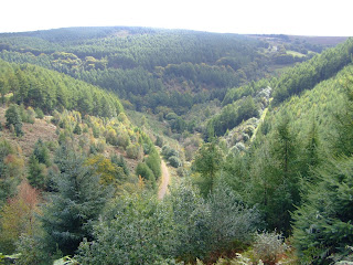
Leaving the car park the route started with the first ascent of the day almost immediately as we left the village of Cwmcarn far below, taking the path into the dense woodland. This circular route saw us gain further height before joining an open forest track for the next three miles, with the first view of Twmbarlwm seen in the distance from Rhyswg Fach across the Craig-Y-Glyn wooded horseshoe valley.
I was soon to establish the real reason for my presence as Lord Twynyrodyn summoned me to act as his Sherpa due to his dodgy back! Although including waterproofs in the rucksack they would not be required today.
The scramble up a particularly steep bank to photograph the fungus in the woods was precarious, but I was reassured as his Lordship kept a watchful vigil!
The second climb took us from the open forest track up onto the opposite ridge and eventually to a country park picnic site on the Forest Drive route, located in a strategic position overlooking the Pant Gwyn valley below. From here the main target of the day, Twmbarlwm, was clearly visible less than a mile away on the horizon to the south west.
As we climbed onto the open moorland of Mynydd Henllys we were treated to a spectacular panoramic view of the Bristol Channel and Severn Estuary, which was laid out before us stretching from Cardiff in the west to Newport and beyond in the east including both the old and new Severn Bridge crossings. The coast of Somerset was also clearly visible across the Channel.
The top of Twmbarlwm features the remains of what is presumed to be a Bronze or Iron Age hill fort, believed to have been built by the Silures, the Celtic tribe that inhabited the area before and during Roman times. There was also possibly a Roman signal point or beacon and there is also a substantial Norman motte and bailey castle incorporated into the eastern end of the fort, probably of early Norman construction.
The mountain top itself is a well known local landmark visible on the skyline for many miles and is indeed seen as a symbol of Monmouthshire/Gwent. It is very popular for hill-walkers who trek the Gwent Ridgeway and mountain bikers who use the extensive tracks around Cwmcarn Forest Drive. It features heavily in local folk legends with tales of a giant buried here, and treasure, supposedly guarded by swarms of bees. Local legend says the druids supposedly regarded it as a sacred site and a place of judgement.
The trig point at Twmbarlwm of 419 metres is the highest point of Caerphilly County.
Soaking up the views we sat on the hill-fort that has been immortalised in the work of local writer W. H. Davies, the Newport born poet and author of "Autobiography of a Supertramp" who wrote of Twmbarlym:
Can I forget the sweet days that have gone
When poetry first began to stir my blood
And from the hills of Gwent I saw
The earth torn in two by Severn's silver flood
The steep descent from Twmbarlwm brought us into contact with a mountain biker from Chepstow at Tegwyn Y Bwlch, a cross road for the walking track and bike trail, who explained that the Twrch trails in Cwmcarn Forest was now considered some of the best mountain biking terrain in Britain. He had been speaking to two guys earlier who had driven from London that morning specifically to experience the ride on the trails.
After this brief stop we continued downhill joining a section of the Raven walk, past the lake in the Lower Nantcarn valley and returned to the Visitor Centre at 2.15pm.
This is a really well designed building that has been recently constructed and the facilities inside are excellent. After a well earned Panini and mug of tea we left the Visitor Centre following an exhilarating days walking in really good weather conditions – perhaps the weather forecasters did get it right after all!
Monday, September 13, 2010
Crib Goch - Part 2
Filmed from a slightly different perspective.
Crib Goch is the wettest part of the United Kingdom, with an average of 4,473 millimetres (176.1 ins) of rainfall per year, over the past 30 years
To the south of the arête lie the lakes of Glaslyn and Llyn Llydaw. To the north is the Llanberis Pass.
Crib Goch which is classed as a Welsh 3000er, is often climbed as the first part of the Snowdon Horseshoe, which includes Garnedd Ugain, Snowdon and Y Lliwedd, before returning to Pen-y-Pass.
The background music used on the video is from the soundtrack to 'The Last of the Mohicans'
Friday, September 10, 2010
Storm Clouds
(the satellite image above was taken at 2.00pm on Friday afternoon)
A number of phone calls and text messages late on Thursday evening, confirmed that the proposed group walk planned for today had been called off due to the extremely poor weather forecast.
Earlier in the week the route had been changed from a coastal walk to the Brecon Beacons because of the poor weather expected during Friday.
With 50.6mm of rain recorded by the Sennybridge weather station for the 24-hour period ending at 22:00 hrs on Friday 10th and with gusts of wind recorded at 37 mph, it looks as though the right decision was made.
Footpaths would have been soaking wet and conditions underfoot difficult if the walk had gone ahead.
Thursday, September 9, 2010
Crib Goch - Part 1
Watch this easy scary stroll along Crib Goch, a knife-edged arête in Snowdonia National Park!
The highest point on the arête is at 923m above sea level. An extremely narrow path leads over the arête and three rock-pinnacles to a grassy col at Bwlch Coch.
This first part of the ridge is very exposed and presents a serious risk with significant drops on either side. This has resulted in several fatalities, even of experienced mountaineers.
The Snowdonia National Park Authority describes it as "not a mountain for the inexperienced".
On fine days the ridge may be very busy and queues can form. To avoid any long queues on the ascent from the east, it is possible to ascend Crib Goch's North Ridge, which adjoins the main ridge. It is recommended that only walkers with the required climbing skills and the right equipment use this particular route.
If you enjoyed this there is more to follow soon!!
Sunday, September 5, 2010
The Black Mountain
Setting out with a prime objective to locate the known aircraft crash sites had proved elusive in the past. This particular attempt was to eventually last well into the early evening before Mike, Steve and Richard discovered the remains of a World War II Wellington Bomber and Vampire Jet, which were both really well camouflaged against the surrounding Carmarthenshire Fan.
After a trek over Fan Hir, which means 'long peak' in English, whose flat summit is just over 760m above sea level, the intrepid trio arrived at Carreg Goch where the debris of a Vickers Wellington Bomber MF-509 had crashed into the southwest slope during a night-training mission on 20th November 1944.
Although the subsequent RAF report attributed the crash to crew error, it is thought more likely to have been caused by carburetor icing in the Wellington's starboard engine. The entire Canadian crew on board the bomber were killed in the crash:
Pilot Sgt Charles Hamel,
Navigator Sgt Jules Robert Rene Villeneuve,
Bomb Aimer F/Off William Joseph Allison,
W/Op/Air Gunner Sgt Joseph Paul Ernest Burke,
Air Gunner Sgt Arthur Grouix and
Air Gunner Sgt Gerard Dusablon.
They were later interred with full military honours in Blacon Cemetery, Chester.
After the crash, a memorial plaque was fixed to the nose wheel strut of the bomber. However, this was later removed by treasure hunters, so a permanent stone memorial was built on the site. Memorial services have often taken place on the site and hikers leave flowers, notes and other mementos.
During the 1990s, efforts were made to remove the plane wreckage from the mountain, but these were abandoned in the face of public outcry.
Up until 2005 the Canadian families of the crew lost in the crash were never aware of its circumstances or location, nor of the existence of the memorial on Carreg Goch. In an effort to identify one of the crew, a photo of an airman retrieved from the crash site in November 1944 was circulated on the Internet, the families believed that the plane had been lost in England. As a result of this search and co-operation between the people of the Swansea Valley and McGill University in Montreal, the families were made aware of the memorial and the plane's specific fate for the first time.
On 9th October 1953, John Baldock, the Pilot Officer of the Vampire Jet VZ106, who was serving at RAF Pembrey was killed when he crashed on the west slope of Fan Hir, which was the second crash site visited. He was just 21 years old, and is buried at Pembrey.
After leaving the crash site the next peak visited was Fan Brycheiniog (at 802m) which is the highest point in the western Black Mountain region.
Llyn y Fan Fawr ('lake of the big peak') is located to the east of the summit. The lake is enclosed within a rock hollow formed as a result of glacial action during the ice ages. It is drained by a stream known as Nant y Llyn ('stream of the lake'), which feeds the River Tawe.
Labels:
Fan Hir,
Nuttalls,
Vampire Jet.,
Wellington Bomber
Thursday, September 2, 2010
August Weather
After one of the driest Springs in the last century, the Summer looks like ending with a whimper.
With pro-longed areas of low pressure, August was cloudy and rather cool with showers or longer spells of rain at times. It was the coolest August since 1993. Rainfall was well above normal over south-east Wales.
In the 24 hours ending at 9.00am on 26th August, 64 mm of rainfall was recorded at Mumbles Head (Swansea).
Three families were also evacuated from their homes in Lower Thomas Street in the early hours of Thursday, August 26, after very heavy rain caused a rear wall to collapse.
A mostly dry start to the month, but rather cloudy. On 9th outbreaks of rain spread to all areas during the day, turning heavy at times. On 20th, 42 mm of rain was recorded at Capel Curig (Conwy) and 30 mm at St Athan (Glamorgan) in 24 hours. On 25th cloud and outbreaks of rain spread from the south-west to affect most areas during the day. Some of this rain turned heavy.
On Bank Holiday Monday, as pressure rose, it became much more settled with sunny spells. Temperatures reached 20 °C locally on 31st.
Data from Met Office
Subscribe to:
Posts (Atom)