Saturday, December 31, 2011
December Weather
In 2010 we experienced the coldest December in more than a century, with heavy snowfalls and prolonged sub-zero temperatures. This year was a totally different story, with conditions being normal for the time of year.
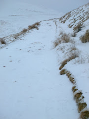
Last year the UK was under a blanket of snow and ice, whereas this year only areas of high ground in Scotland, the Lake District and the Pennines saw any traces of snow.
The main reason for the difference in 2010 was a high pressure system that was sitting over the UK, blocking the normal westerly flow from the Atlantic and allowing easterly winds to bring in cold air from the continent.
This year, the mild westerly has been unimpeded - allowing milder Atlantic air and changeable, often stormy, conditions to take charge.
What a difference a year makes!
December 2010 was the coldest on record for the UK, with temperatures 5°C below the long term average, with -21.3°C being recorded in Altnaharra in Scotland on 2 December. There were also 23 days of frost, 13 more than the average.
Temperatures during December 2011 were notable only for being so average. UK mean temperatures for the first half of the month were spot on the long term average of 6.9°C. The lowest temperature recorded this year was -9.4°C, recorded at Loch Glascarnoch in Scotland on 18 December.
However, the challenge of forecasting the variable British weather is something that the Met Office is able to deal with and explains why they are regularly ranked in the top two national weather services in the world.
Friday, December 16, 2011
Xmas Lunch in Pontsticill
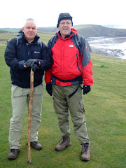
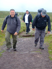
With festive alcohol to consume at the Strollers Xmas luncheon, it was to be a car-free walk for Lord Twynyrodyn and Wandering today (Butterballs, the Fit Fiftysomething from the Cynon Valley and RGB were all unavailable due to prior engagements!).
The predicted heavy snowfall overnight had failed to materialise as we left the Shire of Thomastown at mid-morning although the ground was sprinkled with a light dusting.
After negotiating the western section of Thomastown Park we experienced a white-out as we left Alexandra Avenue en-route to the top gate at Cyfarthfa Park.
Work had started on repairs to the feeder at Cyfarthfa Park lake that Lord Twynyrodyn had a professional interest to see so we went off-road under the bridge at the bottom of Cefn High Street and walked along the old railway tracks behind Lakeside Gardens.
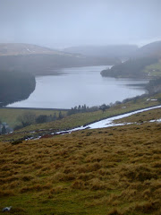
The Cwm Taff Fechan Nature Reserve section of the walk has been covered on the blog previously. However, today the river was almost in flood.
We were graced with the presence of a heron, buzzard, dipper and green tit along the river bank.
We continued over the bridge and under the viaduct at Pontsarn until we reached the White Bridge where we left the trail to climb to the former-Church Tavern, that has now been converted into a dwelling house and is currently for sale at a price of £495k.
The Ironmaster Robert Crawshay is buried in the graveyard of Vaynor Church ("God Forgive Me" is engraved on his tomb) and we walked a few hundred yards to the site of the original church that was built in the 8th Century but was burnt down during the battle of Maesvaynor which took place in 1291.
Leaving this historic site we walked along the country roads into the village of Pontsticill to the Red Cow Inn, where we ate a Dragons Tongue!
From the windows of the service bus we could still see snow covering the agricultural area surrounding the village as we returned to the metropolis by late afternoon.
Monday, December 12, 2011
All Wales Coastal Path
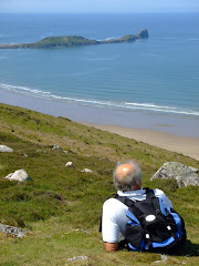
Countryside Officials have confirmed that the 870 mile (1,400km) all-Wales coast path is almost complete. The whole route is on schedule to be officially opened next May.
Some of the completed sections are not yet way marked and others will be subject to future improvements, says the Countryside Council for Wales (CCW). Upgrading work has just started on the largest section of footpath along the Gower coastline which stretches between Caswell and Limeslade.
It will run from Mumbles in the south to Crofty in the north via Three Cliffs Bay, Port Eynon and Llanmadoc. "A lot of work has already been completed to create one single footpath along Gower's coastline," said Chris Dale, Swansea council countryside access officer. "We have also created entirely new sections which walkers can now enjoy."
The CCW explains that 95% of the path is already complete with some in place for years and other sections requiring only small-scale improvements.
Meanwhile, other areas have required a lot more work such as along the coast in Flintshire, near the English border with Chester and running through Flint and Greenfield on the Dee estuary.
The CCW has been co-ordinating the development of the path with 16 coastal councils and national park authorities.
Improvements have been paid for under the Coastal Access Improvement Programme (CAIP), with the assembly government investing £2m a year since 2009 and backed by £3.9m from the European Regional Development Fund.
The path stretches from the Dee estuary in Deeside in north east Wales, west to Anglesey, Gwynedd, and down the south west Wales coast going east to Cardiff and Newport with views over the Bristol Channel.
Cardiff council is trying to resolve an outstanding issue with a Gypsy community who are concerned about walkers using a section of the route close to their caravan site at Rover Way. Tim Wilson from Cardiff Gypsy & Traveller Project said residents' concerns centred around issues of privacy and safety as the route is elevated so the "public would be looking down, and directly in to residents' caravans and utility blocks". He said: "We have been working with both Cardiff council and site residents on ideas to reduce the impact on site residents, and also looking at an alternative route along the front of the site."
The council says no work on the path will take place until consultation is complete with site's residents. Cardiff council said: "We were made aware of privacy concerns during a planned community consultation meeting held some time ago. It was agreed at this meeting that the council would look into this issue and report back to the residents of Rover Way at a further scheduled meeting, to be held later this month."
Subscribe to:
Posts (Atom)