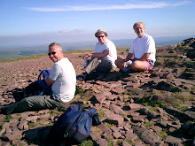
Pen-Y-Fan from Cribyn
Learn to fall in love with the mountain not just the summit
Showing posts with label Met Office. Show all posts

Saturday, December 31, 2011

December Weather


In 2010 we experienced the coldest December in more than a century, with heavy snowfalls and prolonged sub-zero temperatures. This year was a totally different story, with conditions being normal for the time of year.

Last year the UK was under a blanket of snow and ice, whereas this year only areas of high ground in Scotland, the Lake District and the Pennines saw any traces of snow.

The main reason for the difference in 2010 was a high pressure system that was sitting over the UK, blocking the normal westerly flow from the Atlantic and allowing easterly winds to bring in cold air from the continent.

This year, the mild westerly has been unimpeded - allowing milder Atlantic air and changeable, often stormy, conditions to take charge.


What a difference a year makes!

December 2010 was the coldest on record for the UK, with temperatures 5°C below the long term average, with -21.3°C being recorded in Altnaharra in Scotland on 2 December. There were also 23 days of frost, 13 more than the average.

Temperatures during December 2011 were notable only for being so average. UK mean temperatures for the first half of the month were spot on the long term average of 6.9°C. The lowest temperature recorded this year was -9.4°C, recorded at Loch Glascarnoch in Scotland on 18 December.

However, the challenge of forecasting the variable British weather is something that the Met Office is able to deal with and explains why they are regularly ranked in the top two national weather services in the world.

Monday, January 10, 2011

Coldest December in Wales


I don't think that we needed anyone to tell us that December was the coldest since records began - we already had a reasonably good idea!

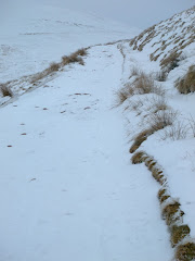
It snowed in the early hours of Friday 17th December, with further heavy snow on Tuesday 21st, this deep covering stayed with us for almost a fortnight until Thursday 30th December.

Provisional figures released by the Meteorological Office reveal that December 2010 has become the coldest December across the UK in the last one hundred years (in fact since records began).

The mean temperature for the UK has been -1.0°C, well below the long term average of 4.2°C. The previous coldest December in the series was 0.1°C, in 1981.

The provisional UK, England and Wales figures for December 2010 show that the month was the coldest month since February 1986. In Scotland it was the coldest month since February 1947, and in Northern Ireland the coldest month on record.
December 2010 saw some exceptionally cold and snowy weather across most of the country, with temperatures quite regularly falling to between -10 and -20°C overnight. Many places also saw temperatures struggling to get above freezing by day.
In the last 100 years, the UK has only experienced five colder months - January 1940, February 1947, January 1963, February 1963 and February 1986.

Although it has been very cold and snowy it has also been relatively sunny and dry. Precipitation (rain and snow) levels were well below average for the UK, recording just 38% of what is normally expected in December. This makes it the third driest December in the series that goes back to 1910.

Wales stats for December
Average temperature -0.4°C (Previous coldest December was in 1981 with a mean temperature of 0.8°C)
Hours of sunshine 61.3 hours (The sunniest is 2001 with 73.5 hours)
Precipitation 53mm (The driest is 1926 with 34.0 mm)

Annual Wales stats
Average temperature 8.2°C (The coldest is 1963 with a mean temperature of 7.6°C)
Hours of sunshine 1612.6 (The sunniest is 1929 with 1684.3 hours)
Precipitation 1118.3mm (The driest is 1933 with 1015.0 mm)

Friday, September 10, 2010

Storm Clouds


(the satellite image above was taken at 2.00pm on Friday afternoon)

A number of phone calls and text messages late on Thursday evening, confirmed that the proposed group walk planned for today had been called off due to the extremely poor weather forecast.

Earlier in the week the route had been changed from a coastal walk to the Brecon Beacons because of the poor weather expected during Friday.

With 50.6mm of rain recorded by the Sennybridge weather station for the 24-hour period ending at 22:00 hrs on Friday 10th and with gusts of wind recorded at 37 mph, it looks as though the right decision was made.

Footpaths would have been soaking wet and conditions underfoot difficult if the walk had gone ahead.

Thursday, September 2, 2010

August Weather

After one of the driest Springs in the last century, the Summer looks like ending with a whimper.

With pro-longed areas of low pressure, August was cloudy and rather cool with showers or longer spells of rain at times. It was the coolest August since 1993. Rainfall was well above normal over south-east Wales.

In the 24 hours ending at 9.00am on 26th August, 64 mm of rainfall was recorded at Mumbles Head (Swansea).

Three families were also evacuated from their homes in Lower Thomas Street in the early hours of Thursday, August 26, after very heavy rain caused a rear wall to collapse.

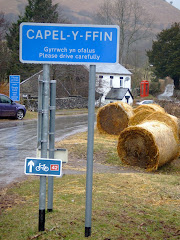
A mostly dry start to the month, but rather cloudy. On 9th outbreaks of rain spread to all areas during the day, turning heavy at times. On 20th, 42 mm of rain was recorded at Capel Curig (Conwy) and 30 mm at St Athan (Glamorgan) in 24 hours. On 25th cloud and outbreaks of rain spread from the south-west to affect most areas during the day. Some of this rain turned heavy.
On Bank Holiday Monday, as pressure rose, it became much more settled with sunny spells. Temperatures reached 20 °C locally on 31st.

Data from Met Office