The gradual thaw over the last few days made this an ideal time to visit the spectacular ice sculpture created from the semi-frozen waterfalls in the Upper Neath Valley.

Sgwd Henrhyd (Henrhyd Waterfall or Henrhyd Falls) is the tallest waterfall in South Wales with a drop of 90 feet (27 metres). It lies on National Trust land on the southern edge of the Brecon Beacons National Park. The falls occur where the small river, the Nant Llech (grid reference SN854122) drops over the faulted edge of a hard sandstone known as the Farewell Rock.
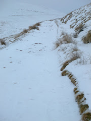
Just outside Coelbren, on the road between Glynneath and Abercraf, from a small car park we started the steep walk down into the valley. Hard packed ice under-foot made progress precarious - crampons and ice-axes would have been more appropriate!

The southern fringe of the Brecon Beacons National Park consists of a long belt of outcrop lime stone which has created a highly distinctive environment characterised by wooded gorges, caves, swallow holes, and waterfalls. This intriguing landform is most distinct in the locality known as Coed Y Rhaeadr, which translates as 'Wood of the Water Falls' but is referred to locally simply as Waterfall Country.

Tackling the wooden walkway to cross the floor of the gorge over the River Nant Llech, was similar to walking on an ice-rink in a pair of flip-flops. Eventually reaching the head of the gorge we all decided that it was a trifle too dangerous to walk behind and underneath the waterfall as the sound of huge chunks of ice cracking before eventually falling echoed around the gorge.

Waterfall Country is situated in a triangle formed by the villages of Hirwaun, Ystradfellte, and Pontneddfechan, including the head waters of the rivers Nedd, Mellte, Pyrddin and Hepste. These rivers drain the old red sandstone mountain ranges of the Fan’s in the north and travel south through the deep 'V' shaped wooded valleys the rivers have formed in the carboniferous limestone of the southern belt of the National Park. Waterfall country is officially designated as a site of special scientific interest containing over 200 species of mosses, liverworts, and ferns. Since designation as a national park in 1957 the popularity of waterfall country combined with a steep and difficult terrain which is subject to heavy rainfall has led to widespread footpath erosion.

After the main event the 3 kilometre walk to Abercraf took us through the surrounding deciduous woodland of Oak and Ash trees. Initially the paths were frozen but eventually it became much softer underfoot.

The well maintained almost sympathetic line of the paths take us high above the deep valley floor. We found ourselves walking alongside the course of the river on a narrow, slippery footpath with extremely steep dangerous drops on one side. The valley is heavily wooded and the leaves that had fallen during the autumn provided a natural surface for the paths. The rock outcrop in sections of the footpaths surface which were either covered in ice or extremely wet, were especially slippery. Particular care and attention was essential.

The gorge was like something out of 'The Lost World' by Sir Arthur Conan Doyle and you could almost imagine pterodactyls and giant eagles flying with the buzzards overhead. Having said that the walk was fascinating and one of the most rewarding experiences of the year.
All of the photographs taken on this walk can be viewed
here. Select 'slide-show' for automated viewing.


