Saturday, December 31, 2011
December Weather
In 2010 we experienced the coldest December in more than a century, with heavy snowfalls and prolonged sub-zero temperatures. This year was a totally different story, with conditions being normal for the time of year.
Last year the UK was under a blanket of snow and ice, whereas this year only areas of high ground in Scotland, the Lake District and the Pennines saw any traces of snow.
The main reason for the difference in 2010 was a high pressure system that was sitting over the UK, blocking the normal westerly flow from the Atlantic and allowing easterly winds to bring in cold air from the continent.
This year, the mild westerly has been unimpeded - allowing milder Atlantic air and changeable, often stormy, conditions to take charge.
What a difference a year makes!
December 2010 was the coldest on record for the UK, with temperatures 5°C below the long term average, with -21.3°C being recorded in Altnaharra in Scotland on 2 December. There were also 23 days of frost, 13 more than the average.
Temperatures during December 2011 were notable only for being so average. UK mean temperatures for the first half of the month were spot on the long term average of 6.9°C. The lowest temperature recorded this year was -9.4°C, recorded at Loch Glascarnoch in Scotland on 18 December.
However, the challenge of forecasting the variable British weather is something that the Met Office is able to deal with and explains why they are regularly ranked in the top two national weather services in the world.
Friday, December 16, 2011
Xmas Lunch in Pontsticill
With festive alcohol to consume at the Strollers Xmas luncheon, it was to be a car-free walk for Lord Twynyrodyn and Wandering today (Butterballs, the Fit Fiftysomething from the Cynon Valley and RGB were all unavailable due to prior engagements!).
The predicted heavy snowfall overnight had failed to materialise as we left the Shire of Thomastown at mid-morning although the ground was sprinkled with a light dusting.
After negotiating the western section of Thomastown Park we experienced a white-out as we left Alexandra Avenue en-route to the top gate at Cyfarthfa Park.
Work had started on repairs to the feeder at Cyfarthfa Park lake that Lord Twynyrodyn had a professional interest to see so we went off-road under the bridge at the bottom of Cefn High Street and walked along the old railway tracks behind Lakeside Gardens.
The Cwm Taff Fechan Nature Reserve section of the walk has been covered on the blog previously. However, today the river was almost in flood.
We were graced with the presence of a heron, buzzard, dipper and green tit along the river bank.
We continued over the bridge and under the viaduct at Pontsarn until we reached the White Bridge where we left the trail to climb to the former-Church Tavern, that has now been converted into a dwelling house and is currently for sale at a price of £495k.
The Ironmaster Robert Crawshay is buried in the graveyard of Vaynor Church ("God Forgive Me" is engraved on his tomb) and we walked a few hundred yards to the site of the original church that was built in the 8th Century but was burnt down during the battle of Maesvaynor which took place in 1291.
Leaving this historic site we walked along the country roads into the village of Pontsticill to the Red Cow Inn, where we ate a Dragons Tongue!
From the windows of the service bus we could still see snow covering the agricultural area surrounding the village as we returned to the metropolis by late afternoon.
Monday, December 12, 2011
All Wales Coastal Path
Countryside Officials have confirmed that the 870 mile (1,400km) all-Wales coast path is almost complete. The whole route is on schedule to be officially opened next May.
Some of the completed sections are not yet way marked and others will be subject to future improvements, says the Countryside Council for Wales (CCW). Upgrading work has just started on the largest section of footpath along the Gower coastline which stretches between Caswell and Limeslade.
It will run from Mumbles in the south to Crofty in the north via Three Cliffs Bay, Port Eynon and Llanmadoc. "A lot of work has already been completed to create one single footpath along Gower's coastline," said Chris Dale, Swansea council countryside access officer. "We have also created entirely new sections which walkers can now enjoy."
The CCW explains that 95% of the path is already complete with some in place for years and other sections requiring only small-scale improvements.
Meanwhile, other areas have required a lot more work such as along the coast in Flintshire, near the English border with Chester and running through Flint and Greenfield on the Dee estuary.
The CCW has been co-ordinating the development of the path with 16 coastal councils and national park authorities.
Improvements have been paid for under the Coastal Access Improvement Programme (CAIP), with the assembly government investing £2m a year since 2009 and backed by £3.9m from the European Regional Development Fund.
The path stretches from the Dee estuary in Deeside in north east Wales, west to Anglesey, Gwynedd, and down the south west Wales coast going east to Cardiff and Newport with views over the Bristol Channel.
Cardiff council is trying to resolve an outstanding issue with a Gypsy community who are concerned about walkers using a section of the route close to their caravan site at Rover Way. Tim Wilson from Cardiff Gypsy & Traveller Project said residents' concerns centred around issues of privacy and safety as the route is elevated so the "public would be looking down, and directly in to residents' caravans and utility blocks". He said: "We have been working with both Cardiff council and site residents on ideas to reduce the impact on site residents, and also looking at an alternative route along the front of the site."
The council says no work on the path will take place until consultation is complete with site's residents. Cardiff council said: "We were made aware of privacy concerns during a planned community consultation meeting held some time ago. It was agreed at this meeting that the council would look into this issue and report back to the residents of Rover Way at a further scheduled meeting, to be held later this month."
Wednesday, November 2, 2011
Jewels of Wales
In this particular episode Iolo looks at the mineral wealth of the Principality, demonstrating how it has affected the land and the creatures who live there.
With stunning aerial photography of Ffos Y Fan, he sees how Lapwings (one of the rarest breeding birds in Wales) are thriving amongst one of the largest open-cast industrial sites in South Wales, he also visits the blast furnace at Cyfarthfa Ironworks that is now a roost for Jackdaws and shows how the abandoned railway lines including Pontsarn Viaduct are now wonderful wildlife habitats.
Friday, October 28, 2011
Misty Llwyn Onn
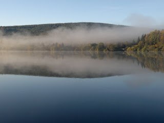
As the mist created by the warm air meeting the cool surface of the reservoir was just about to clear the following images were capture by Butterballs on his daily walk.
The reflection of the trees on the opposite bank bouncing off the surface of the reservoir is a mirror image.
With totally clear azure autumnal skies overhead it doesn't get much better than this.
The reflection of the trees on the opposite bank bouncing off the surface of the reservoir is a mirror image.
With totally clear azure autumnal skies overhead it doesn't get much better than this.
Monday, October 24, 2011
The Way - Camino de Santiago
Martin Sheen, plays Tom, an American doctor who comes to St. Jean Pied de Port, France to collect the remains of his adult son, killed in the Pyrenees in a storm while walking The Camino de Santiago, also known as The Way of Saint James.
Driven by his profound sadness and desire to understand his son better, Tom decides to embark on the historical pilgrimage, leaving his "California bubble life" behind.
Armed with his son's backpack and guidebook, Tom navigates the 800km historical pilgrimage from the French Pyrenees, to Santiago de Compostela in the north west of Spain, but soon discovers that he will not be alone on this journey.
While walking The Camino, Tom meets other pilgrims from around the world, all broken and looking for greater meaning in their lives: a Dutchman (Yorick van Wageningen) a Canadian (Deborah Kara Unger) and an Irish writer (James Nesbitt) who is suffering from a bout of "writer's block."
From the hardship experienced along "The Way" this unlikely quartet of misfits create an everlasting bond and Tom begins to learn what it means to be a citizen of the world again, and discovers the difference between "The life we live and the life we choose."
'The Way' was filmed entirely in Spain and France along the actual Camino de Santiago.
Friday, October 21, 2011
Ray Mears on Skomer Island
Only a few days after Tydfil Strollers visited Skomer Island in Pembrokeshire in May 2011, the skipper of the Dale Princess was transporting Ray and the film crew to witness the delights of the wildlife in this haven for seabirds.
Watch the full episode from Skomer here.
Wednesday, October 5, 2011
We Didn't Start The Fire
American history teacher's have praised the 1980's lyrics of this Billy Joel song for their educational value.
Through the displayed images in the embedded video you can begin to 'see' precisely what your 'ears' may not hear.
The lyrics in the song are Joel's homage to the 40-years of historical headlines since his birth in 1949. It's surprising what Joel was able to put into the music and lyrics lasting less than five minutes.
Tuesday, September 27, 2011
Pay and Display at Pen-Y-Fan?
The National Trust intends to submit a planning application later this year seeking to build a visitor centre at Pont ar Daf near Storey Arms and improve the car park's safety and security.
The Trust spends more than £100,000 a year on the upkeep of Pen y Fan and other parts of the Brecon Beacons, and says it has started the consultation process on the introduction of parking charges to the site. There will be opposition from Ramblers Cymru who have criticised the move, saying walking should be free and accessible for everyone.
The car park at Pont ar Daf was created in the 1960s after road improvements left a section of the A470 isolated from the main carriageway. It was soon adopted by walkers because it offered easy access to Pen y Fan.
"If you arrive at the car park you have access to the three most important things, a loo, a brew and a view," said National Trust property manager Philip Park. "If we are successful in gaining permission the offer will remain essentially the same, but it will be designed to meet the higher expectations of visitors to the area nowadays. We believe this development can really improve the enjoyment that visitors can experience in this wonderful part of Wales".
But director Angela Charlton said: "Ramblers Cymru are disappointed that the National Trust feel they have to start charging for parking. People have been freely walking Pen y Fan for many years. Ramblers Cymru works with groups such as Turning Point who use Pen y Fan for inspirational training for recovering addicts. We hope this will not have a detrimental effect."
Thursday, September 22, 2011
Pwll Du Headland, Gower
After pulling into the car park Wandering asked Lord Twynyrodyn whether he had checked the tide times? Oh no, not that old chestnut again?
"B*ll@x, why didn't you suggest that before we left!" came the response!
As you can guess this was a last minute choice. Anyway after paying to park all day (£5), it was a stroll across the almost deserted beach (apart from the lifeguards on a training exercise) before joining the Coastal Path and yes the tide was on the way out!
The steep steps in the far corner of the bay below the apartment block, took us onto the coastal path itself towards Brandy Cove and Pwll Du Bay.
As the name suggests - Brandy Bay was named after the smuggling which took place there. The small, quiet bay was used to unload illegal tobacco and alcohol during the eighteenth century.
We followed the cliff top path until Pwll Du Bay, which consisted of millions of pebbles that formed part of the large shingle bank. Pwll Du or "Black Pool" is one of the most inaccessible bays on Gower so remains unknown to the majority of visitors. The pool is caused by the shingle bank blocking the river flowing into Pwll Du bay.
Previously there were five public houses in Pwll Du Bay, but now only two actually remain as private houses - Ship Cottage (Ship Inn) and Beaufort House (Beaufort Arms). We spoke to a couple who owned one of the houses about the route ahead.
We continue uphill through the woodland, towards Pwll Du Head rejoining the coastal path. During the smuggling activities the 300 foot high headland provided a very convenient vantage point to keep an eye out for customs officers.
We were able to eat lunch with a magnificent view above Pennard Cliffs looking towards Three Cliffs and Oxwich Bay.
Leaving the coastal path we entered Bishopton woods eventually reaching the path next to the stream on the valley floor.
Keeping the stream to our right, we continued through the dense woodland looking for the point where the stream re-surfaced from under ground.
We were able to located both Long Ash Mine, an old silver lead mine and a small cavern called Guzzle Hole, where the sound of the the river running underground is surprising loud!
After leaving the Guzzle Hole the route on the map indicated that the walk continued north along the dry river-bed. Well we passed two disused quarries on the way to Church Lane and then realised that the directions were naff! It was only when we refreshed ourselves with a pint in the Joiners Arms in Bishopstown that we established that we had gone too far on the dry river-bed!
After a short walk through the village we stood on the corner of Pwll Du Lane looking for Brandy Cove Road. Wandering pointed out the street sign to Lord Twynyrodyn - it was difficult to curtail the laughter when we realised that we were already standing in Brandy Cove Road.
The bridle path led back to Brandy Cove and from there we re-traced your steps along the cliff-top path back to Caswell Bay and a cup of tea in the beach front cafe.
The walk was nine miles and took us four hours, with stops for lunch and alcoholic refreshments.
Tuesday, September 20, 2011
Mountain Rescue Team in Crash
The volunteers who are on call to help anyone who encounters difficulty in the mountains of South Wales, had a fortunate escape over the weekend after their vehicle was badly damaged in a collision while on a call-out shout.
This was the extent of the damage caused to the Brecon Mountain Rescue Team communications vehicle in the accident. The specialist mobile command vehicle for the BMRT was involved in a three-vehicle collision during a call out near Builth Wells.
Incredibly the two team members in the vehicle escaped with only minor injuries. Other team members treated casualties on the scene until ambulances arrived.
Nigel Dawson, team leader of Brecon MRT, said: "What is most important is that our two team members escaped serious injury. We attend around 100 call outs every year and this vehicle was also central to many other rescues across South and Mid Wales. Our fundraising team, who already raise all the money for our day to day operating costs, are about to launch a campaign for a new mobile HQ. Until then we have been generously loaned a communications vehicle so that we can continue providing the cover that the public has come to expect."
Friday, September 16, 2011
Sunday, September 4, 2011
Snowdon in a Frontera
Police are investigating why a Vauxhall Frontera was left on a footpath near to the summit of Snowdon.
It is understood that the 4x4 was driven up sometime on Saturday morning but may have become stuck on the descent about 400 yards (365m) from the 1,085m (3,560 ft)high top of the mountain.
North Wales Police confirmed they were called to the incident but currently have no more details.
Walkers passing the Vauxhall Frontera (close to the Snowdon mountain railway line) have taken photographs of the vehicle on the Llanberis side of the summit, close to the train track.
Ian Henderson of Llanberis Mountain Rescue said the emergency services or national park officers would never attempt to drive up Snowdon.
Sunday, July 31, 2011
Cwm Pit and Aberdare Tunnel
It's very often surprising what precisely still exists in your local environment. After seeing an episode of 'Fishlock's Adventures in Wales' a few years ago in which this particular location was highlighted, Lord Twynyrodyn decided to introduce Wandering to a hidden relic of the industrial revolution.
After a pleasant walk on bridle paths and through deciduous woodland, the duo entered what we believe to be a former drift mine. A furnace at the base of a large chimney stack and dressed stonework walls approximately 20 feet high retain part of the fault line along a former river-bed.
This was possibly once part of the Cyfarthfa Works, if so the pit was sunk under the management of Robert Thompson Crawshay in 1845. This shallow mine would have worked the steam coal seams, which ran close to the surface in this area on the northern edge of the South Wales coalfield. A total of 1,030 men would have worked at this pit in 1908.
It would have closed down in December 1910, but would have been retained as a watercourse until abandoned in 1924.
After leaving Cwm Pit another pathway led us to a small rusty bridge, which is possibly the Upper Glyncanaid bridge. This crosses the disused Merthyr to Aberdare railway cutting. Approximately a few hundred yards along the cutting is the entrance to the Abernant tunnel. As we scrambled our way down into the cutting the temperature suddenly dropped considerably - as if someone had opened the door of a refrigerator. It was positively eerie.
Built in 1853, and bricked up in 1967, the tunnel is 2,497 yards long and must have witnessed a significant amount of traffic in it's hay-day linking one of the most prolific coal mining regions in the Principality with the steelworks and docks.
It’s really sad to see such civil engineering works, which provide our rich industrial heritage, now abandoned and totally forgotten.
If anyone reading this knows any background to this area please post a comment.
Thursday, July 21, 2011
St. Govans Head
Less than two months since his last visit, the almost irresistible magnetic pull of the majestic Pembrokeshire Coast line drew Butterballs to Lydstep, where he based himself for a short Summer break.
Using the good weather conditions he explored an area 3 miles to the west on the first morning walking to Skrinkle Cove.
The beach at Broad Haven is the best he has ever seen anywhere - "as I rounded a mound it was a staggering site really - totally unspoilt and run by National Trust". It is one of Pembrokeshire's finest beaches in terms of the water quality, its south-facing location and dramatic cliff views backed by sand dunes and expansive National Trust woodland and lily ponds.
On the second day he headed east to the Ministry Of Defence firing range at Penally, passing Gillar Point which is the nearest area of land to Caldey Island.
One of the highlights of his stay was a visit to St. Govans Head where he went in search of St. Govans Chapel. This was built in a fissure in the cliff face in the 13th century.
This he discovered at the bottom of a long flight of stone steps. The present small vaulted chapel of local limestone was built over a cave although the site may have been of monastic importance since the 5th century
We are blessed that with both the Gower Peninsular and Pembrokeshire National Park we have such area’s of outstanding natural beauty on our doorstep and within such easy reach.
Wednesday, July 20, 2011
Monday, July 18, 2011
Pengarnddu walking and cycling bridge
Anyone who has driven past the Asda Roundabout at Dowlais Top on the A465 during the last week will have been surprised to see this new foot-bridge that opens up new routes for walkers and cyclists.
The bridge will provide a safer, traffic-free crossing for walkers and cyclists over the busy A465 when it opens in September.
Rachel Lister, Sustrans project officer in the valleys, said: "This is a significant development as it is the first new part of the Heads of the Valleys route to be put in place. It crosses an extremely busy road and will allow connect existing parts of the National Cycle Network together for those doing longer walking and cycling journeys. This is exactly the sort of safer and more attractive route that is needed if we are to encourage people to do more of their daily journeys on foot or bike."
The Heads of the Valleys route will open fully in 2012, and will be known as National Cycle Network Route 46, providing a walking and cycling 'spine' through the valleys. It will incorporate a mix of new sections of route and existing parts of the National Cycle Network like the popular Route 8 on the Taff Trail.
Thursday, July 14, 2011
Carreg Goch (Black Mountain)
Based on the weather forecast for the next few days, it was an absolute 'no brainer' according to Lord Twynyrodyn to use today for this particular walk. He had decided to lead the expedition into the Black Mountain to locate the site of the MF509 Wellington Bomber for a second time.
The start of the path leading to the mountain is accessed via the surface car park at Dan-Yr-Ogof caves. As we gained altitude we were able to see Fan Gyhirych across the valley and Madam Patti's castle nestled on the valley floor. We also encountered the first of five separate groups of youths on the Duke of Edinburgh's award scheme!
Thankfully the ground underfoot was exceptionally dry that made the walking really easy. As we approached the site from the south his Lordship decided that based on his compass bearing it was time to leave the drovers path and head into the wilderness.
We entered a valley with no sign of even a feint footpath and his Lordship decided that we needed to gain height to the top of the ridge to have any chance of finding the site. As we stood at the top of the ridge Wandering pointed in a south-westerly direction and asked Lord Twynyrodyn whether that was the location - where a group of four other men were standing.
As we made our way to the site the remains of the Wellington bomber became clear. The gun metal gray of the bodywork blends almost naturally with the limestone outcrop that makes it really difficult to differentiate between the wreckage and the surrounding rock formations.
On the night of 20th November 1944, as Vickers Wellington MF509 from the 22nd OTU at Wellesbourne Mountford made its way over Wales on a night cross country exercise problems developed in the starboard engine. The aircraft began to lose height due to icing and crashed into Carreg Goch, all six aircrew aboard were killed.
In the village of Ynyswen, Eric Price and some friends heard aircraft engines and witnessed a fiery glow in the mountains. The following day they were discussing the report that an aircraft had crashed in the mountains, the report was later confirmed by the authorities.
Three days after the crash, Eric Price decided to explore the crash site. He and his dog traveled up the sheep’s path which ran along the mountain range until reaching the location of the wreck. While exploring the remains of the Wellington, Eric spotted something that seemed out of place amongst the heaps of twisted metal and burnt fabric. After picking up a small piece of the Wellington’s wing, he noticed a rectangular piece of white card. Upon further inspection, the object was revealed to be a photograph that had somehow been spared from the crash and subsequent fire. The photograph was of a solitary airman, there was no name or any other identification found on the photograph.
Not wanting to leave the photograph to the elements, Eric Price put it in his pocket. Not certain who the airman in the photograph was or whom he should return it to, Eric kept it in safe keeping for over 61 years.
Even after 66 years there is still a large amount of wreckage scattered around the site.
After spending a leisurely forty minutes eating our lunch we decided to ascend the ridge, crossing an excellent example of a limestone pavement, to view the remains of a Vampire jet on the flank of Fan Brycheiniog - through a pair of binoculars!
Refreshments to quench the thirst were taken at the Pen-Y-Cae Inn. Surprisingly two people who obviously live in the local community admitted that neither of them had visited the site.
Photographs taken on this walk can be viewed here. Select 'slide-show' for automated viewing.
Subscribe to:
Posts (Atom)