Pen-Y-Fan from Cribyn
Learn to fall in love with the mountain not just the summit
Showing posts with label Nuttalls. Show all posts

Friday, April 29, 2011

Black Hill and Hay Bluff


The drive through the deserted village of Longtown at 11.00am could only mean one thing - all of the inhabitants were watching the Royal Wedding - the event that we had decided to avoid. So it was a major surprise when we arrived at the car park to find it was already full!

I don't think that I've ever been asked whether I'm a botanist before but that was the strange question posed by a very academic looking lady with a posh voice as we changed our boots to start the walk.


The Black Hill itself rises just north of Longtown and west of the village of Craswall, near the Wales/England border. It is known locally as the 'Cat's Back' as when viewed from Herefordshire it looks like a crouching cat ready to pounce.


After the initial steep climb we encountered a tremendous 2 kilometre narrow ridge with the Olchon Valley on the western side and Golden Valley to the eastern flank. This was a really stunning stretch of mountain ridgeway.


Unfortunately, it was windy and cold after the really warm weather of the last few weeks.

We soon reached the first trig. point at Black Hill (640 metres) and then headed north west to join Offa's Dyke Path for the two kilometre walk to the trig. point at Hay Bluff (677 metres). Our second Nuttall summit of the day (both on the English side of the border).

Although the visibility was patchy the views down to the car park near the stone circle at the foot of the Bluff were amazing.


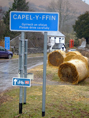
After eating our lunch we started the trek south on Offa's Dyke Path toward Hatterall Ridge. A distinctive path marked on the OS map was rather in-distinctive in reality and we needed to eventually head east at the stone marker at the crossroads to the Olchon Valley and Capel-Y-Ffin. At this point the weather conditions started to improve and the spectacular views began to open up around us.


The decent to the valley floor was an almost vertical drop of nearly 1,000 feet and we commented that we were really pleased that we did not have to climb this at the end of the walk as we passed someone who would shortly be on their way up. We crossed the Olchon Brook and walked through Black Hill Farm en route to the starting point.

After the main cultural spot of the day - a visit to the remains of Longtown Castle, which was built in the 13th Century to keep the maurading Celts out of England - it was a brief stop at the Crown Inn for liquid refreshments before sneaking back over the border into the Principality at Pandy.

The walk was 13.5 kilometres and took four hours thirty minutes including half an hour for lunch and a scheduled tea break.

Photographs taken on this walk can be viewed here. Select 'slide-show' for automated viewing.

Bruce Chatwin used the Black Hill as the setting for his novel 'On the Black Hill'.

Wednesday, January 19, 2011

Craig Cerrig-Gleisiad


A ridge of extremely high pressure guaranteed clear blue skies this morning, although with the severe hoar frost overnight the temperature at the start was a rather low -2 celsius!

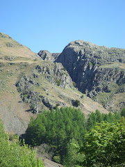
After leaving the lay-by on the A470 you walk into an enclosed atmospheric amphitheatre created by the soaring, craggy cliffs - formed by glacial action over 20,000 years ago - the high ridge seen above will eventually provide the middle section of the walk.

The grinding action of the ice carved the 500 feet cliff face and escarpments that remain. Ironic that the moraines created by glacial action were covered in frost and ice!

The north facing rocks rarely see the sun, probably only occasionally in summer. Because of the cold, dark conditions rare arctic-plants survive at their southern most limit only re-appearing in the Alps.


The initial walk takes you into the 'bowl' of the Nature Reserve below Craig Cerrig-Gleisiad before starting the steep climb towards Fan Frynych. Luckily the paths were still frozen so the conditions underfoot were perfect. Looking back to the east you see the first view of Pen-Y-Fan and in the far distance the Black Mountains.


At the top of the ascent (after climbing to a height of 629 metres) the route bears left towards the ridge of the crag. The wonderful landscape opened out providing crystal clear views to the west of Fan Llia, Fan Nedd, Fan Gyhirych and Fan Fraith which all looked superb bathed in the winter sunshine.


The ridge of the crag takes the walk eastwards providing superb views down into the cwm, to the low lands of Brecon and east to Pen-Y-Fan and Corn Du.


The descent was extremely trecherous as the ground (it was like walking on Crunchy Nut Cornflakes!) was still very frozen and slippery. In normal conditions this would have been relatively straight forward but this morning it was very much a case of take your time or end up on your bottom!


The final section of the walk down the flank of the crag returns across a semi-frozen brook to the original path used at the start.

All of the photographs taken on this walk can be viewed here. Select 'slide-show' for automated viewing.

Thursday, October 28, 2010

Fan Gyhirych


Driving along the A4215 about a mile outside Defynnog my heart skipped a beat, as less than 20 feet away in an open field beside the road I could see the unmistakable fanned tail and large wing-span of a Red Kite. I watched almost hypnotised as the Kite hovered and swooped oblivious that he or she was being watched in admiration. Before arriving in Defynnog a Buzzard flew across the road about 30 feet in front of me! A great start to the day.

It's wonderful that the Red Kites are becoming a common sight again in this part of Powys. This is the fourth that I've seen at quite close quarters this summer.

Turning left at the junction of the A4067 the route takes me south of Crai to the start of the walk. Unfortunately, the summit of Fan Gyhirych was hidden behind low cloud but I suspect that the views back to the Cray Reservoir would be stunning in really good clear weather.


We had seen Fan Gyhirych earlier in the year from Fan Nedd in the east and it had intrigued me. However, I was approaching it on this occasion from a totally different direction. Climbing from the road to the north west of the summit the lower section of the mountain was quite boggy after the recent period of wet weather, although the streams running off the mountain were in full flow.

Unlike their more popular neighbours to the east, there are no well worn 'highways' created by the populist walkers who tramp the Pen-Y-Fan range. You just need to first of all find and then follow any feint paths that you are lucky enough to stumble upon.

The first section was adjacent to the fast rushing water as it crashed down from the upper slopes. Listening to the sound of the streams as they rushed past me I could easily imagine eating a picnic in the summer next to some of the stunning waterfalls.


The west face of Fan Gyhirych is remarkably steep when you get to about 400 feet from the summit. My calves were screaming because of the increase in Lactic Acid as the scramble up the final gully was tricky although not really difficult.


A brief shower swept almost horizontally across the mountain side, although surprisingly it wasn't very heavy and didn't last very long.

Emerging through the deep cleft you are pleased to reach the flat plateau.

Searching for the trig point in the cloud two walkers appear from nowhere and disappear almost as quickly, after we exchange brief greetings.

The highest point at 725m (another South Wales Nuttall to tick off the list) is located towards the western side of the summit plateau.
I was disappointed that I couldn't see the superb eastern face of Fan Gyhirych or the spectacular views further west to Fan Hir and Fan Brycheiniog.


The wet grass and rocks caused an embarrassing fall as I slid down the first section of the cleft and tumbled over to end up lying on my chest – luckily the only bruise was caused to my ego!

I was able to follow a similar line back down the mountain out of the clouds to return to the start point.

If you want to walk in solitude then Forest Fawr is the place to visit. Steve and I climbed Fan Llia and Fan Nedd in June and we didn't see anyone after we left the car park.


The following are some of the landscape that I missed on todays walk because of the low cloud:


Fan Gyhirych's dramatic eastern face.


To the west Fan Hir and Fan Brycheiniog.

Sunday, September 5, 2010

The Black Mountain


Setting out with a prime objective to locate the known aircraft crash sites had proved elusive in the past. This particular attempt was to eventually last well into the early evening before Mike, Steve and Richard discovered the remains of a World War II Wellington Bomber and Vampire Jet, which were both really well camouflaged against the surrounding Carmarthenshire Fan.


After a trek over Fan Hir, which means 'long peak' in English, whose flat summit is just over 760m above sea level, the intrepid trio arrived at Carreg Goch where the debris of a Vickers Wellington Bomber MF-509 had crashed into the southwest slope during a night-training mission on 20th November 1944.

Although the subsequent RAF report attributed the crash to crew error, it is thought more likely to have been caused by carburetor icing in the Wellington's starboard engine. The entire Canadian crew on board the bomber were killed in the crash:
Pilot Sgt Charles Hamel,
Navigator Sgt Jules Robert Rene Villeneuve,
Bomb Aimer F/Off William Joseph Allison,
W/Op/Air Gunner Sgt Joseph Paul Ernest Burke,
Air Gunner Sgt Arthur Grouix and
Air Gunner Sgt Gerard Dusablon.

They were later interred with full military honours in Blacon Cemetery, Chester.

After the crash, a memorial plaque was fixed to the nose wheel strut of the bomber. However, this was later removed by treasure hunters, so a permanent stone memorial was built on the site. Memorial services have often taken place on the site and hikers leave flowers, notes and other mementos.


During the 1990s, efforts were made to remove the plane wreckage from the mountain, but these were abandoned in the face of public outcry.

Up until 2005 the Canadian families of the crew lost in the crash were never aware of its circumstances or location, nor of the existence of the memorial on Carreg Goch. In an effort to identify one of the crew, a photo of an airman retrieved from the crash site in November 1944 was circulated on the Internet, the families believed that the plane had been lost in England. As a result of this search and co-operation between the people of the Swansea Valley and McGill University in Montreal, the families were made aware of the memorial and the plane's specific fate for the first time.


On 9th October 1953, John Baldock, the Pilot Officer of the Vampire Jet VZ106, who was serving at RAF Pembrey was killed when he crashed on the west slope of Fan Hir, which was the second crash site visited. He was just 21 years old, and is buried at Pembrey.


After leaving the crash site the next peak visited was Fan Brycheiniog (at 802m) which is the highest point in the western Black Mountain region.


Llyn y Fan Fawr ('lake of the big peak') is located to the east of the summit. The lake is enclosed within a rock hollow formed as a result of glacial action during the ice ages. It is drained by a stream known as Nant y Llyn ('stream of the lake'), which feeds the River Tawe.


Saturday, August 14, 2010

South Wales Nuttalls

Like the Munro's in Scotland all hills in Wales that are at least 2,000 feet (610 metres), high with a relative height of at least 15 metres (49.2 feet) are classified as Nuttalls. The definitive list was compiled by John and Anne Nuttall and published in 'The Mountains of England & Wales'.

All of the qualifying hills in the two main regions of South Wales are listed below. In total there are 34 Nuttalls to climb in South Wales.
Check how many you may have climbed?

Black Mountains
Waun Fach (811 mtrs)
Pen y Gadair Fawr (800 mtrs)
Pen Allt-mawr (720 mtrs)
Rhos Dirion (713 mtrs)
Black Mountain 3 (703 mtrs)
Pen Cerrig-calch (701 mtrs)
Twmpa (690 mtrs)
Chwarel y Fan (679mtrs)
Mynydd Llysiau (663 mtrs)
Pen Twyn Mawr (658 mtrs)
Pen Twyn Glas (646 mtrs)
Black Mountain Sth Top (637 mtrs)

Brecon Beacons
Pen y Fan (886 mtrs)
Corn Du (873 mtrs)
Fan Brycheiniog (802 mtrs)
Cribyn (795 mtrs)
Waun Rydd (769 mtrs)
Fan Hir (761 mtrs)
Bwlch y Ddwyallt (754 mtrs)
Bannau Sir Gaer (749 mtrs)
Fan Fawr (734 mtrs)
Fan Gyhirych (725 mtrs)
Fan y Big (719 mtrs)
Waun Lefrith (677 mtrs)
Fan Fraith (668 mtrs)
Fan Nedd (663 mtrs)
Allt Lwyd (654 mtrs)
Garreg Las or Twyn Swnd (635 mtrs)
Fan Llia (632 mtrs)
Fan Frynych (629 mtrs)
Craig Cerrig-gleisiad (629 mtrs)
Y Gyrn (619 mtrs)
Cefn yr Ystrad (617 mtrs)
Garreg Lwyd or Moel Gornach (616 mtrs)

Thursday, August 5, 2010

Grwyne Fechan


Leaving Blaenau Gwent (where the Eisteddfod 2010 is being held – Welsh Learner of the Year on the Maes today), you soon cross over the border into Powys and on the descent from Mynydd Llangynidr the western flank of the Black Mountains is laid out before you in it’s magnificent splendour.

Although the dark storm clouds were gathered over the A470 Heads of the Valley the sun was breaking through less than twenty minutes later as the journey weaved it’s way north of Crickhowell.

The main purpose of the day was to bag a few South Wales Nuttalls (peaks over 2,000 feet…….but more of that in another posting).

The walk started along a narrow country lane bordered by hedges of hazel and holly. After leaving the road just past Pentwyn Farm, I followed the trail that leads from Tir Y Nant into the forest and starts to climb almost immediately gaining height quickly. Before too long I was in open countryside only to disappear into the eerily quiet and darkness of the forest itself for a relatively short period.

Crossing a stile to leave the canopy of trees the trail leads diagonally upwards along a heathery clad hillside with evidence of the early stages of the late Summer wimberry harvest. The sun had started to shine and it was getting warmer as the sheep tracks suddenly started to lead off in all directions! Eventually after about 45 minutes and 750 feet of ascent I joined a wide pathway that runs along the crest of the ridge.

After walking for a mile on the ridge I climbed an insignificant path to a forlorn cairn that marked the heather-clad peak of Pen-twyn Mawr, the first Nuttall of the day at 658 metres. This was also a signal to celebrate the first mini-break of the walk.


The more distinctive summit of Pen-y-Gadair Fawr was a further mile in the distance. The wind had picked up as I approached the second highest peak in the Black Mountains at 800 metres, the windswept summit gained pride of place as the second Nuttall of the day.


Although Waun Fach at 810 metres is actually the highest peak in the Black Mountains (and another Nuttall bagged on the day) it is not very attractive, surrounded by dark peat and approached over coarse boggy grass . However, there were a number of walkers arriving or departing at this central hub.


The journey continues to the west as I departed Waun Fach as the route heads towards Pen Trumau which is a rugged interesting start to the downhill section. Passing through the ‘V’ shaped shoulder at the foot of the col, the original intention was to cut to the left and return to the starting point by the low level Grwyne Fechan route crossing the Hermitage bridge, but I couldn’t resist climbing first Mynydd Llysiau at 663 metres and then Pentwynglas at 646 metres (where I enjoyed another brew) to bag two additional Nuttalls (making 5 in total for the day).

The walk came to a conclusion after the long steady descent down Tal Trwynau with Pen Allt-mawr towering to the west and really MASSIVE awesome views of Grwyne Fechan and Cwn Banw to the east. Passing through some unusual dis-used quarry workings with a particularly distinctive cairn, I finally left the hillside through some open fields and a rickety lane.

This was a really superb days walking in very good conditions.

The total distance covered was 18 kilometres or 11 miles in four and a half hours. A link to the map of the route is here.

All of the photographs taken on this walk can be viewed here. Select 'slideshow' for automated viewing.

Friday, June 11, 2010

Fforest Fawr

Conveniently tucked between the Brecon Beacons and Mynydd Du (Black Mountain), with the Senni valley from the north and Mellte valley from the south merging to split both two thousand feet peaks of Fan LLia and Fan Nedd - which were our initial targets on the opening day of the 2010 World Cup in South Africa. Probably one of the 'forgotten' hill regions of South Wales, they certainly appeared to live up to their reputation today because in this vast open space we appeared to be the only two visitors! The whole western area of Fforest Fawr is part of the privately owned Cnewr Estate, with a section of our chosen route closed annually between 15th April and 10th May for lambing.


Some basic navigation skills along the narrow country lanes confirmed our arrival at the starting point at the conveniently remote parking area at Blaen Llia forestry. Crossing the bridge over the Avon Llia we started the relatively gentle climb of Cefn Perfedd along this particular section of the Beacons Way. Firm short-cropped grass and patches of bracken created excellent hill-walking conditions underfoot.


Less than forty minutes later we had reached the cairn at 600 metres just below the summit of Fan Llia (2,071 feet). With superb views including Ystradfellte Reservoir and Fan Fawr to our east we continued to Fan Dringarth before turning westward to start the descent to the neolithic standing stone at Maen Llia. With no pre-defined path the going wasn't easy over the tussocks of grass.


Both Steve and I agreed that the weather conditions were perfect for walking. With wispy strands of cirrus clouds high above us at an altitude of 20,000 feet confirming the fine weather. They never produce rain as the clouds form in such a cold part of the atmosphere that they contain only ice crystals. Seeing the cirrus clouds provided us with reassurance that we would not need to use the waterproofs today.


The proud standing stone at Maen Llia is perfectly aligned on a magnetic north/south axis between Ystradfellte and Defynnog. Dating from the Bronze age, it is likely that a quarter to a third of the stone is located below ground level, helping it with-stand thousands of years of wild Welsh weather. The landmark is clearly visibile from some distance and this suggests that it could possibly be a territorial marker or was used to guide travellers down an ancient trackway. Some faint Latin and Ogam inscriptions were visible on the stone's surface until recently.


There is a common legend attached to many standing stones, when usually at mid-summer, the stone 'gets up and goes for a walk' down to the local stream or lake. At sunset on Mid-Summers Day, the shadow from Maen Llia is at its longest. It stretches for over 300 metres and goes through the stream of the Afon Llia. The shadow, because of the shape of the stone and the angle of the setting sun, looks like a tongue, and this could be interpreted as 'going down to the stream for a drink'. if you combine this with the alternative translation for 'Llia', which is to 'lick or to lap', then 'Maen Llia' is literally the licking stone, or the stone that licks (or laps).

Our expertly timed arrival at Maen Llia allowed us the luxury of a well deserved lunch interval before crossing the road that splits the valley to commence the ascent towards Fan Nedd (2,176 feet) via a ladder-stile.

This particular ascent was much tougher then the relatively gentle climb of Fan Llia although we both found the steepest section near the summit to be the easiest!! The views when we arrived at the 'cone shaped' cairn at the northern end of the ridge were spectacular, with the giant of Fan Brycheiniog (definitely another one to do really soon!) to the west and Penyfan in the east.

We then reached the haven of tranquility at the trig point over-looking the Mellte valley at 663 metres before the easy descent and our return to the parking area. This was thirsty work and a compulsory rest and recuperation stop at the Nant Ddu was essential.


This particular walk was 11km (7 Miles) with a link to the map of the route here.

All of the photographs taken on this walk can be viewed here. Select 'slideshow' for automated viewing.