Friday, April 29, 2011
Black Hill and Hay Bluff
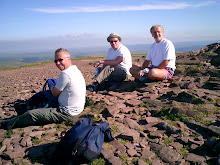
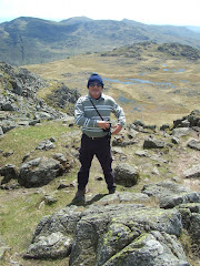
The drive through the deserted village of Longtown at 11.00am could only mean one thing - all of the inhabitants were watching the Royal Wedding - the event that we had decided to avoid. So it was a major surprise when we arrived at the car park to find it was already full!
I don't think that I've ever been asked whether I'm a botanist before but that was the strange question posed by a very academic looking lady with a posh voice as we changed our boots to start the walk.
The Black Hill itself rises just north of Longtown and west of the village of Craswall, near the Wales/England border. It is known locally as the 'Cat's Back' as when viewed from Herefordshire it looks like a crouching cat ready to pounce.
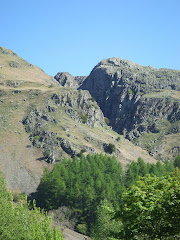
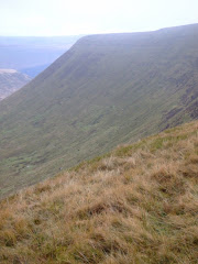
After the initial steep climb we encountered a tremendous 2 kilometre narrow ridge with the Olchon Valley on the western side and Golden Valley to the eastern flank. This was a really stunning stretch of mountain ridgeway.
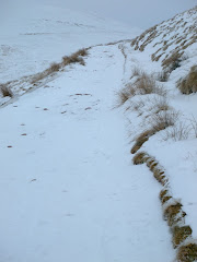
Unfortunately, it was windy and cold after the really warm weather of the last few weeks.
We soon reached the first trig. point at Black Hill (640 metres) and then headed north west to join Offa's Dyke Path for the two kilometre walk to the trig. point at Hay Bluff (677 metres). Our second Nuttall summit of the day (both on the English side of the border).
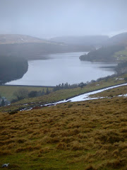
Although the visibility was patchy the views down to the car park near the stone circle at the foot of the Bluff were amazing.
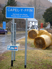
After eating our lunch we started the trek south on Offa's Dyke Path toward Hatterall Ridge. A distinctive path marked on the OS map was rather in-distinctive in reality and we needed to eventually head east at the stone marker at the crossroads to the Olchon Valley and Capel-Y-Ffin. At this point the weather conditions started to improve and the spectacular views began to open up around us.
The decent to the valley floor was an almost vertical drop of nearly 1,000 feet and we commented that we were really pleased that we did not have to climb this at the end of the walk as we passed someone who would shortly be on their way up. We crossed the Olchon Brook and walked through Black Hill Farm en route to the starting point.
After the main cultural spot of the day - a visit to the remains of Longtown Castle, which was built in the 13th Century to keep the maurading Celts out of England - it was a brief stop at the Crown Inn for liquid refreshments before sneaking back over the border into the Principality at Pandy.
The walk was 13.5 kilometres and took four hours thirty minutes including half an hour for lunch and a scheduled tea break.
Photographs taken on this walk can be viewed here. Select 'slide-show' for automated viewing.
Bruce Chatwin used the Black Hill as the setting for his novel 'On the Black Hill'.
Sunday, April 24, 2011
Tai Mawr Leat
A scheduled ancient monument, the remains of the Tai Mawr Leat run from Cefn Viaduct and down towards the Cyfarthfa Ironworks, which they once served.
Built in 1766/7, (shortly after the cyfarthfa ironworks were founded) as the watercourse that served the Cyfarthfa Ironworks (at that time the third coke-fired blast furnace was being constructed), this was before Richard Crawshay ran the ironworks, and Charles Wood (managing agent for the Cyfarthfa partners Anthony Bacon and William Brownrigg) recorded the construction in his diaries;
Saturday, 2nd May 1767
...Agreed with John Morgan of Tai Mawr for three of his fields, one more than yesterday, where the cut comes through at five pounds ten shillings p. Annum to prevent any dispute about Trespass which I find very difficult...An exorbitant rate...'
Monday, 4th May 1767
'...William Davis, Labourer, was sent to clear the Land belonging to Thomas Lewis, of the stones that fell from the rock in making the Taimawr cut. The men in driving thro' this rock, find it hard & go on but slowly.'
Much of the leat is still intact, despite being very overgrown in places, and originally underwent a phased development. It was designed by William Edwards (architect of the Pontypridd bridge) and revised by Wood to reach a higher point on the Taff.
The leat disappears into a cut tunnel (102 yards) with a stone paved floor before emerging and returning to the river bank. The walling constructed to hold up the bank failed sometime before 1850, and the tunnel was extended to the end of the fingertip along side which it remains an open channel. There is also a former rail crossing in evidence.
The Cyfarthfa fingertip, alongside the leat is a testament to the amount of waste produced by the one time biggest Ironworks in the World.
The thousands of tons of iron produced in the 19th Century, resulted in the production of several tons of waste products which had to be deposited somewhere and scrambling up the Cyfarthfa Finger you can see the cinder, ash and slag at first hand!
A site of special scientific interest, nature is now reclaiming this land back, with tree roots cracking through the jet black slag, and Dippers, Buzzards and Meadow Brown butterflies being in regular residence in the area. From the top of the finger you also get a great view of the confluence between the Taf Fechan and Taf Fawr rivers.
Article written by JN.
Photographs by SD.
Wednesday, April 20, 2011
Cardiff Bay Barrage
Tiger Bay, as it was colloquially known, has changed beyond recognition over the last twenty years. The construction of the barrage across the bay between Penarth Head and the former docks area has created a magnificent freshwater lagoon, that still provides access to the Bristol Channel via a number of sluice gates.
If most men would ask their wives or girlfriends to walk six miles to enjoy the fresh air you probably know what the answer would be, but for some totally illogical reason they will happliy walk more than this distance window shopping! So I'm afraid it was a visit to walk the rim of Cardiff Bay basin on a glorious spring day in temperatures that only occassionally occur in July!
Leaving the popular waterfront area, the walk passes the Senedd (Welsh Parliament) and the Norwegian Church, where Roald Dahl was christened. After leaving the Queen Alexandria docks you start the walk across the barrage itself which is 1.1 km long.
Construction started in 1994, following the successful passage of the Cardiff Bay Barrage Act of 1993. It was completed in November 1999, at a cost of £120 million. The barrage has played an important role in the regeneration of the area. Attractions such as the Wales Millennium Centre, the National Assembly for Wales, restaurants and watersports have since moved onto the waterfront.
After a number of disputes over access were resolved the barrage was finally opened to the public on Monday 30 June 2008, allowing public access from Mermaid Quay to Penarth Marina.
The concept of a barrage was first suggested in the 1980s as a way to help regenerate Cardiff's largely disused docklands. The bay was part of the Bristol Channel which has the second largest tidal range in the world. As a result, for 12 hours a day, the bay was drained of water, leaving large area's of exposed unsightly mudflats.
The engineering work including the hydraulics for the sluice gates is amazing.
After completing the crossing of the barrage the walk takes you through Penarth Marina, across Pont Y Wern footbridge (which was opened in 2010) and past the Cardiff International White Water Centre.
It was near this point that Marconi transmitted the first wireless communication over open sea in 1897, to Flat Holm Island.
The walk then returns past Cardiff Yacht Club and the wetlands area back to Cardiff Bay waterfront.
The total distance covered was 10 kilometres (6.2 miles). There was no 'upness' because the walk remained at sea level at all times.
Saturday, April 16, 2011
Visitor Map
Although the original intention of the blog was to maintain a historical record of the walks that the group experienced and to provide some structure to the annual escapades, surprisingly the site is currently attracting visitors from around the globe.
From New Zealand to Canada, from Sweden to California, from Belgium to Kuala Lumpar, or Italy to Australia - 'surfers' (or users of the internet not the beach variety!) are using the search engines to find information on the Black Mountain, which is one of the most popular searches on the site, Kilpeck, Worms Head or the Taff Trail.
We are both honoured and privileged!
* Click on the image of the map to see a larger version
Monday, April 11, 2011
Cefn Coed-Y-Cymmer - An early evening walk
This is just a sample of the countryside right outside Steve's doorstep!
The route passed under the curving Cefn viaduct which formerly carried the railway over the River Taff but which is now part of the Taff Trail, Route 8 of the National Cycleway.
The village itself is situated in the neck of land between the rivers Taf Fawr and Taf Fechan, at their confluence (Welsh translation: 'cymer')
A fine example of a limestone slab as you pass under the Cefn viaduct.
Typical back-country bridle path on way to Cefn Penmailard.
Sluce gate (a water channel that is controlled at its head by a gate [from the Dutch word 'sluis']) for the Tai Mawr leat.
Views of Pwll (English translation: 'pool') Tear Bridge.
Limestone quarry cut into mountainside at Darren Fawr below Cefn Cil-Sanws.
Quiet secluded spot for contemplation.
The warm weather has provided perfect conditions for the Magnolia Blossom.
Saturday, April 9, 2011
Blaencwm
In the upper reaches of the headland of the historic Rhondda Fawr, the intrepid duo of Butterballs and Lord Twynyrodyn tackled the wild mountainous area around the hilltops of Treherbert to Rhigos. Setting out from the Penpych woodland car park and heading east towards the pine forests and waterfalls as the sun shone high in the azure blue April sky.
Everywhere they looked vast conifer forests surrounded a tight knit former coal mining community. However, most of the old industrial heritage has now been reclaimed by nature.
Making their way over mountain streams they continued onwards and upwards into Mynydd Blaenrhondda until they saw the first of the smaller waterfalls. As the ascent increased a stone track led to an impressive larger waterfall that cascades over the edge of a high cliff.
After reached the hilltop, the view opens out to become the domain of ravens, kestrals and buzzards where a Manchester United flag - in memory of a young local boy who died in a tragic motor accident - adorns this magnificent viewpoint above Treherbert in the valley below.
The landscape changed as the duo became over-shadowed by the steep cliffs and scars of Craig Blaenrhondda. Then after leaving the woods in the distance the A4061 Rhigos Road dissects the valley like a sword cast from the precious metals hidden beneath the rugged hillside, before arriving at the stunning Nant Melyn waterfall which flows into a large pond created by the constant flow of water off the mountain.
A grassy track takes the duo down past the ruins of the Iron Age settlement known as Hen Dre’r Mynydd. There is evidence in the area of Mesolithic and Neolithic human activity, mainly through the discovery of basic hunting, foraging and tool making items.
The settlement is now in ruins but you can clearly see where the round stone buildings once stood. The walk opened up dramatically as the valley floor widens.
Leaving the ridge the walk returns down the snaking dirt road towards the nearby town of Treherbert, lying in the shadow of Penpych. Refreshments on the return journey were take at the Glancynon Inn in Hirwaun.
The walk was 6 miles and took approximately 4 hours to complete. It featured on Weatherman Walking earlier this year.
Tuesday, April 5, 2011
Thomastown Park - Spring
Saturday, April 2, 2011
Ueli Steck
Stunning footage of the record-breaking Alpinist speed ascent in the Alps - climbing the Eiger in under 3 hours! Literally racing up an 8,000 feet mountain that other mountaineers may take days to summit.
Subscribe to:
Posts (Atom)