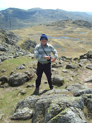
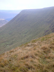
Pen-Y-Fan from Cribyn
Learn to fall in love with the mountain not just the summit

Monday, November 29, 2010

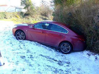
It's Snow Joke!


This was the tricky problem facing a neighbour early this morning, when his Vauxhall slid down a bank near his house.

Needless to say he needed a breakdown truck to extract the car from its 'off piste' slalom run into the waiting hedge.

Sunday, November 28, 2010

Thomastown Park - Winter


With temperatures overnight falling to -10 degrees celsius, the lowest in November for 25 years, the snow that fell during Friday afternoon provided our first taste of real winter conditions since..........well at least March!


The recent autumn conditions have quickly turned into a winter landscape, long before the solstice.


The forecast is for more freezing temperatures well into next week.


It's slightly warmer in Brisbane were the First Ashes test match of the series is currently taking place!


Even the usual dog-walkers appear to have decided to remain indoors, in the warmth of their livingroom.


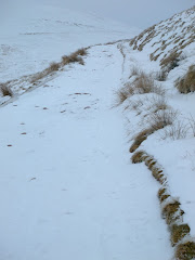
Conditions on the mountains in the Brecon Beacons should be perfect for outdoor activities.


Anyone remember where this squirrel buried his winter food supply!

Saturday, November 27, 2010

Brecon Beacons Mountain Rescue


During the walk to Pontsticill yesterday a real life drama was unfolding a few miles further north on Pen-Y-Fan.

As heavy snow swept across South Wales, members of the Central Beacons Mountain Rescue Team were called at 11:45 to a light aircraft crash on Bwlch Duwynt near the summit of Corn Du. A helicopter from RAF Chivenor, Devon, was called to the scene but the team were not initially needed after the pilot, a businessman from Bridgend, managed to free himself. But shortly afterwards they were called to airlift a 70-year-old man with a leg injury and hypothermia, and a mountain rescuer with a head wound.

Huw Jones, of the Central Beacons Mountain Rescue team, said it took about five hours to reach and rescue the walker at about 18:30. During the operation a rescuer slipped and suffered a head injury.

The helicopter landed on the closed road between Storey Arms and Merthyr to brief the crew. Rescuers praised "an incredible bit of flying" by the helicopter to reach the casualties in conditions they described as "more like Alaska than south Wales".

"In all my years in mountain rescue, I struggle to say when I remember seeing a helicopter crew flying in those conditions," said Mr Jones.

The heavy snow forced the crew to abort attempts to land at the nearest hospital, Prince Charles in Merthyr, and then at the University Hospital of Wales in Cardiff and the Royal Glamorgan in Llantrisant, before finally managing it at Morriston.

The 70-year-old man was treated for a broken leg and the mountain rescuer was sent home with concussion.

Mr Jones said the weather forecast for coming days brought higher risks for walkers, and said they should take crampons and an ice axe.

Friday, November 26, 2010

The Taff Trail - Cefn Coed to Pontsticill

This particular section starts at the Community Centre and alongside St. Johns Church is a very narrow path that very soon crosses a bridge over the A465.

Leaving Cefn Coed behind, rapid progress is made to the south east of Trefechan before you enter the Cwm Taf Fechan Nature Reserve. Although it wasn't snowing at the start of the walk a few small flakes started falling on the approach to Pontsarn.

The next footbridge takes you over the Glais hill before you pass the remains of the platform at Pontsarn Station. The first train came through the station on 8th August 1868, before increasing to 21 trains a day by 1873. The station was closed in 1963 as part of the Beeching review.


Almost at the end of the platform you pass under a bridge and then cross the Pontsarn Viaduct which was built in 1866 to carry the Brecon and Merthyr Railway. The viaduct, which has seven spans and is a listed structure, is 455 feet (139 mtrs) long and 92 feet (28 mtrs) high.


The trail continues the well defined route before the path ends rather abruptly at a sign declaring the next section is private land. The trial now joins the main vehicle access under a bridge then turns right past the water treatment works to the dam of Ponsticill Reservoir.


Passing under the bridge (above) this particular walk left the official Taff Trail to climb the Ffynon Dwn straight into Pontsticill. At this point it was snowing persistently and starting to stick!


The blazing open coal fire in the Red Cow invited me to stay longer than just one pint and it was tempting, but with the snow falling heavier it was definitely time to depart.

The walk was 4 miles and took just over 80 minutes to complete in snowy conditions! Again the terrain was easy underfoot with only one ascent into Pontsticill. All of the photographs taken on this walk can be viewed here. Select 'slide-show' for automated viewing.

Monday, November 22, 2010

The Taff Trail - Aberfan to Quakers Yard


This is the next stage - linked to a previous walk - along the southern section of the Taff Trail. Because this section was always likely to be a linear walk it was to commence (......and end) using public transport with a bus to Aberfan to pick up the start of the walk (.....where the first section ended) at the Community Centre.

Within a few hundred yards of joining this southern bound section the cemetery, with the headstones of the 116 children who tragically lost their young lives in the disaster that engulfed the village forty four years ago, are clearly visible from the trail.


You soon start to leave the urban sprawl of Aberfan and Merthyr Vale and return to the delightful woodland, which at this time of the year is showing its true autumnal colours.


You switch back through an underpass beneath the A470 and for the next few miles the trail runs parallel with the main trunk road, as the vehicles hurtle past at 70 mph. Surely, life is too short to rush everywhere and not enjoy the natural surroundings.

Leaving the path for a brief de-tour, a walk to the 'Giant's Bite' above Edwardsville could also be included in the trek. However, at this point the trail returns back under the A470 and shortly arrives at the quirky Pontygwaith Bridge. The camber on this is incredibly steep and would have been extremely difficult to navigate in a car. An episode of the BBC series 'Merlin' was filmed under the bridge.


Pontygwaith (in English means "Bridge of the Ironworks") was previously a small village where a Sussex Ironmaster named Anthony Morley set up a small ironworks in 1583. There is little of the original village remaining today, which was inhabited and continued to exist until approximately 1977, as a terrace of ten houses and a farm.

After crossing the River Taff to the Merthyr Vale side of the valley you now enter the Pontygwaith Nature Reserve, located on land owned by Taff Bargoed Fishing Club.


The trail now follows the historic tramroad along which the first steam locomotive in the world made its debut journey. In 1804, Cornishman Richard Trevithick adapted the design of his high pressure steam engine to build the first full scale steam locomotive.

Samuel Homfray (a local ironmaster) was so impressed with Trevithick's locomotive that he made a bet with another ironmaster, Richard Crawshay, for 500 guineas that Trevithick's steam locomotive could haul 10 tons of iron along the Merthyr Tydfil Tramroad from Penydarren to Abercynon, a distance of 9.75 miles (16 km). Amid great interest from the public, on 21 February 1804 it successfully carried 10 tons of iron, 5 wagons and 70 men the full distance in 4 hours and 5 minutes, an average speed of approximately 2.4 mph (3.9 km/h)

The nature reserve, where herons, otters, foxes and kingfisher can be seen, must be a twitchers delight with the large number of native British birds that were seen during this brief section.

Climbing a bank to leave the trail the path crosses the railway track and leads to the northern end of Quakers Yard station, where the use of public transport continued with a return to Rhydycar on an Arriva train, that was right on time!


The walk was 3.4 miles and took just over an hour to complete. Again the terrain was easy underfoot with only two minor ascents. All of the photographs taken on this walk can be viewed here. Select 'slide-show' for automated viewing.

Saturday, November 20, 2010

Offa's Dyke Centre


The extremely poor weather conditions this week which prevented any outdoor activity, also provided an opportunity to visit the Offa's Dyke Centre based in Knighton, Powys.

The Centre, which was opened in 1999, forms a focus for activities based around the 8th Century earthwork built by Offa, the King of Mercia. The dyke follows the Welsh English border from the hills above Prestatyn to the Severn Estuary near Chepstow.


A free exhibition provides a wide range of information to visitors exploring the border area by car, bike or on foot.

An interactive exhibition allows visitors to explore the history of the Dyke, its associated long distance footpath, and the border area of the Marches in general. The main features include:

The construction of Offa's Dyke
The Welsh Princes of the Anglo-Saxon period
The flora and fauna of the area
Environmental considerations
The history of Knighton
The activities required to maintain the Dyke and the Long Distance Footpath


The Centre is managed by the Offa's Dyke Association, a charity originally set up to provide help for walkers on the Long Distance Path. It also provides a base for the Knighton Tourist Information Centre and a shop.

The Centre is positioned at the halfway point of the Offa's Dyke Path National Trail and at the start of Glyndwr's Way National Trail. The Wye Valley Walk crosses the Offa's Dyke Path at Hay-on-Wye as does the Severn Way at Pool Quay, and a wide range of shorter walks radiate from Knighton. The footpath continues from the rear of the Centre.

Saturday, November 13, 2010

The Taff Trail - Rhydycar to Aberfan


It was an extremely local walk this morning, under a crisp almost cloud free sky with a bright, low autumn sun.

There was plenty of company from the cawing of the magpies, to the red breasts of the robins and singing of the blackbirds.


After leaving Rhydycar within ten minutes the leisurely stroll arrives at Lower Abercanaid, first passing Quay Row some listed cottages and then Pond Row on the Upper Tramroad.


The trail was originally launched in September 1988 by Sir Wyn Roberts, Minister of State for the Welsh Office. The project was initiated and co-ordinated by the Merthyr and Cynon Groundwork Trust, with the co-operation of the local councils that the trail passes through. Financial and logistical support has been given by the Welsh Development Agency and Sustrans, a sustainable transport charity.


Arriving at Upper Abercanaid, unfortunately, it was still way too early to call into the Llwyn Yr Eos, which has been serving the locals for over two hundred years. However, I expect that Lord Twynyrodyn, Butterballs, Brownie and yours truly will make a visit during a balmy evening next summer.


Before the trail was conceived, several similar and disjointed facilities existed in the area. Taff Ely Borough Council had created cycling routes within its boundaries, Cardiff City Council had provided the Three Castles Cycle Route from Caerphilly into Cardiff, and the Brecon Beacons National Park was developing leisure trails to encourage the use of the park. The Groundwork Trust for Merthyr Tydfil and Rhondda Cynon Taf saw a need for the co-ordination of these efforts, and the Taff Trail was born.


On the short journey between Abercanaid and Troedyrhiw I passed the Dynevor Arms but it was still too early to open its doors! The majority of people that I passed were all out for an early morning walk with their dogs, which was precisely what former Plymouth Ward Councillor Ron Clarke was doing when I was passing him. We walked together for half a mile talking about various things before I also met someone that I used to work with a few years ago who was walking her parents dog - the shy but extremely handsome, Maxie.

There were also some mountain bikers (perfect route for cycling) and a few joggers.


The trail makes much use of an abandoned branch of the Taff Vale Railway and the Glamorganshire Canal. These had been built in the 18th and 19th century to transport coal and iron ore from Merthyr Tydfil and the Rhondda Valley to the docks at Cardiff and Barry. The canals had become disused due to competition from the railways, and the railways in turn had become surplus to requirement as the heavy industries upon which they depended closed. These routes, which although disused had remained largely intact, proved ideal for the needs of the trail, providing a convenient path along the narrow base of the Taff Valley.

The trail continues to follow the A470 as far as Aberfan, where it descends below the road and continues through mainly residential areas.

I briefly left the trail to visit the Memorial Garden that was constructed to remember those who lost their lives in the Aberfan Disaster of 1966, before I returned to the trail and retraced the earlier route back to Rhydycar.


This provided me with an appetite for some home made cawl for lunch, before settling down to watch South Africa beat Wales 29-25 at the Millennium Stadium, which is located just a few miles from the actual start of the southern end of the Taff Trail.


The walk was 7 miles and took just over two hours to complete. Mainly because there were no metres of ascent! All of the photographs taken on this walk can be viewed here. Select 'slide-show' for automated viewing.